Enhanced Risk Added For Extreme NW Alabama
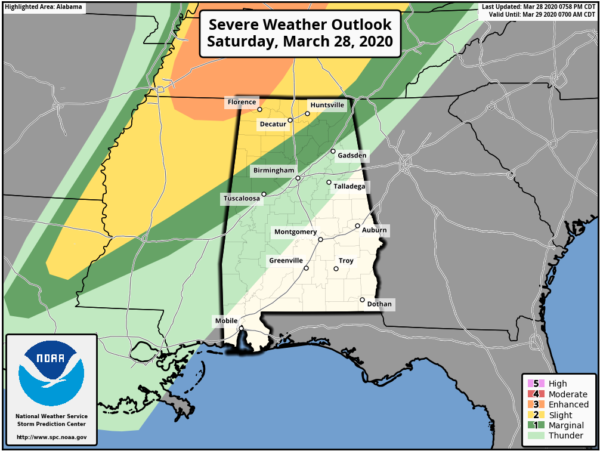
The latest update from the Storm Prediction Center has now extended the Enhanced Risk southward to include the northwestern corner of Alabama, mainly for locations north and west of Cherokee (Colbert Co.) to Florence to St. Florian (Lauderdale Co.).
A Slight Risk continues south and east of that for locations along and north of a line from just north of Millport (Lamar Co.) to just north of West Point (Cullman Co.) to just south of Hytop (Jackson Co.).
The Marginal Risk now extends south of the slight risk to a line stretching from Gainesville (Sumter Co.) to Tarrant (Jefferson Co.) to Sand Rock (Cherokee Co.).
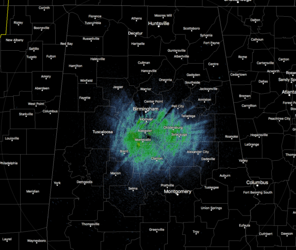
Weather is still calm for us at the moment (as of 8:13 pm), but storms will begin to move into the area after 11:00 pm.
We’ll keep you posted.
Text from the SPC on the new Day 1 Outlook…
THERE IS AN ENHANCED RISK OF SEVERE THUNDERSTORMS FROM A PORTION OF THE TENNESSEE AND OHIO VALLEYS INTO THE MIDWEST REGION
SUMMARY…
Scattered severe storms posing a threat for tornadoes, damaging wind and large hail will continue this evening into the overnight from a portion of the Tennessee and Ohio Valleys into the Midwest region.
Midwest region…
The warm sector is in the process of being pinched off across northeast IA suggesting the tornado threat in this region should end by 9:00pm. However… additional storms are developing farther south across northwestern and west central IL and will move eastward into central and eastern IL where the 00Z RAOB from Lincoln indicated around 800 J/kg MLCAPE, large low-level hodographs and 80 kt effective bulk shear. This environment will continue to support organized storms incuding supercells capable of producing tornadoes, a couple of which could be strong this evening.
Tennessee and Ohio Valleys…
A secondary branch of the low-level jet is forecast to strengthen tonight from middle TN into the OH Valley in association with a strong upper jet moving through the base of a progressive trough situated across the Midwest. This will contribute to modest low-level theta-e advection with MUCAPE from 500 to 1000 J/kg as well as large hodographs with 300-400 m2/s2 0-1 km storm-relative helicity within an otherwise strongly sheared environment. The band of scattered storms developing along the warm conveyor belt from southwest IN into western TN and northwest MS will likely maintain embedded organized structures including supercells and bowing segments capable of tornadoes, damaging wind and large hail as they develop eastward into the overnight.
Category: Alabama's Weather, ALL POSTS, Severe Weather
About the Author (Author Profile)
Scott Martin is an operational meteorologist, professional graphic artist, musician, husband, and father. Not only is Scott a member of the National Weather Association, but he is also the Central Alabama Chapter of the NWA president. Scott is also the co-founder of Racecast Weather, which provides forecasts for many racing series across the USA. He also supplies forecasts for the BassMaster Elite Series events including the BassMaster Classic.Subscribe
If you enjoyed this article, subscribe to receive more just like it.


