High impact Severe Weather Event Likely Today and Tonight
Here’s an early morning update on the Alabama weather situation. Alabama and much of the South is preparing for an Easter Sunday severe weather outbreak in the middle of a pandemic, so there is a lot to unpack. Let’s get started.
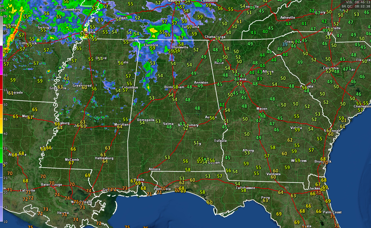
RIGHT NOW: Early on this Easter Sunday, skies are cloudy across Alabama, except over southeastern sections. A passing disturbance is producing showers over the northwestern quarter of the area as it pushes just t our northwest. There is not much in the way of instability, so thunder will be limited. Temperatures are in the upper 40s over Northeast Alabama, with 50s elsewhere. Dewpoints are on the rise, and that will be the trend for the day, with things quickly becoming quite humid later today The air may not have that severe weather feel right now, but it will by this afternoon. Winds are generally calm now, but an occasional gust will start kicking up to 10 mph or more this morning, rustling the wind chimes. Those winds will pick up after lunch. Wind advisories are in effect for much of the area for this afternoon through Monday morning.
SEVERE WEATHER THREAT TODAY AND TONIGHT: A wide area of the South will experience severe weather today and tonight, from eastern Texas all the way to Virginia and the Carolinas and as far north as the Ohio Valley. The greatest impact will come over the Deep South, including parts of Alabama, and Mississippi, back into Louisiana and Arkansas, where the potential is there for supercells to develop this afternoon.
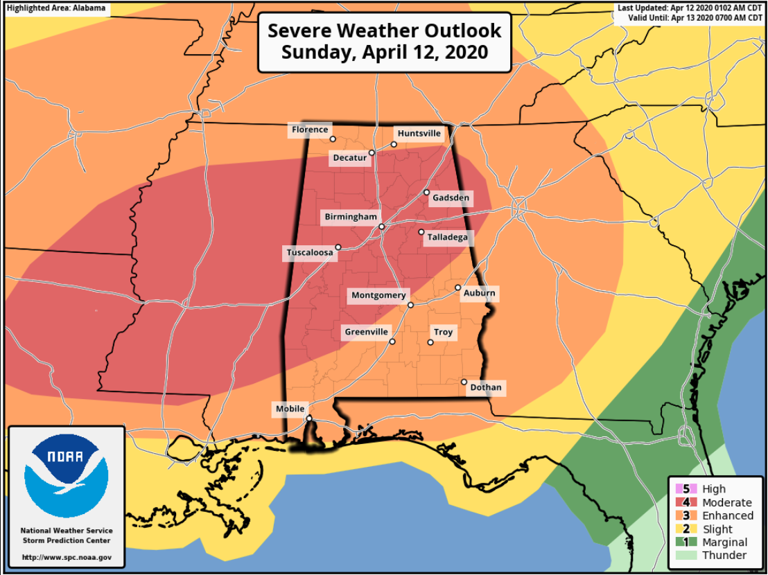
LATEST SPC OUTLOOK: The Storm Prediction Center has its next to highest outlook level (moderate) posted for much of the state west of a line from Russellville to Gadsden to Anniston to Alex City to Montgomery to Chatom. In this area, there is a greater risk of supercells that could produce potential strong, long-track tornadoes this afternoon and tonight. All of the remainder of the state is in the standard slight risk outlook, but we urge you not to focus on whether you are in or out of which risk. The ENTIRE state has a significant risk of a high impact severe weather event from this system and you need to prepare accordingly. The event will come in waves, like some of our other big past events. This timing is not poured in concrete, but let’s talk about how it might unfold. Remember to check back frequently, as timing will change and your timing may vary.
FIRST QUARTER (NOW – NOON): Let’s break this long-duration event down into four quarters. We are in the first quarter now, with the rain pushing across the northern parts of the area. This will lift into the Tennessee Valley during the morning hours. There will be a brief lull behind the first round, and skies will remain cloudy as temperatures warm through the 60s and winds slowly increase.
ROUND TWO (12-4 PM): The second round will come in the form of a rapidly advancing warm front that will move northeastward as a surface low develop to the west of Alabama and a strong upper-level trough moves east through Texas. Showers and storms will develop with this boundary, and you can already see that on the radar over Mississippi at this hour even with lightning starting to show up in some of the developing storms. Behind this front, you will really notice the difference in the feel of the air, with temperatures jumping well into the 70s, with 80s south of US-280. Dewpoints will quickly rise into the middle and upper 60s, meaning there will be ample moisture. This air will be capped with some warmer, dry fairer aloft from the southwest, which will make it harder for storms Toto form. Any discrete storms that form in this warm sector will have the potential to become severe quickly with ample instability.
ROUND THREE (4 PM – 8 PM: The period behind the warm front and ahead of the main squall line will potentially be the most dangerous. We will be carefully watching developments over Mississippi and western Alabama at that time, as any of those supercell storms would have the potential to produce significant tornadoes. A powerful low-level jet will be developing over Mississippi by late afternoon and early evening and this will really enhance not only the tornado threat but also the threat for damaging winds and heavy rain. The airmass over Alabama will be quite volatile with Significant Tornado Parameters around 4. Any value over 1 is significant, and anything over 2 becomes extra concerning. But any supercell storms that can form by themselves, that number will be much higher.
ROUND FOUR (8 PM – 4 AM): As the dryline moves into Alabama ahead of the cold front, it will spark a powerful line of storms that will present the threat of damaging winds, large hail, and tornadoes, especially if the airmass has remained capped and pristine of thunderstorm development. This activity should push southeast of I-85 by 4 a.m. Monday morning.
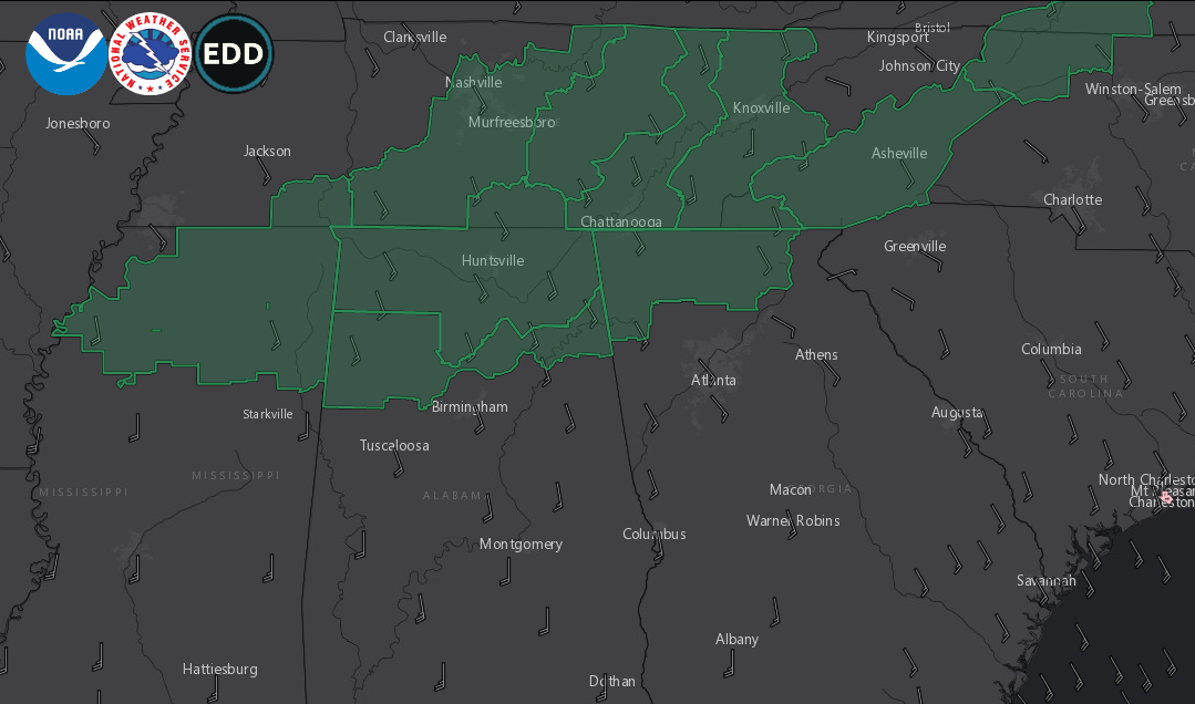
Flash flood watches issued
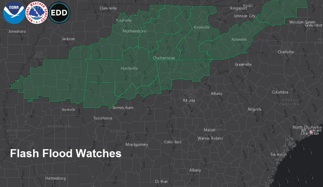
RAINFALL AMOUNTS: Rainfall amounts will average around one inch, but streaky higher amounts will be observed where stronger storms line up. Areas that see thunderstorms train over the same location could see 2-3 inches of rain. Flash flood watches have been issued for northwestern and northern Alabama.
UNCERTAINTY: With any forecast, there are limiting factors that will affect the final outcome. But the signals are strong enough that we must prepare for the worst and be grateful if that doesn’t materialize.
PREPARING: The time leading up to a severe weather event is not a time to panic, but rather a time to plan. First, you need to have redundant reliable ways to receive weather warnings for your location.
GETTING WARNINGS: A properly programmed NOAA Weatheradio with fresh batteries is a great first line of defense. Bolster this with your favorite weather smartphone app or call system. Monitor the blog for frequent updates throughout the event and watch ABC3440 when tornado warnings begin to be issued. Don’t rely on outdoor sirens to alert you.
A SAFE PLACE: Refresh your emergency kit and put it in your safe place. Know where you and your family will go when a warning issued. Think lowest floor, interior room. Putting as many walls between you and the outside as possible. Refresh your emergency kit and put it in your safe place. Have hard-soled shoes, helmets, and an air horn to signal rescuers. Mobile and manufactured homes are not the places to be in a tornado or strong winds. Know where you can go to a substantial structure or community shelter well before the storm arrives.
COMMUNITY SHELTERS AND COVID-19: The pandemic means that many community shelters will not be open. Check now to see if yours will be or not. If it will, plan on going in time to arrive ahead of the storm. Don’t go in until the storm is getting close. Practice proper social distancing in the shelter. Go home and wash up once the all-clear is given. The Alabama Department of Emergency Management, the National Weather Service, and the American Meteorological Society all remind you that you must protect yourself from the more immediate threat of the tornado first and foremost.
BE A WEATHER AMBASSADOR: Pay attention to weather information throughout the event. Notify friends, families, and neighbors who may not be aware.
STAY WIITH THE BLOG: We will have frequent updates throughout the day today and through the night tonight. I will be back with the video around 6:30 a.m.
Category: Alabama's Weather, ALL POSTS, Severe Weather
About the Author (Author Profile)
Bill Murray is the President of The Weather Factory. He is the site's official weather historian and a weekend forecaster. He also anchors the site's severe weather coverage. Bill Murray is the proud holder of National Weather Association Digital Seal #0001 @wxhistorianSubscribe
If you enjoyed this article, subscribe to receive more just like it.


