NWS Birmingham Expands Flash Flood Watch For Sunday
In addition to the severe weather threat on Sunday, we will deal with a heavy rainfall threat as well across Alabama.
Here are expected rainfall totals through Monday 1 p.m. from the Weather Prediction Center:
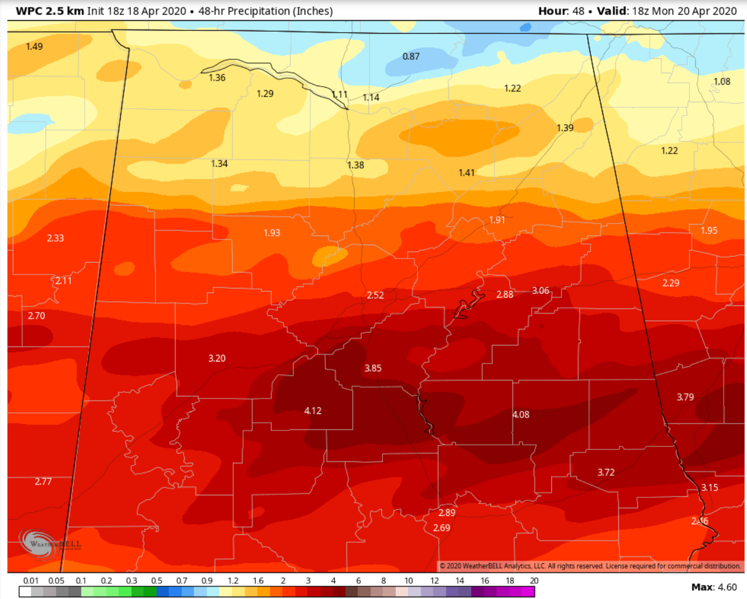
Any areas that see the training of heavier rainfall could see even more. Some spots across Central Alabama could see as much as 4-6 inches.
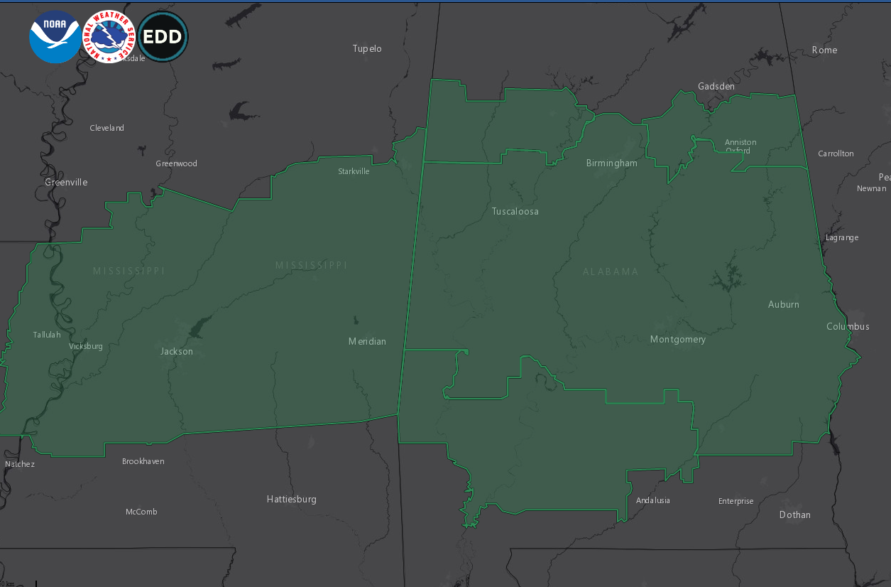
The NWS Birmingham ahs added counties to the flash flood watch that they issued early this morning. The new counties include: Calhoun, Cleburne, Fayette, Lamar, St. Clair, and Walker.
The counties that were already in the watch include: Autauga, Barbour, Bibb, Bullock, Chambers, Chilton, Clay, Coosa, Dallas, Elmore, Greene, Hale, Jefferson, Lee, Lowndes, Macon, Marengo, Montgomery, Perry, Pickens, Pike, Randolph, Russell, Shelby, Sumter, Talladega, Tallapoosa, and Tuscaloosa.
The watch will be in effect from 7:00 AM CDT Sunday until 1:00 AM CDT early Monday morning.
Flash flood watches now cover these areas across the South:
Category: Alabama's Weather, ALL POSTS, Severe Weather
About the Author (Author Profile)
Bill Murray is the President of The Weather Factory. He is the site's official weather historian and a weekend forecaster. He also anchors the site's severe weather coverage. Bill Murray is the proud holder of National Weather Association Digital Seal #0001 @wxhistorianSubscribe
If you enjoyed this article, subscribe to receive more just like it.


