An After Midnight Look At The Severe Weather Threat For Later Today
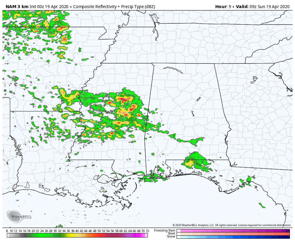
As of the 00z run of the high-resolution NAM, it looks like the surface low’s track across Central Alabama will be a little farther south than projected during the 18z run. The HWRF has the low moving across the northern portions of North Alabama. The HRRR has the low just south of the I-20 corridor as it moves across the area. So with that being said, I still believe that the forecast is still on track with the potential of strong to severe storms occurring in multiple waves throughout the day on Sunday and into early Monday morning.
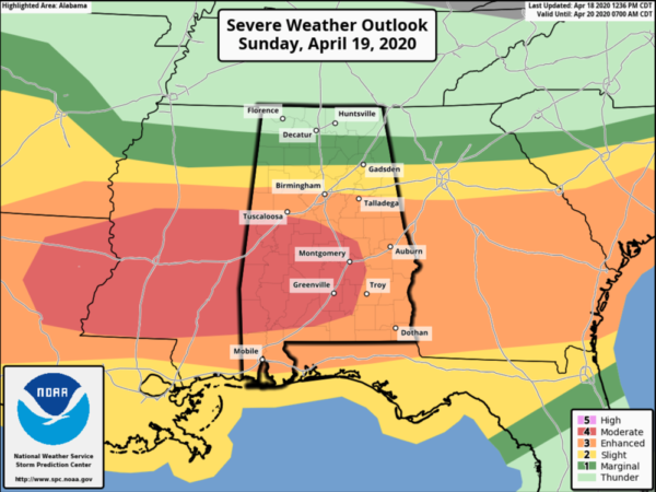
While a new update will be coming out shortly, just after 1:00 am, I think that the risk levels may be pushed a little farther south by a few miles, but I do not expect a big change. Forecast soundings for the extreme southern parts of the area continue to show a significant threat for severe storms, while farther to the north around the I-20 corridor, an isolated damaging wind and large hail threat will be the main story. A brief spinup tornado or two may be possible, but highly unlikely.
The first round of stronger to severe storms continues to be forecast in a window from 4:00 am to 11:00 am this morning, with the second window being open from 2:00 pm today through 2:00 am Monday morning. We’ll get a better idea of the exact timing once everything gets started in the morning.
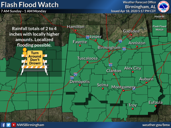
We also continue to see a heavy rain event for much of the area as well, as training of heavier thunderstorms will be possible. Due to the potential of 2-4 inches of rainfall with localized heavier amounts, a Flash Flood Watch will go into effect at 7:00 am this morning and is set to expire at 1:00 am Monday morning.
Category: Alabama's Weather, ALL POSTS, Severe Weather
About the Author (Author Profile)
Scott Martin is an operational meteorologist, professional graphic artist, musician, husband, and father. Not only is Scott a member of the National Weather Association, but he is also the Central Alabama Chapter of the NWA president. Scott is also the co-founder of Racecast Weather, which provides forecasts for many racing series across the USA. He also supplies forecasts for the BassMaster Elite Series events including the BassMaster Classic.Subscribe
If you enjoyed this article, subscribe to receive more just like it.


