2:15 Update on the Sunday Severe Weather Situation: Storms Firing Over Mississippi, Moving Towards Alabama Early This Morning
The SPC put out their new Day One Severe Weather outlook a little after midnight and the biggest change is that the Moderate Risk area (4/5) is expanded eastward to include the entire southern half of Alabama, with the exception of southern Mobile and Baldwin Counties. Here is the map:
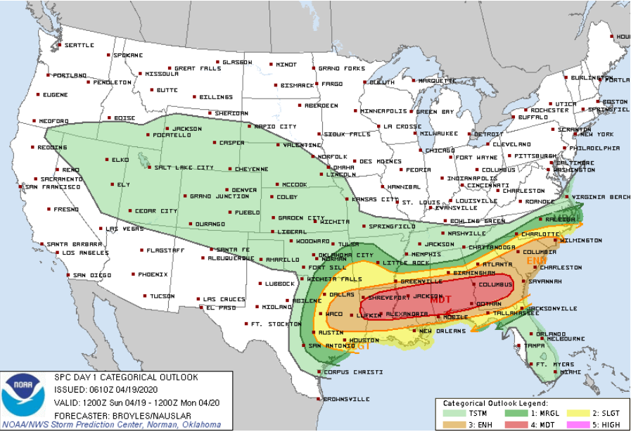
That Moderate Risk area encompasses the area where the highest threat of an EF2 or greater tornado exists for today through tonight.
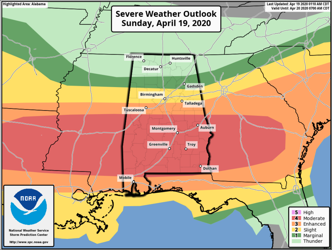
Zoomed into Alabama:
At 2 a.m. it was quiet across Alabama. But storms were over Mississippi, associated with an upper-level disturbance that was pushing northeastward. Storms that produced quarter-sized hail near Raleigh, MS south of Forest, had weakened, but new ones north oof Meridian were intensifying. Those storms will move towards West Alabama’s Pickens and Sumter Counties.
Storms in western Mississippi, near Yazoo City, were severe, with large hail and the potential for damaging winds.
These storms are not surface-based, so they are not expected to develop tornadoes, but they will be capable of producing damaging winds and large hail as they push across Mississippi and into Alabama through the morning hours.
The main threat though will come late this morning through the afternoon and into tonight as a surface low tracks across Alabama and with a warm front brings an unstable airmass northward across the state. Multiple rounds of storms will have the potential to produce damaging winds, large hail, and tornadoes.
With the severe weather threat again today, it is time to review that severe weather safety plan, check your multiple ways of receiving warnings, know where your place of safety is during a tornado or severe thunderstorm warning and have the things you need in there now like helmets in case a warning is issued.
Stay with us all day for the latest breaking weather for North and Central Alabama here on the AlabamaWx Weather Blog.
I will have updates as necessary and the morning Weather Xtreme Video by 6:30.
Category: Alabama's Weather, ALL POSTS, Severe Weather
About the Author (Author Profile)
Bill Murray is the President of The Weather Factory. He is the site's official weather historian and a weekend forecaster. He also anchors the site's severe weather coverage. Bill Murray is the proud holder of National Weather Association Digital Seal #0001 @wxhistorianSubscribe
If you enjoyed this article, subscribe to receive more just like it.


