Storms Over Eastern Mississiippi Moving Toward Sumter, Pickens, and Greene Counties in West Alabama
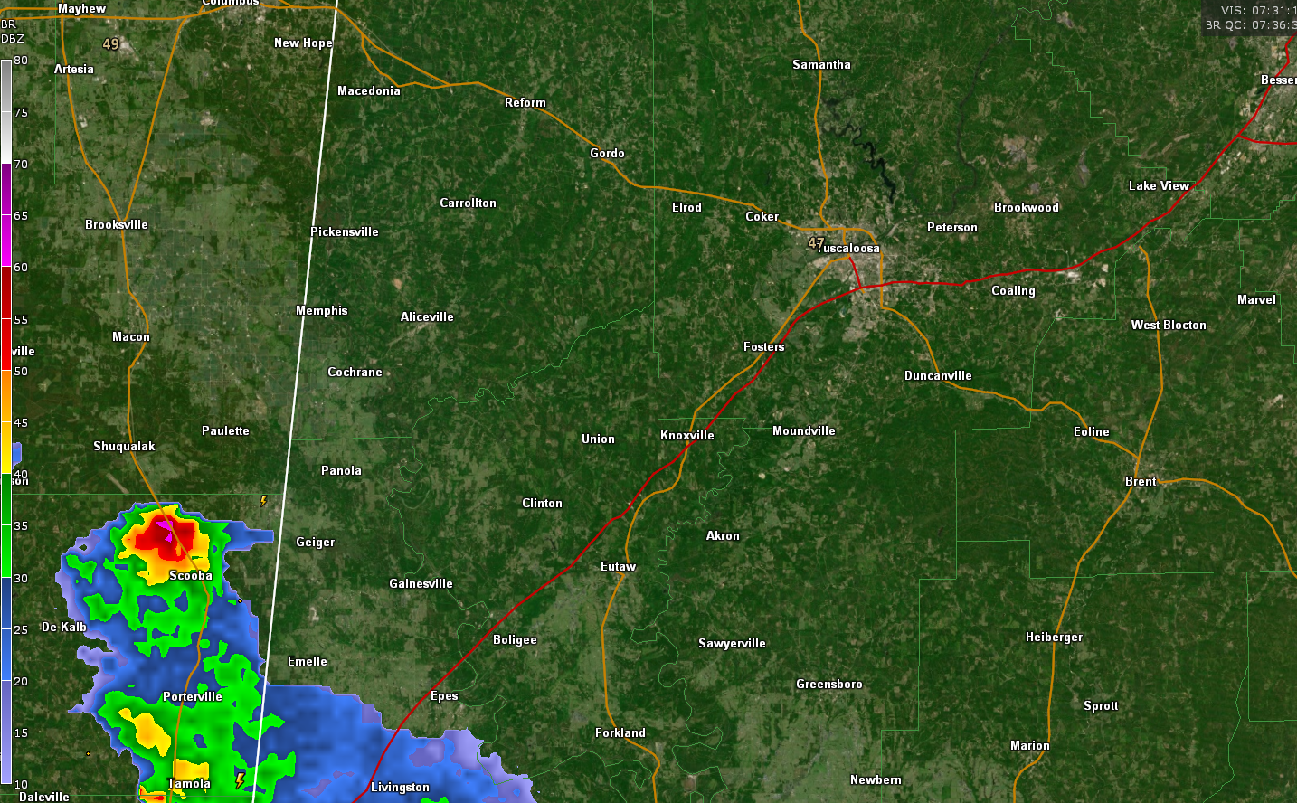
Thunderstorm to the southwest of Sumter and Pickens County is holding together and does show signs of producing hail as it pushes northeast at 55 mph. The hail could reach nickel size and winds could exceed 40 mph. It will affect these counties, as well as Greene Counties over the next hour, pushing eventually toward Tuscaloosa.
These storms are elevated in nature, meaning they are not surface-based but have their roots above the stable boundary layer, so they are not likely to produce tornadoes.
The SPC just weighed in that they do not expect to need to issue any type of watch over the next few hours, but could need to after sunrise if this activity gets more organized and becomes surface based.
Category: Alabama's Weather, ALL POSTS
About the Author (Author Profile)
Bill Murray is the President of The Weather Factory. He is the site's official weather historian and a weekend forecaster. He also anchors the site's severe weather coverage. Bill Murray is the proud holder of National Weather Association Digital Seal #0001 @wxhistorianSubscribe
If you enjoyed this article, subscribe to receive more just like it.


