Storm Moving From Bibb into Chilton Has Potential to Produce Hail
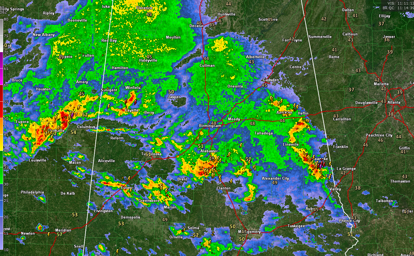
The storm currently southwest of Ashby in Bibb County shows indications of hail still. The NWS is still monitoring closely in case a warning is needed.
There is no tornado threat from this storm or any of this morning’s storms.
Very very rain is falling from the Shelby County Airport to Calera to Montevallo back into Bibb County. There is a good bit of lightning as well.
Moderate rain is moving through the Birmingham Metro with some thunder. Thunderstorms continue over Hale and Sumter Counties.
Over East Alabama, storms with lots of lightning are lined up from Anniston to Lineville to Wadley to Lafayette.
In eastern Mississippi, more strong storms are lined up from west of Columbus to west of Starkville and north of Louisville. This activity will push into Lamar and Pickens Counties over the next hour. Some storms are already over southern Marion and Fayette Counties.
This activity will be monitored all morning until it moves into Georgia for the threat of hail mainly.
The main threat for severe weather will come from 2 p.m. to midnight today as an outbreak of tornadoes, very large hall and damaging winds is expected from Louisiana through Mississippi, Alabama and into Georgia and South Carolina.
Flash flooding is also a threat today with 2-4 inches expected across much of Central Alabama and some 4-6 inch amounts possible.
Category: Alabama's Weather, ALL POSTS, Severe Weather
About the Author (Author Profile)
Bill Murray is the President of The Weather Factory. He is the site's official weather historian and a weekend forecaster. He also anchors the site's severe weather coverage. Bill Murray is the proud holder of National Weather Association Digital Seal #0001 @wxhistorianSubscribe
If you enjoyed this article, subscribe to receive more just like it.


