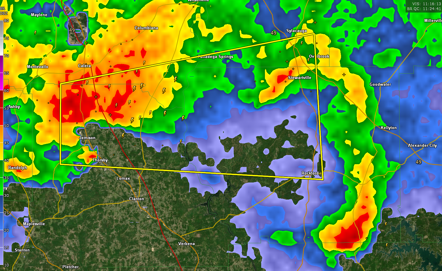
Severe Thunderstorm Warning for Parts of Chilton, Coosa, Shelby, and Talladega Counties till 7:00 AM CDT
The National Weather Service in Birmingham has issued a
* Severe Thunderstorm Warning for…
South central Talladega County in east central Alabama…
Northeastern Chilton County in central Alabama…
Southeastern Shelby County in central Alabama…
Northwestern Coosa County in east central Alabama…
* Until 700 AM CDT.
* At 623 AM CDT, a severe thunderstorm was located near Gap Of The
Mountain, or 7 miles east of Jemison, moving east at 55 mph.
HAZARD…60 mph wind gusts and quarter size hail.
SOURCE…Radar indicated.
IMPACT…Hail damage to vehicles is expected. Expect wind damage
to roofs, siding, and trees.
* Locations impacted include…
Sylacauga, Calera, Jemison, Rockford, Talladega Springs, Weogufka,
Stewartville, Thorsby, Hanover, Lyle, Gap Of The Mountain,
Strickland Crossroads, Bentleyville, Marble Valley, Moriah, Lay
Lake Dam, Unity, Lay Lake, Mitchell Lake and Minooka Park.
Category: Alabama's Weather, ALL POSTS, Severe Weather
About the Author (Author Profile)
Bill Murray is the President of The Weather Factory. He is the site's official weather historian and a weekend forecaster. He also anchors the site's severe weather coverage. Bill Murray is the proud holder of National Weather Association Digital Seal #0001 @wxhistorianSubscribe
If you enjoyed this article, subscribe to receive more just like it.


