Severe Thunderstorm Warning for Coosa, Tallapoosa Counties till 7:30 AM CDT
This storm has a high potential for large, damaging hail. Damaging winds are likely. Winds could reach 80 mph. Hail could be baseball size!
THIS IS A VERY DANGEROUS STORM!!
James reports several trees down on houses with people trapped in Thorsby & Gap of Mountain area.
Local Storm Report by NWS BMX: Thorsby [Chilton Co, AL] 911 call center reports TSTM WND DMG at 06:18 AM CDT — multiple reports of trees down in the thorsby area. a few reports of roads blocked by falling trees. a few reports of trees fallen onto vehicles. a few trees fell on some structures. reports of some power lines down.
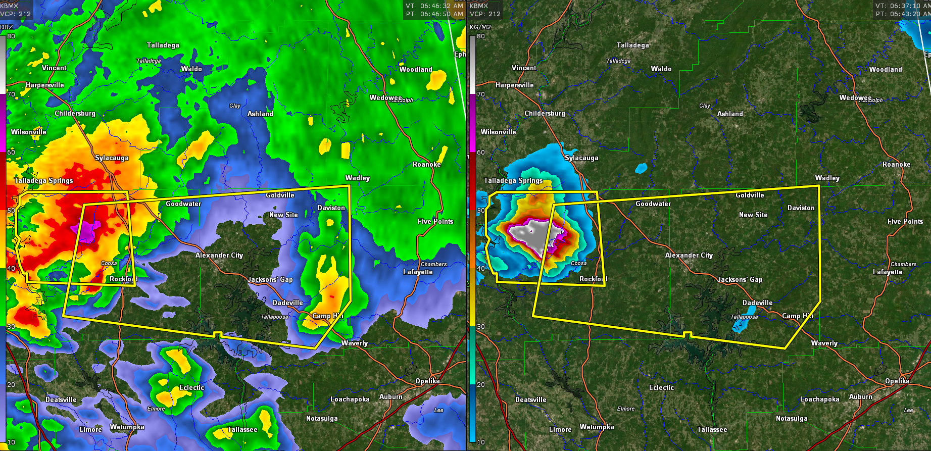
The National Weather Service in Birmingham has issued a
* Severe Thunderstorm Warning for…
Tallapoosa County in east central Alabama…
Coosa County in east central Alabama…
* Until 730 AM CDT.
* At 646 AM CDT, a severe thunderstorm was located over Bentleyville,
or near Weogufka, moving east at 60 mph.
This is a very dangerous storm.
HAZARD…80 mph wind gusts and half dollar size hail.
SOURCE…Radar indicated.
IMPACT…Flying debris will be dangerous to those caught without
shelter. Mobile homes will be heavily damaged. Expect
considerable damage to roofs, windows, and vehicles.
Extensive tree damage and power outages are likely.
* Locations impacted include…
Alexander City, Dadeville, Goodwater, Camp Hill, Rockford,
Kellyton, Weogufka, Jacksons’ Gap, New Site, Goldville, Hanover,
Lyle, Pentonville, Bradford, Cottage Grove, Bentleyville, Moriah,
Hatchet, Nixburg and Hillabee Creek.e
Category: Alabama's Weather, ALL POSTS, Severe Weather
About the Author (Author Profile)
Bill Murray is the President of The Weather Factory. He is the site's official weather historian and a weekend forecaster. He also anchors the site's severe weather coverage. Bill Murray is the proud holder of National Weather Association Digital Seal #0001 @wxhistorianSubscribe
If you enjoyed this article, subscribe to receive more just like it.


