Brief Mesoscale Update From NWS Birmingham
This is the latest Mesoscale Update from NWS Birmingham’s Area Forcast Discussion:
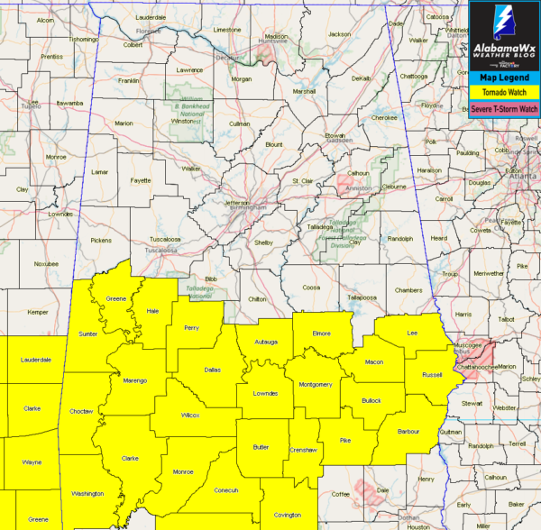
A Tornado Watch continues for several southern counties this evening.
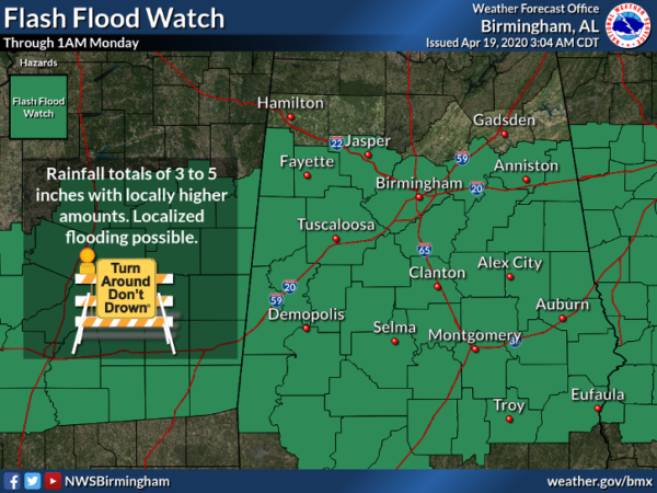
A Flash Flood Watch remains in effect for a majority of Central Alabama through midnight. Severe thunderstorms and flooding look likely south the next few hours.
Rain rates are 2 to 4 inches per hour in several spots but the storms are moving, but continued rain training over the same areas will keep a flood threat through at least midnight. Several measured amounts over 3 inches have occurred and some areas will certainly receive totals in the 4-5 inch range.
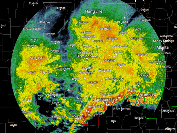
It appears that two distinct boundaries and in the vicinity of south-central Alabama this evening. One boundary is generally the remnant outflows from convection last night through this evening and the second boundary is the actual warm front. The airmass near and south of the warm front is super buoyant and poses a significant threat for severe thunderstorms. The air between the two boundaries which is generally where the current radar depicts thunderstorms in Central Alabama is slightly removed just north of the warm front. There is quite a gradient in several severe parameters right along the boundary where storms are riding from Lowndes County to Russell County. Storm-relative helicity/Bulk Shear/and Instability are concerning enough that severe storms are certainly likely near the effective boundary. The mixed-up surface winds are having an effect on the tornado development and magnitude and for the better at this time.
Another wave was over Mississippi at this time and will move into south-central Alabama within a few hours. NWS Birmingham is hesitant to remove any counties west from the watch due to the possibility of additional storms riding near leftover boundaries. The highest risk for any significant severe remains the far southern few counties. We will make some adjustments to the severe graphics to move the target zone even farther south but certainly hold a risk.
Category: Alabama's Weather, ALL POSTS, Severe Weather
About the Author (Author Profile)
Scott Martin is an operational meteorologist, professional graphic artist, musician, husband, and father. Not only is Scott a member of the National Weather Association, but he is also the Central Alabama Chapter of the NWA president. Scott is also the co-founder of Racecast Weather, which provides forecasts for many racing series across the USA. He also supplies forecasts for the BassMaster Elite Series events including the BassMaster Classic.Subscribe
If you enjoyed this article, subscribe to receive more just like it.


