Strong Storms Affecting Autauga & Lowndes County
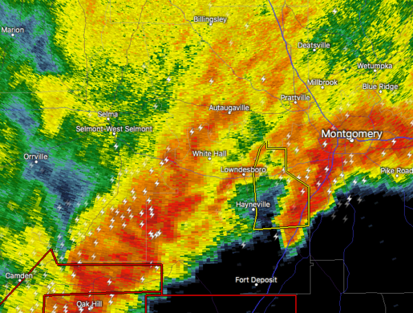
At 714 PM CDT, Doppler radar was tracking strong thunderstorms along
a line extending from near Vida Junction to 9 miles northeast of Pine
Apple. Movement was east at 40 mph.
Half inch hail and wind gusts up to 50 mph will be possible with
these storms.
Locations impacted include…
Prattville, Fort Deposit, Mosses, Hayneville, Autaugaville, White
Hall, Gordonville, Lowndesboro, Benton, Booth, Beechwood, Autauga
County Airport, Logan, Calhoun, Manack, Robert F. Henry Lock And Dam,
Letohatchee, Mount Willing, Collirene and Clover Hill.
These storms may intensify, so be certain to monitor local radio
stations and available television stations for additional information
and possible warnings from the National Weather Service.
Category: Alabama's Weather, ALL POSTS, Severe Weather
About the Author (Author Profile)
Scott Martin is an operational meteorologist, professional graphic artist, musician, husband, and father. Not only is Scott a member of the National Weather Association, but he is also the Central Alabama Chapter of the NWA president. Scott is also the co-founder of Racecast Weather, which provides forecasts for many racing series across the USA. He also supplies forecasts for the BassMaster Elite Series events including the BassMaster Classic.Subscribe
If you enjoyed this article, subscribe to receive more just like it.


