Mild summer
After the coolest 4-day period at Birmingham in July since 1972 (neat statistics here), I started looking a little closer at past summers, and the weather to come over the next few days.
In a normal summer, we have 15 days with highs of 95+ degrees, and 2 at 100+. So far this year, we’ve only had 2 days at 95 or hotter (by now, we’ve usually already had 7). Of course, the pattern could change in August and produce 100 degree weather, but with our moist ground due to plenty of rain this year, a big heat wave is unlikely.
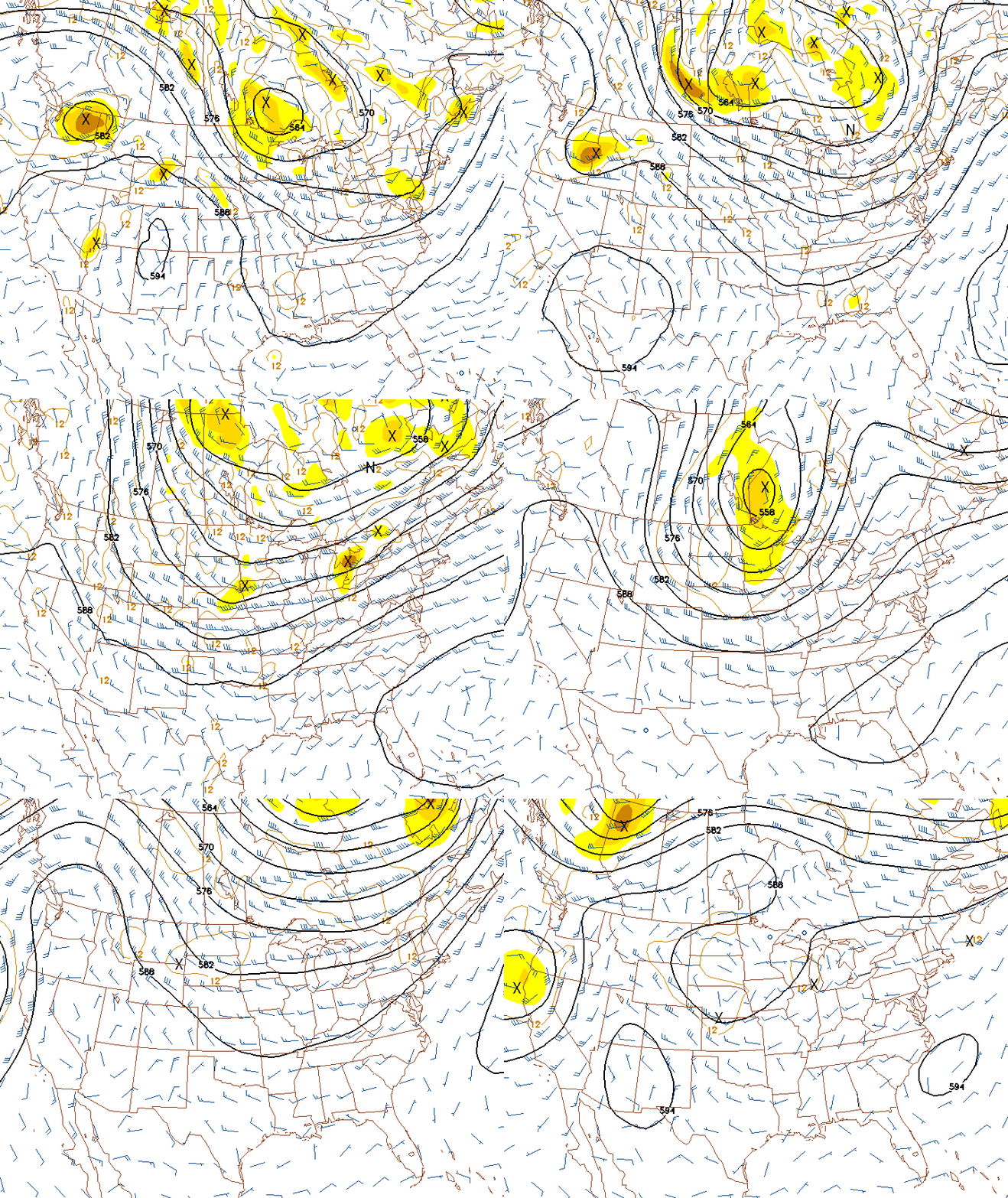
Looking at the forecast, the upper-air pattern looks a little more like winter than summer, with a trough over the eastern half of the US holding at least into next week. Since warm is less dense than cool air, the height of the 500 mb surface (shown in these maps) is lower in cool air, so troughs are generally associated with cool air and ridges with warm air. Here is the 500 mb forecast from the GFS for the next 2 weeks, at 12-hour intervals.
The model hints that the western ridge will start to break down next week, allowing the eastern trough to retreat some and our temperatures to warm up. That should start happening this weekend, with strong sunshine. Just enjoy the mild temperatures while they’re here…after near record lows this morning, we should drop into the 60s again tonight.
Category: Alabama's Weather, Pre-November 2010 Posts


