Storms Already Forming In The Western Parts Of The Area & Back Into Mississippi
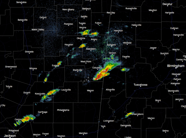
At 10:13 am, we are already starting to see storms fire up back in the eastern parts of Mississippi and moving into Lamar and Pickens counties. At this point, they are staying well-behaved at the moment, but we’ll need to continue to watch this part of the area for more development which could become severe.
Instability remains very low at this point over much of Central Alabama, but with the earlier activity making such an early exit, it should allow the atmosphere to recover rather quickly and more storms will be likely to form with time.
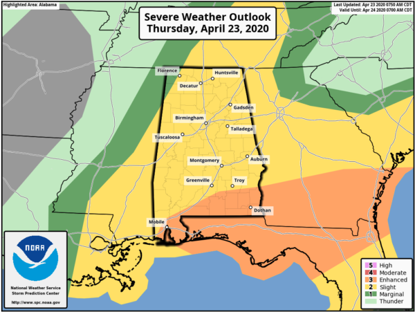
A LEVEL 3 ENHANCED RISK is up for the extreme southern portions of Pike and Barbour counties. The LEVEL 2 SLIGHT RISK is up for nearly the rest of North/Central Alabama with the exception of the northwest corner of the area, where a LEVEL 1 MARGINAL RISK exists.
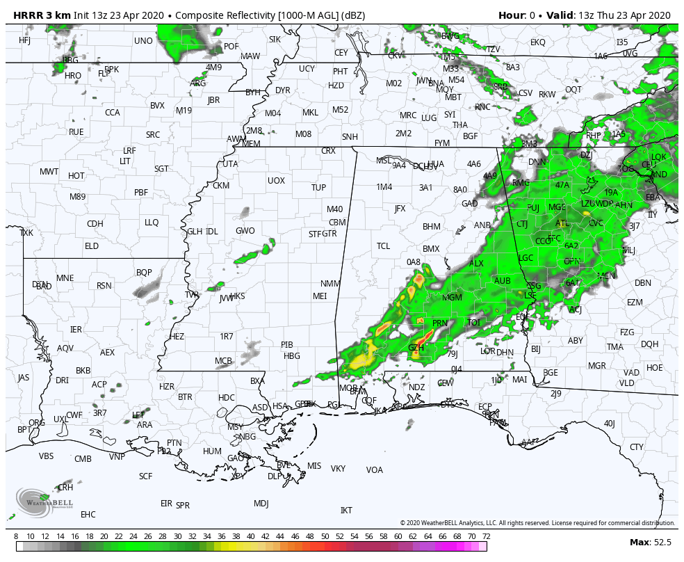
The latest HRRR is picking up on convective thunderstorms forming back in Mississippi and moving across Central Alabama throughout the rest of the morning and into the afternoon and evening hours. If these storms continue to develop, there will be a threat of damaging winds, large hail, and maybe a tornado or two.
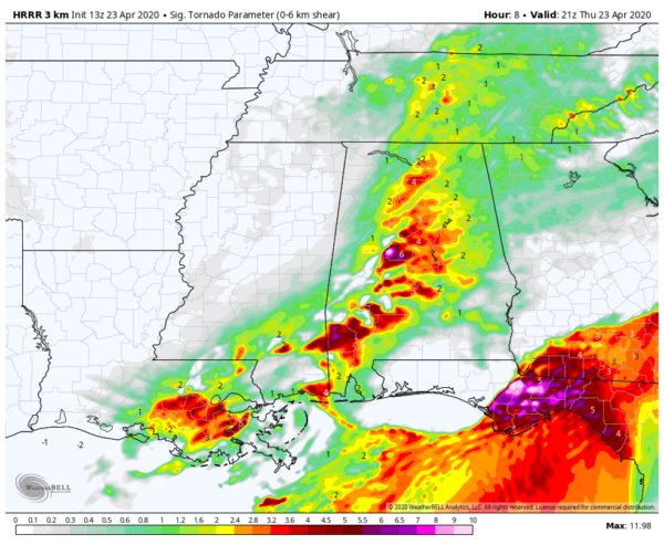
This is the latest Significant Tornado Parameter run off of the HRRR valid at 4:00 pm this afternoon, and it continues to show a definite risk of tornadoes if storms do form. The Significant Tornado Parameter is a multiple-ingredient, composite index that uses a combination of bulk wind difference, storm-relative felicity, mean parcel instability, mean parcel lifted condensation level height, and mean level convective inhibition.
A majority of significant tornadoes (F2 or greater damage) have been associated with Significant Tornado Parameter values greater than 1.0 within an hour of tornado occurrence, while most non-tornadic supercells have been associated with values less than 1.0.
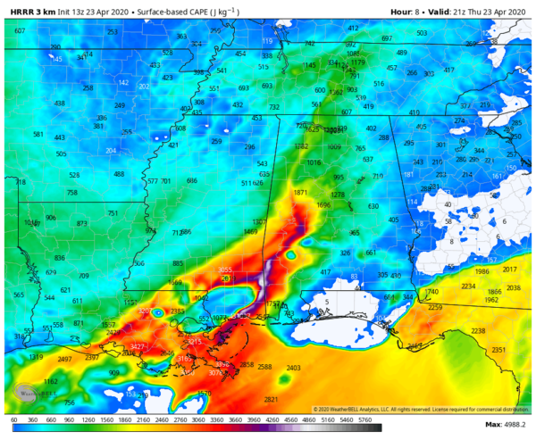
There will be plenty of instability available across all of North/Central Alabama, so we’ll need to stay alert to see if any storms form and how they will act when or if the atmosphere recovers.
Category: Alabama's Weather, ALL POSTS, Severe Weather
About the Author (Author Profile)
Scott Martin is an operational meteorologist, professional graphic artist, musician, husband, and father. Not only is Scott a member of the National Weather Association, but he is also the Central Alabama Chapter of the NWA president. Scott is also the co-founder of Racecast Weather, which provides forecasts for many racing series across the USA. He also supplies forecasts for the BassMaster Elite Series events including the BassMaster Classic.Subscribe
If you enjoyed this article, subscribe to receive more just like it.


