Warm, Breezy Saturday; Cooler, Breezy Sunday
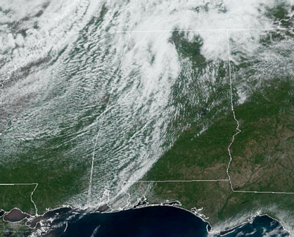
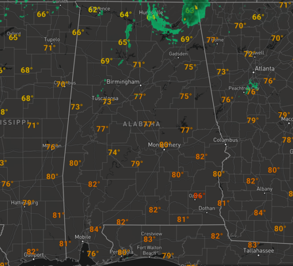
We started the day off with some scattered areas of rain across North/Central Alabama, but that activity has since pushed north into Tennessee Valley of Northeast Alabama. For the rest of us today, we are seeing some sun and some clouds, as we wait on the front to push through the state. The front is pretty moisture starved and is why we are seeing very little rain associated with it this afternoon, but there could certainly be some showers develop, with even a rumble of thunder possible, but the vast majority of us stay dry; we are seeing more clouds as the front pushes through the state. Out ahead of the front, we are seeing blustery southwesterly winds sustained between 15-25 mph, with gust as high as 30-35 mph.Temperatures are very warm with mid 70s early this afternoon, and buy the end of the day, we should see upper 70s and lower 80s.
Once the front passes by later today, winds will become westerly and then more northwesterly as the low pressure to out north pulls away from the state. Tonight should be partly cloud and cooler with upper 40s and lower 50s by first thing tomorrow morning.
We note to out north, across extreme North and Northeast Alabama, a few stronger storms are possible this afternoon and evening, however the greater threat for severe storms today will be across East Tennessee, across the Appalachian Mountains into the Carolinas, where some storms could produce gusty winds and hail.
COOLER, BREEZY SUNDAY: Tomorrow will be dry and pleasant with tons of sunshine, for a lot of Alabama. Portions of Northeast Alabama may stay cloud tomorrow due to wrap around moisture from the departing low. Behind the cold front tomorrow, it will be a noticeably cooler day, with many locations staying in the mid to upper 60s across North/Central Alabama, with lower 70s down south. Tomorrow will be another breezy day, but instead of warm southwesterly winds, the winds will be northwesterly, at 10-25 mph, making it feel cooler.
THE START THE WEEK: High pressure builds in late Sunday across the Southeast, and that will provide quiet and calm weather on Monday and Tuesday. Expect sunny mild days, with lower 70s Monday, followed by upper 70s Tuesday. Nights will be chilly, and we should lower to mid 40s Monday morning, followed by upper 40s and lower 50s Tuesday morning. Late Tuesday, clouds will begin to increase ahead of our next storm system.
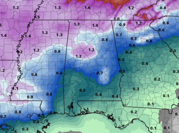
STORMS MIDWEEK: By late Tuesday and into Wednesday, rain and storms return to Alabama. This is a very dynamic storm system, but the models still show the surface low and bettered dynamics well to the north of Alabama in the Great Lakes, so we do not anticipate severe weather with this system in Alabama. But as the trailing cold front swings through the state, rain and thunderstorms are expected and a few strong storms are certainly going to be possible. If the threat for severe weather were to develop across Alabama, of course we will let you know. Nevertheless, many of us should see nice soaking rainl, as rainfall amounts will be around one inch, with higher amounts to the north, and lower amounts to the south.
THURSDAY/FRIDAY: High pressure builds in behind the midweek front, and terrific spring weather looks to round April and continue into the first weekend of May. Expect sunny days, with sensational 70s for highs, lows will be in the upper 40s and lower 50s.
BEACH FORECAST CENTER: Get the latest weather and rip current forecasts for the beaches from Fort Morgan to Panama City on our Beach Forecast Center page. There, you can select the forecast of the region that you are interested in visiting.
WORLD TEMPERATURE EXTREMES: Over the last 24 hours, the highest observation outside the U.S. was 113.7F at Diffa, Niger. The lowest observation was -87.7F at Vostok, Antarctica.
CONTIGUOUS TEMPERATURE EXTREMES: Over the last 24 hours, the highest observation was 110F at Falcon Lake, TX. The lowest observation was 12F at Pikes Peak, CO.
WEATHER ON THIS DATE IN 1875: New York City received three inches of snow, the latest measurable snow of record for that location.
Category: Alabama's Weather, ALL POSTS
About the Author (Author Profile)
Macon, Georgia Television Chief Meteorologist, Birmingham native, and long time Contributor on AlabamaWX. Stormchaser. I did not choose Weather, it chose Me. College Football Fanatic. @Ryan_StinnetSubscribe
If you enjoyed this article, subscribe to receive more just like it.


