

Plenty of Sun; Getting Hot
Plenty of sunshine and very warm to hot temperatures highlight the forecast for the rest of our Saturday. The sky is not severe clear, but has some upper-level cirrus as well as fair weather cumulus.
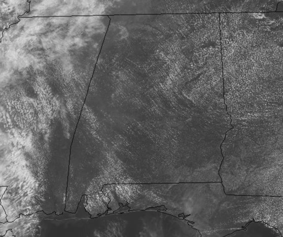
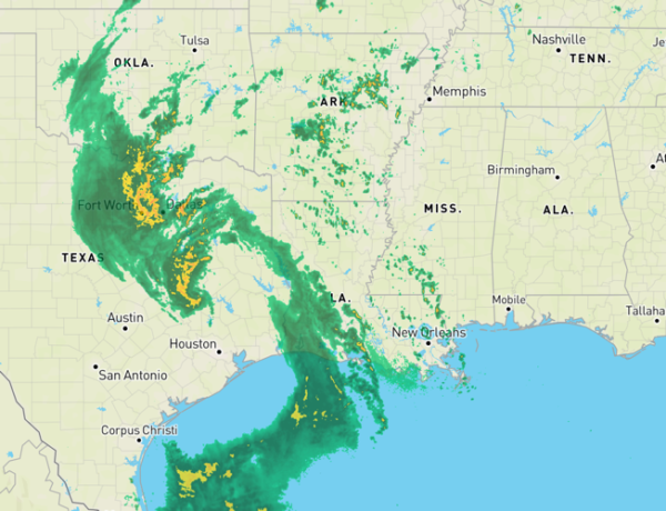
Unfortunately the radar is quiet with little to no rain in Alabama today, so no heat relief and we could certainly use it as temperatures this afternoon will be in the upper 80s and lower 90s across Alabama. Now rain chances are not zero, but are generally less than 10% the rest of today. Tonight, expect a very midl night with lows in the mid to upper 60s.
ON THE MAPS: We have a cut-off low to the west of Alabama today and it is ever so slowly inching eastward this weekend.
Of course, to our southeast, we are we are watching the tropics, waiting on Arthur, which will not impact Alabama. However, the low to the west, will begin to influence Alabama’s weather tomorrow with better rain chances. Also, well to the northwest, a cold front is making its way to through the Plains, and should arrive in the Southeast for the middle part of next week.
FOR SUNDAY: With the low inching closer tomorrow, we are going to see more clouds and bring the chance for scatters showers and storms into Alabama through the day tomorrow, especially tomorrow afternoon and evening. Highs tomorrow should be a bit cooler with highs generally in the mid 80s.
WAITING ON ARTHUR: An area of low pressure located just offshore of the southeast coast of Florida
continues to produce shower activity and gusty winds from portions of southeast and east-central Florida eastward across the northwestern Bahamas and the adjacent Atlantic waters. Satellite images and surface observations indicate that the low is gradually becoming better defined, but the associated showers and thunderstorms remain disorganized.
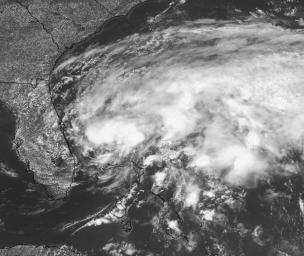
Continued gradual development is expected, and the system is likely to become a tropical or subtropical depression or storm later today or tonight while it moves north-northeastward over the Atlantic waters east of Florida.
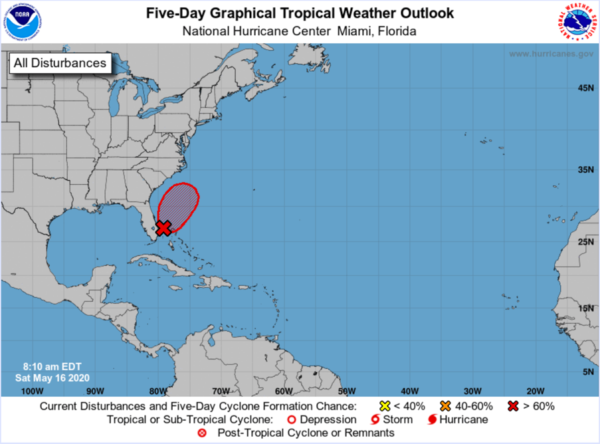
Later in the weekend and early next week, the system is expected to move generally northeastward over the western Atlantic near or east of the Carolinas. An Air Force Reserve Hurricane Hunter aircraft is currently enroute to investigate the disturbance. Formation chance through 48 hours…high…80 percent.
BEACH FORECAST CENTER: Get the latest weather and rip current forecasts for the beaches from Fort Morgan to Panama City on our Beach Forecast Center page. There, you can select the forecast of the region that you are interested in visiting.
WORLD TEMPERATURE EXTREMES: Over the last 24 hours, the highest observation outside the U.S. was 117.0F at Matam, Senegal. The lowest observation was -95.4F at Vostok, Antarctica.
CONTIGUOUS TEMPERATURE EXTREMES: Over the last 24 hours, the highest observation was 103F at Rio Grande Village, TX. The lowest observation was 15F at Copper Basin, ID.
Category: Alabama's Weather, ALL POSTS
About the Author (Author Profile)
Macon, Georgia Television Chief Meteorologist, Birmingham native, and long time Contributor on AlabamaWX. Stormchaser. I did not choose Weather, it chose Me. College Football Fanatic. @Ryan_StinnetSubscribe
If you enjoyed this article, subscribe to receive more just like it.


