From NOAA’s CPC: Busy Atlantic Hurricane Season Predicted for 2020
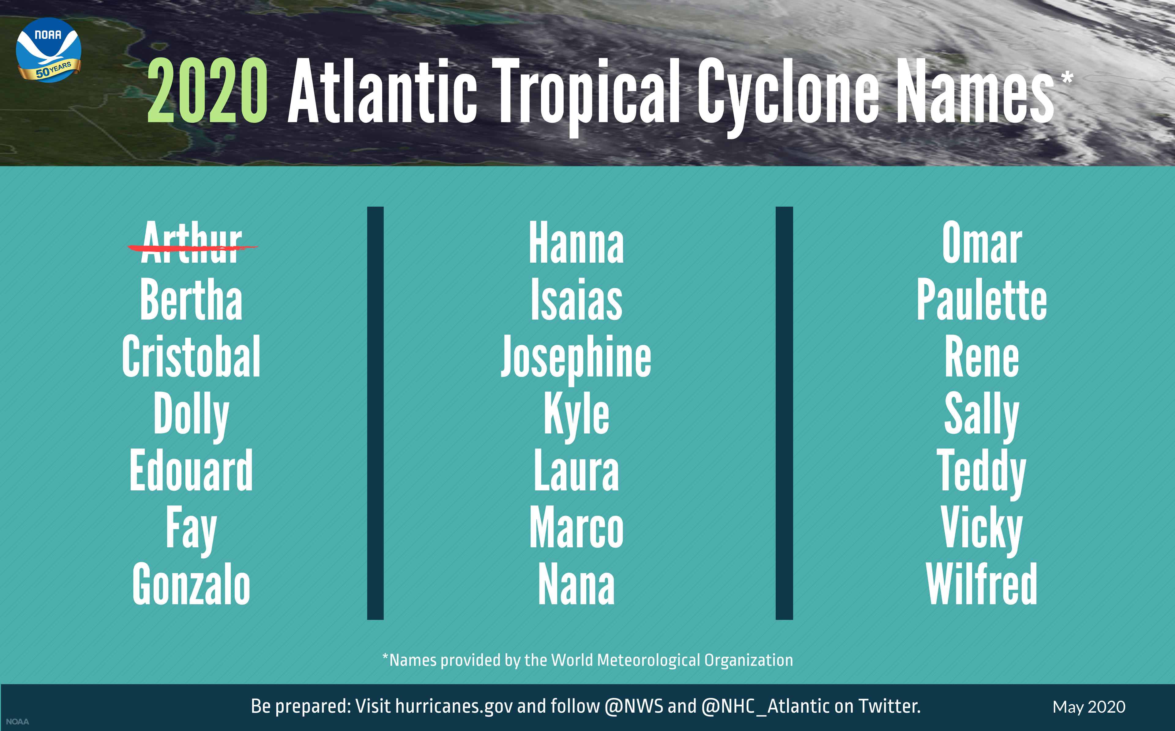
While the Atlantic Hurricane Season doesn’t officially start until June 1st, the tropics have already seen activity as Tropical Storm Arthur formed over this past weekend and scooted along the Atlantic coast of the Southeastern US before losing its tropical characteristics on Tuesday morning. The Climate Prediction Center of NOAA released its tropical outlook for the Atlantic Hurricane Season earlier this morning and believes a busy season is likely to occur. Here is the latest from the CPC:
From NOAA.gov
Multiple climate factors indicate above-normal activity is most likely.
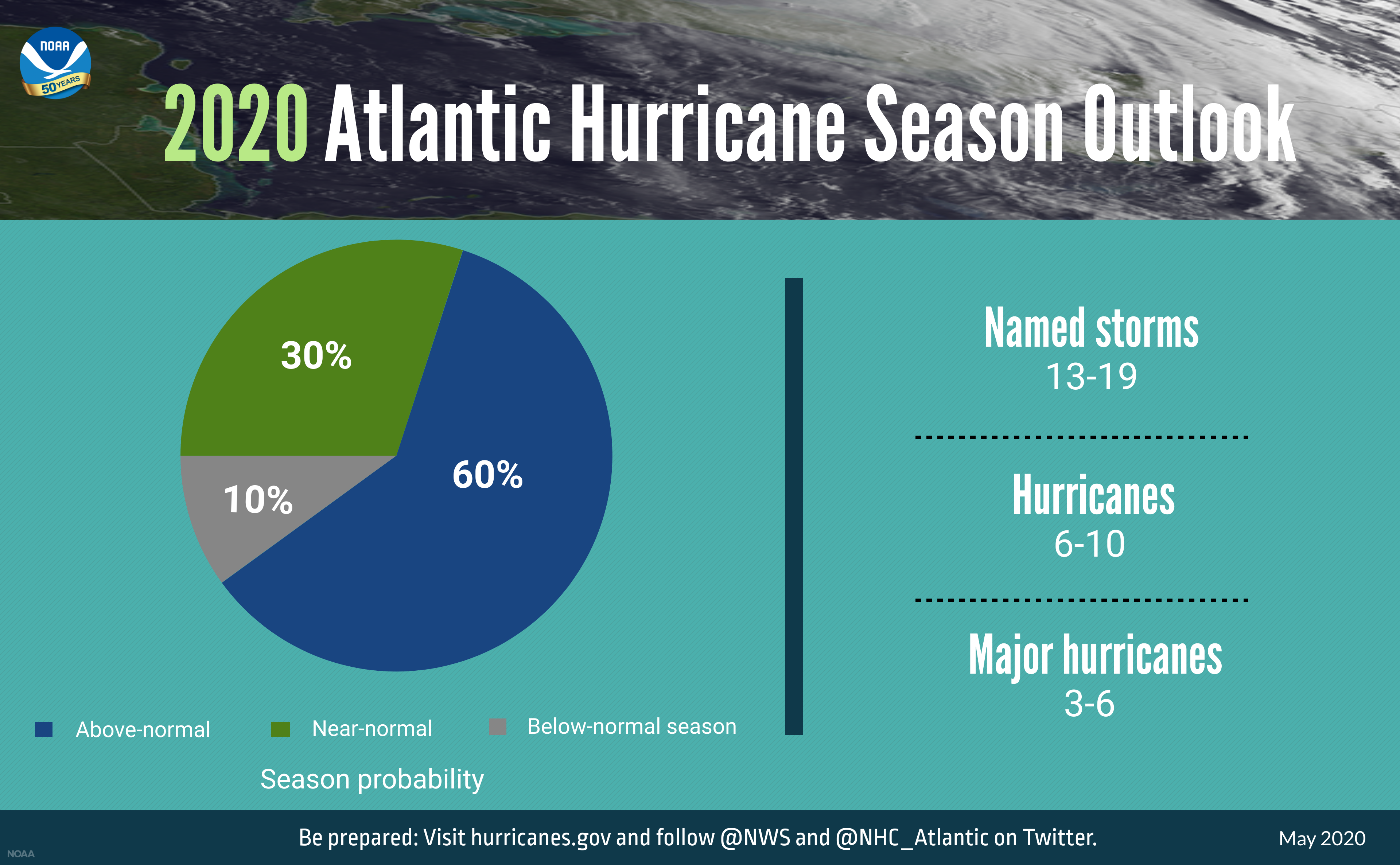
An above-normal 2020 Atlantic hurricane season is expected, according to forecasters with NOAA’s Climate Prediction Center, a division of the National Weather Service. The outlook predicts a 60% chance of an above-normal season, a 30% chance of a near-normal season, and only a 10% chance of a below-normal season. The Atlantic hurricane season runs from June 1 through November 30.
NOAA’s Climate Prediction Center is forecasting a likely range of 13 to 19 named storms (winds of 39 mph or higher), of which 6 to 10 could become hurricanes (winds of 74 mph or higher), including 3 to 6 major hurricanes (category 3, 4 or 5; with winds of 111 mph or higher). NOAA provides these ranges with a 70% confidence. An average hurricane season produces 12 named storms, of which 6 become hurricanes, including 3 major hurricanes.
The combination of several climate factors is driving the strong likelihood of above-normal activity in the Atlantic this year. El Nino Southern Oscillation (ENSO) conditions are expected to either remain neutral or to trend toward La Nina, meaning there will not be an El Nino present to suppress hurricane activity. Also, warmer-than-average sea surface temperatures in the tropical Atlantic Ocean and the Caribbean Sea, coupled with reduced vertical wind shear, weaker tropical Atlantic trade winds, and an enhanced west African monsoon all increase the likelihood for an above-normal Atlantic hurricane season. Similar conditions have been producing more active seasons since the current high-activity era began in 1995.
This year, as during any hurricane season, the men and women of NOAA remain ready to provide the life-saving forecasts and warnings that the public rely on. And as storms show signs of developing, NOAA hurricane hunter aircraft will be prepared to collect valuable data for our forecasters and computer models.
In addition to this high level of science and service, NOAA is also launching new upgrades to products and tools that will further improve critical services during the hurricane season.
NOAA will upgrade the hurricane-specific Hurricane Weather Research and Forecast system (HWRF) and the Hurricanes in a Multi-scale Ocean coupled Non-hydrostatic model (HMON) models this summer. HWRF will incorporate new data from satellites and radar from NOAA’s coastal Doppler data network to help produce better forecasts of hurricane track and intensity during the critical watch and warning time frame. HMON will undergo enhancements to include higher resolution, improved physics, and coupling with ocean models.
As the hurricane season gets underway, NOAA will begin feeding data from the COSMIC-2 satellites into weather models to help track hurricane intensity and boost forecast accuracy. COSMIC-2 provides data about air temperature, pressure, and humidity in the tropical regions of Earth — precisely where hurricane and tropical storm systems form.
Also during the 2020 hurricane season, NOAA and the U.S. Navy will deploy a fleet of autonomous diving hurricane gliders to observe conditions in the tropical Atlantic Ocean and the Caribbean Sea in areas where hurricanes have historically traveled and intensified.
NOAA’s outlook is for overall seasonal activity and is not a landfall forecast. The Climate Prediction Center will update the 2020 Atlantic seasonal outlook in August prior to the historical peak of the season.
About the Author (Author Profile)
Scott Martin is an operational meteorologist, professional graphic artist, musician, husband, and father. Not only is Scott a member of the National Weather Association, but he is also the Central Alabama Chapter of the NWA president. Scott is also the co-founder of Racecast Weather, which provides forecasts for many racing series across the USA. He also supplies forecasts for the BassMaster Elite Series events including the BassMaster Classic.Subscribe
If you enjoyed this article, subscribe to receive more just like it.


