All Dry & Warming Up as of 11:00 am; Some Strong Storms Possible on Friday
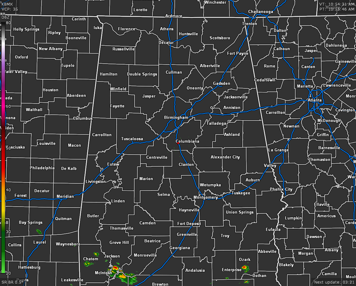
As we have hit the 11 o’clock hour across Central Alabama, we see that radar is all quiet for the area, but a few showers and thunderstorms have already developed in portions of South Alabama. The general direction of that activity is to the southeast and is not heading toward Central Alabama. Temperatures were in the upper 60s to the mid-70s across the area.
There is a front that has stalled out over the extreme southern portions of the state that will begin to very slowly moving to the north throughout the day perhaps only making it as far north as the US-80 and I-85 corridors. That will keep the main focus of scattered showers and thunderstorms along and south of those corridors as we move through the rest of the daylight hours. North of that, the rest of Central Alabama will stay mainly dry with only a very slight chance of isolated showers or thunderstorms. Afternoon highs will top out in the upper 70s to the mid-80s across the area.
A very small chance of a few isolated showers will continue for all of Central Alabama during the late-night and overnight hours. We may also have to deal with areas of patchy fog. Overnight lows will be in the lower to mid-60s for most.
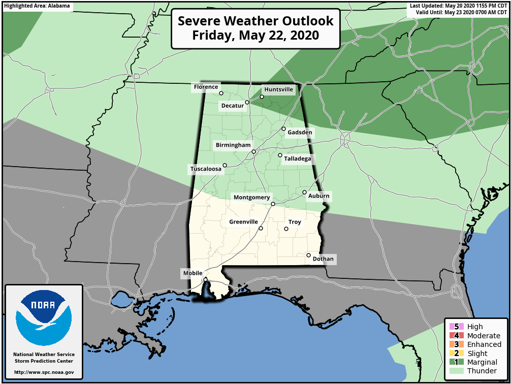
As the front continues to lift slowly northward as a warm front, we may have a wave of energy move along the front may bring just enough support for the formation of strong to marginally severe thunderstorms to the northeastern parts of North Alabama and perhaps clipping the extreme northeastern tip of Central Alabama. There is a decent chance of scattered showers and thunderstorms for all of Central Alabama mainly during the afternoon and early evening hours, with stronger storms possible in the Marginal Risk locations (north of a line from Decatur to Guntersville to Cedar Bluff). Highs look to top out in the mid to upper 80s. You may see a few locations in the southern half of the area briefly touch 90 degrees.
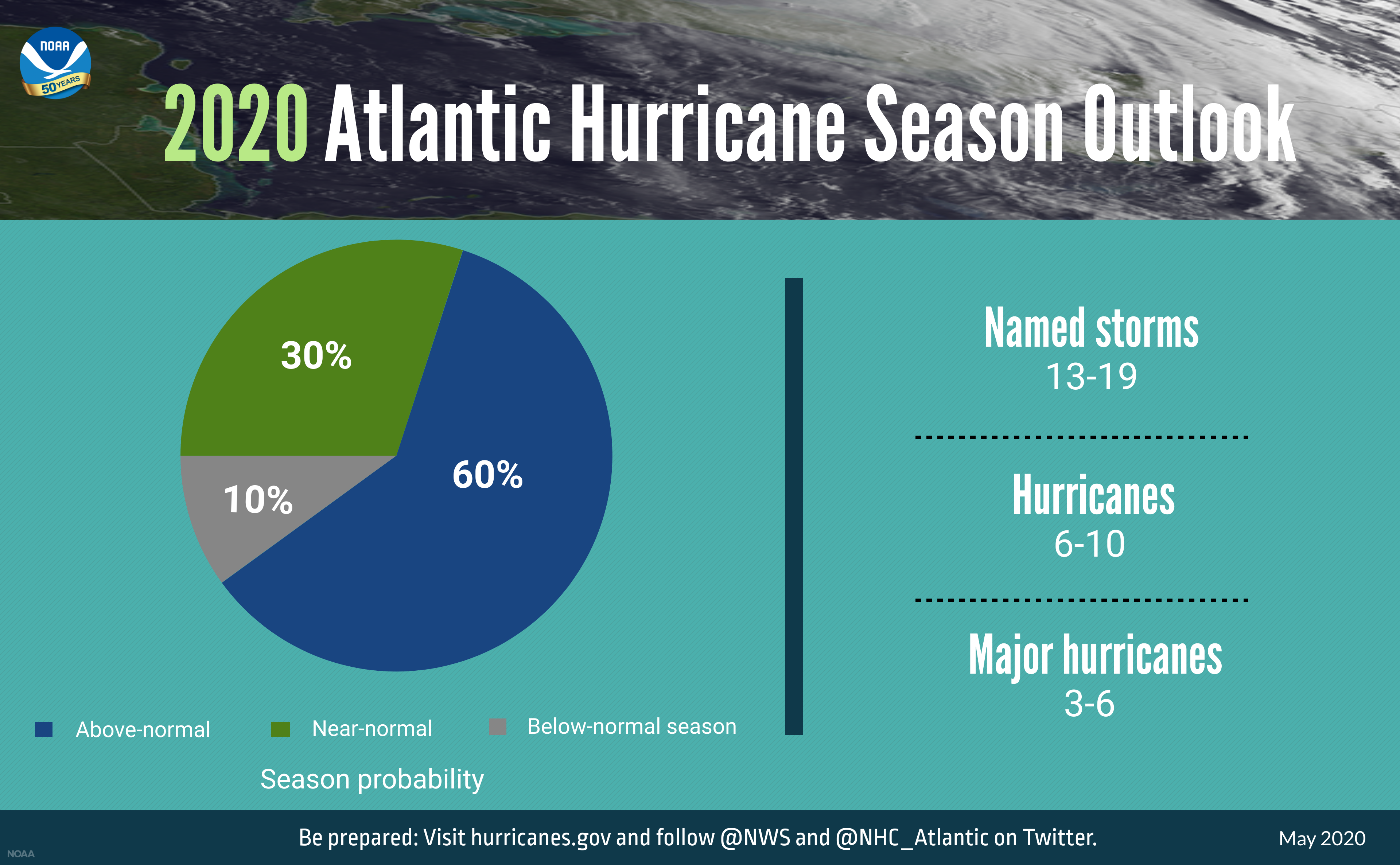
NOAA’s Climate Prediction Center released its outlook for the Atlantic Hurricane Season stating it is forecasting a likely range of 13 to 19 named storms (winds of 39 mph or higher), of which 6 to 10 could become hurricanes (winds of 74 mph or higher), including 3 to 6 major hurricanes (category 3, 4 or 5; with winds of 111 mph or higher). The Atlantic hurricane season starts on June 1st and runs through November 30th.
Category: Alabama's Weather, ALL POSTS, Severe Weather, Tropical
About the Author (Author Profile)
Scott Martin is an operational meteorologist, professional graphic artist, musician, husband, and father. Not only is Scott a member of the National Weather Association, but he is also the Central Alabama Chapter of the NWA president. Scott is also the co-founder of Racecast Weather, which provides forecasts for many racing series across the USA. He also supplies forecasts for the BassMaster Elite Series events including the BassMaster Classic.Subscribe
If you enjoyed this article, subscribe to receive more just like it.


