Strong Storms About to Move Into Cherokee County
…SIGNIFICANT WEATHER ADVISORY FOR CENTRAL CHEROKEE COUNTY UNTIL 10:15 AM CDT…
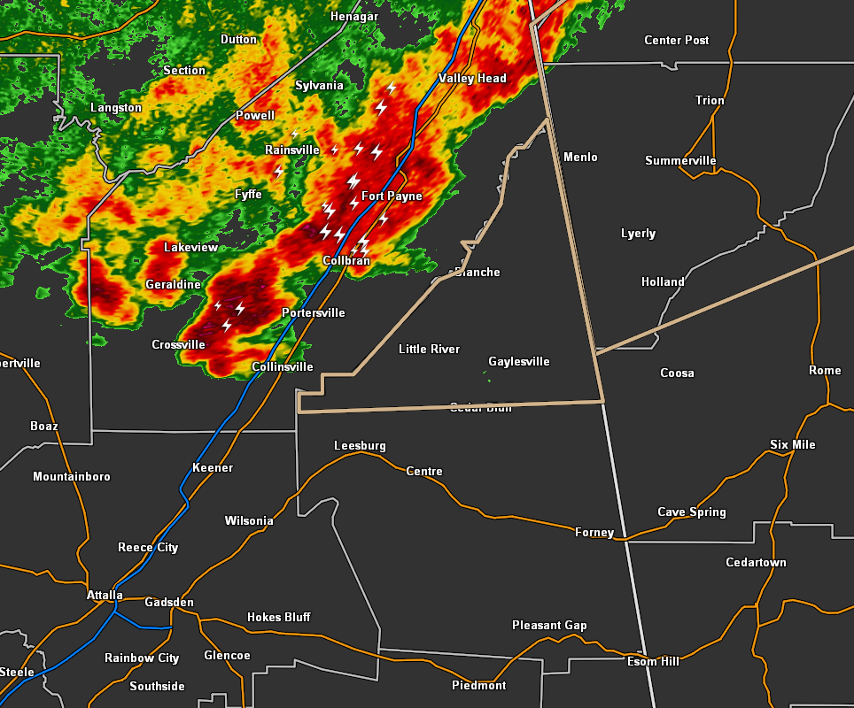
At 9:31 AM CDT, Doppler radar was tracking strong thunderstorms along a line extending from 8 miles northeast of Fort Payne to near Crossville. Movement was east at 30 mph.
Pea size hail and winds up to 40 mph will be possible with these storms.
Locations impacted include…
Cedar Bluff, Little River Canyon National Preserve, Sand Rock, Gaylesville, Cornwall Furnace Park, Blanche, Little River Falls, Eastern Weiss Lake, Western Weiss Lake, Fullerton, New Moon, Yellow Creek Falls, Broomtown, Chesterfield and Little River Canyon NP.
Category: Alabama's Weather, ALL POSTS
About the Author (Author Profile)
Scott Martin is an operational meteorologist, professional graphic artist, musician, husband, and father. Not only is Scott a member of the National Weather Association, but he is also the Central Alabama Chapter of the NWA president. Scott is also the co-founder of Racecast Weather, which provides forecasts for many racing series across the USA. He also supplies forecasts for the BassMaster Elite Series events including the BassMaster Classic.Subscribe
If you enjoyed this article, subscribe to receive more just like it.


