Tropical Storm Bertha Makes Landfall Near Mount Pleasant, SC
SUMMARY OF 10:00 AM CDT…1500 UTC…INFORMATION
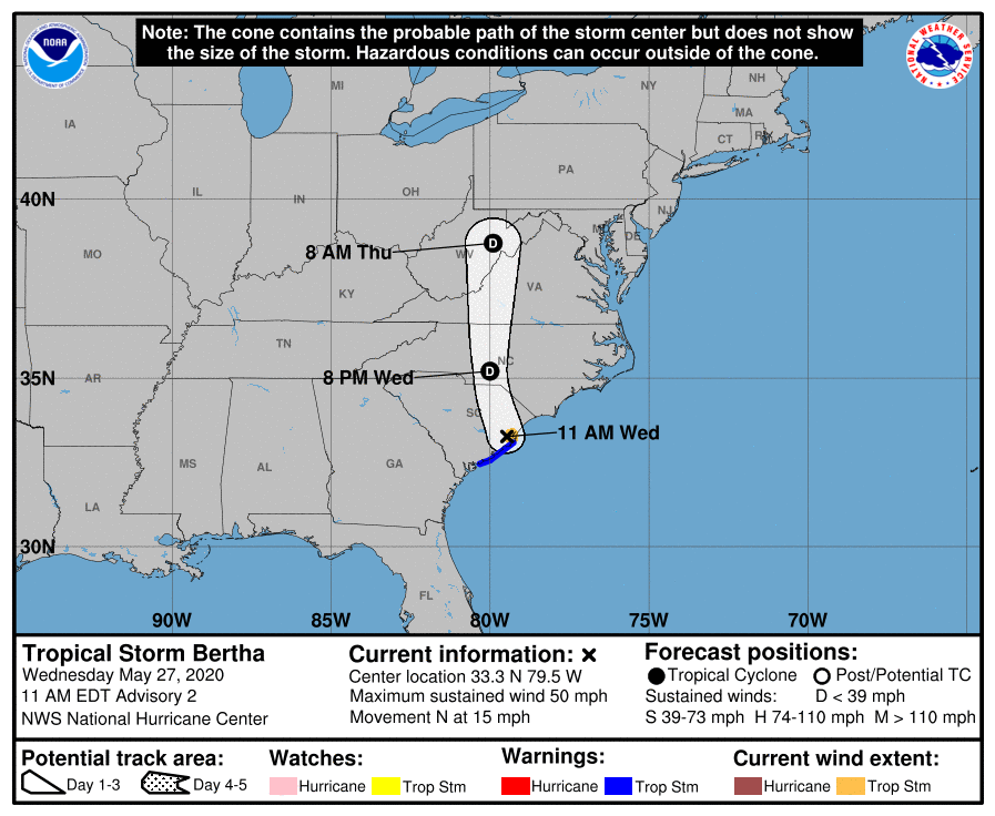
LOCATION…33.3N 79.5W
ABOUT 40 MI…65 KM NE OF CHARLESTON SOUTH CAROLINA
MAXIMUM SUSTAINED WINDS…50 MPH…85 KM/H
PRESENT MOVEMENT…N OR 350 DEGREES AT 15 MPH…24 KM/H
MINIMUM CENTRAL PRESSURE…1005 MB…29.68 INCHES
WATCHES AND WARNINGS
A Tropical Storm Warning is in effect for the coast of South Carolina from Edisto Beach to South Santee River.
A Tropical Storm Warning means that tropical storm conditions are expected somewhere within the warning, in this case for the next few hours.
DISCUSSION AND OUTLOOK
At 10:00 AM CDT (1500 UTC), the center of Tropical Storm Bertha was located near latitude 33.3 North, longitude 79.5 West. Bertha is moving toward the north near 15 mph (24 km/h) and this general motion is expected to continue through tonight with a gradual increase in forward speed. On the forecast track, Bertha will move inland across eastern and northern South Carolina later today and into central North Carolina by tonight.
Maximum sustained winds are near 50 mph (85 km/h) with higher gusts. Weakening is forecast during the next 48 hours. Bertha is expected to weaken to a tropical depression later today and become a remnant low tonight.
Tropical-storm-force winds extend outward up to 25 miles (35 km) from the center. The estimated minimum central pressure is 1005 mb (29.68 inches).
HAZARDS AFFECTING LAND
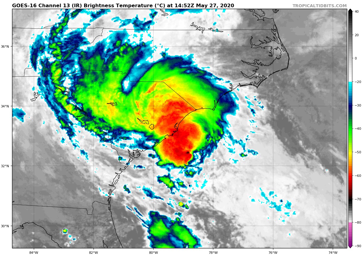
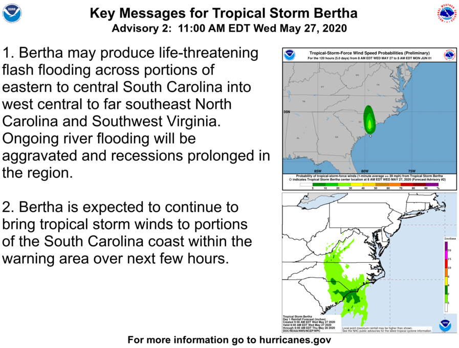
RAINFALL: Bertha is expected to produce total rain accumulation of 2 to 4 inches with isolated totals of 8 inches across eastern and central South Carolina into west-central to far southeastern North Carolina and southwest Virginia. Given very saturated antecedent conditions, this rainfall may produce life-threatening flash flooding, aggravate and prolong ongoing river flooding, and produce rapid out of bank rises on smaller rivers.
WIND: Tropical storm conditions are expected to continue near the coast for the next few hours.
About the Author (Author Profile)
Scott Martin is an operational meteorologist, professional graphic artist, musician, husband, and father. Not only is Scott a member of the National Weather Association, but he is also the Central Alabama Chapter of the NWA president. Scott is also the co-founder of Racecast Weather, which provides forecasts for many racing series across the USA. He also supplies forecasts for the BassMaster Elite Series events including the BassMaster Classic.Subscribe
If you enjoyed this article, subscribe to receive more just like it.


