Warm, Dry Final Weekend of May
Not too many issues with the weather this weekend. A front pushed through North/Central Alabama and that has brought drier air into the northern half of the state as dew points have at least slid down into the lower and mid 60s and will slide down into the 50s over the next 24 hours. It remains warm as temps are in the 80s this afternoon and by the end of the day, most locations should see mid 80s for highs. The sky remains mainly sunny and it should remain a dry afternoon as the better rain chances are across the southern half of the state today.
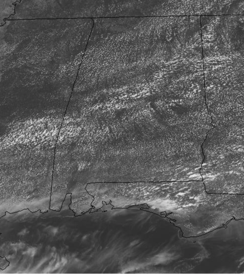
For tonight, expect a clear and comfortable night with lows likely sliding in the upper 50s by first thing tomorrow morning. For our Sunday, expect more of the same with plenty go sunshine, comfortable humidity levels, and warm temps with highs back in the lower to mid 80s.
COULD WE SEE CRISTOBAL?: Special Tropical Weather Outlook issued to discuss the area of low pressure over the central Atlantic. Shower activity has changed little overnight in association with a broad area of low pressure located about 500 miles east-southeast of Bermuda. Some development of this system is still possible through tonight, and it could become a short-lived subtropical depression while it moves northwestward over the central Atlantic. After that time, further development is not anticipated due to unfavorable environmental conditions. Formation chance through 48 hours…medium…60 percent.
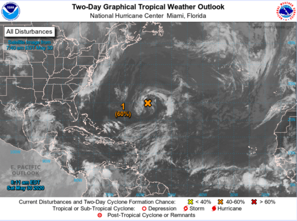
Just a reminder, hurricane season officially starts Monday June 1st, but technically the season is well-underway with two named system already. Next name on the list is Cristobal.
BEACH FORECAST CENTER: Get the latest weather and rip current forecasts for the beaches from Fort Morgan to Panama City on our Beach Forecast Center page. There, you can select the forecast of the region that you are interested in visiting.
WORLD TEMPERATURE EXTREMES: Over the last 24 hours, the highest observation outside the U.S. was 121.1F at Mitribah, Kuwait. The lowest observation was -96.3F at Dome C, Antarctica.
CONTIGUOUS TEMPERATURE EXTREMES: Over the last 24 hours, the highest observation was 118F at Death Valley, CA. The lowest observation was 30F at Hibbing & Silver Bay, NM.
WEATHER ON THIS DATE IN 1948: A railroad bed acting as a dam gave way during a flood along the Columbia River destroying the town of Vanport, OR. The nearly 19,000 residents escaped with little more than the clothes on their backs.
Category: Alabama's Weather, ALL POSTS
About the Author (Author Profile)
Macon, Georgia Television Chief Meteorologist, Birmingham native, and long time Contributor on AlabamaWX. Stormchaser. I did not choose Weather, it chose Me. College Football Fanatic. @Ryan_StinnetSubscribe
If you enjoyed this article, subscribe to receive more just like it.


