Late Morning Look at Tropical Storm Cristobal
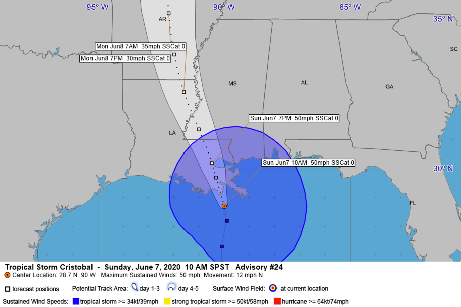
The center of Tropica Storm Cristobal s just about 35 miles south of Grand Isle, Louisiana at 10 a.m., or about 80 miles south of Houma, and about 90 miles south of New Orleans.
Top winds are 50 mph. Movement is north at 12 mph. The center will reach the coast in the next few hours between Grand Isle and Morgan City and move north northeast through southern Louisiana.
The storm is rather disorganized and almost appears subtropical in nature, so not much additional strengthening is anticipated.
Water levels are rising along the coast. Here is the tidal trace at Shell Beach in Plaquemines Parish, southeast of New Orleans:
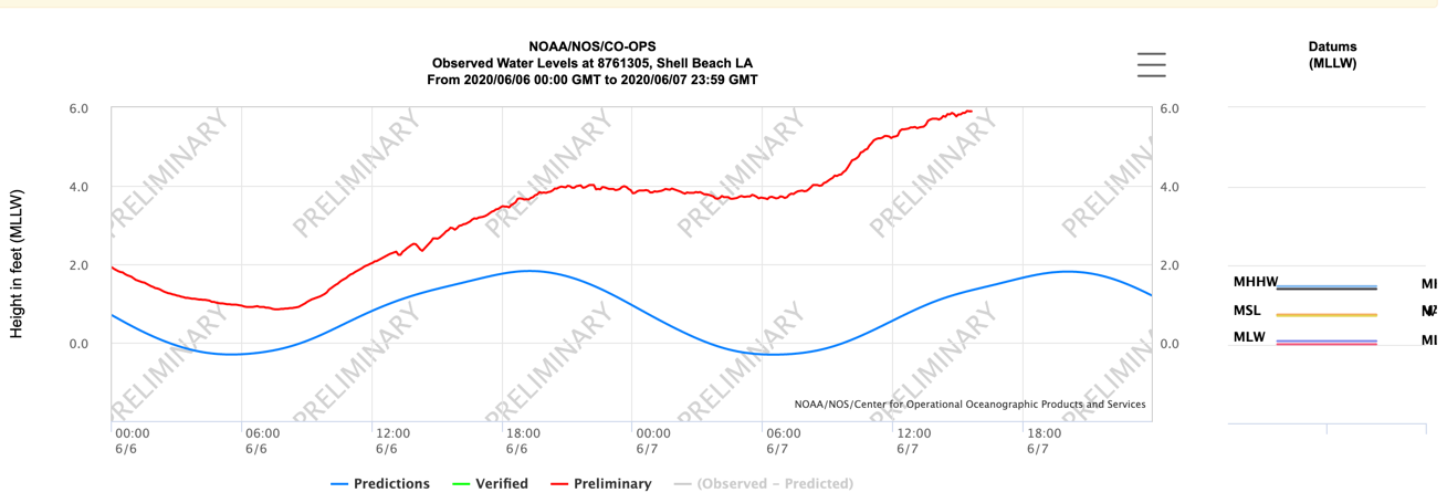
Here is the trace at Waveland, Mississippi. In both cases, the blue line is where the water should be, the red line is where it is.
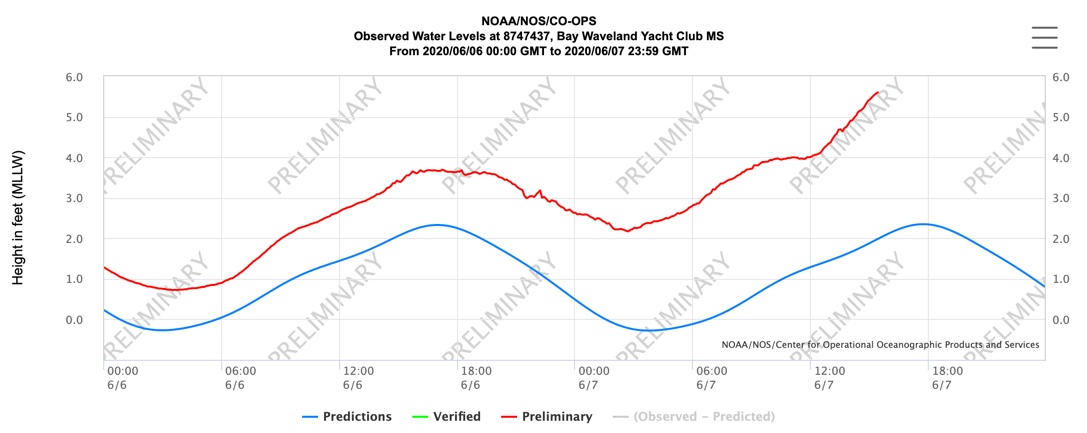
Tides may reach 3-5 feet above normal from the Mouth of the Mississippi River to Ocean Springs and 1-3 feet eastward across the Mississippi, Alabama, and Florida coasts all the way to Naples. 204 foot tides are possible back to Morgan City near where the storm center makes landfall.
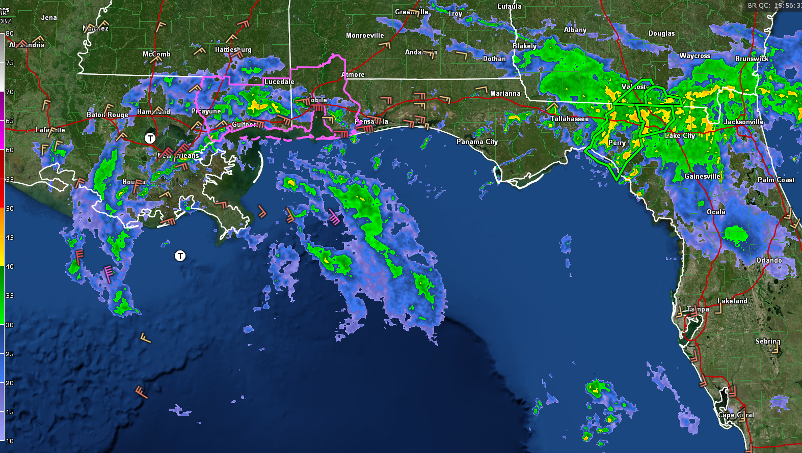
Tornadoes are possible today in feeder bands over parts of southeastern Louisiana, southwestern, Alabama, and southern Mississippi, as well as the Florida Panhandle.
Flash flood watches cover areas from southern Missouri through Arkansas, Louisiana, Mississippi, Alabama, and Florida where 4-8 inches of rain may fall along and east of the center. Parts of Central Alabama will see 1-2 inches of rain between now and Wednesday.
Here are spot reports along the coast:
Morgan City…Cloudy 77/73…NNE 19 mph gusting to 30 mph…barometer 29.56
Houma…Rain 75/75…N 23 mph gusting to 33 mph…barometer 29.50
MSY Armstrong International New Orleans…Cloudy 80/75…NE 23 mph gusting to 35 mph…barometer 29.53
Lakefront Airport New Orleans…Cloudy 80/75…NE at 32 mph gusting to 40 mph…barometer 29.53
Keesler/Biloxi…Light Rain…79/77…E 20 mph gusting to 30 mph…barometer 29.62
Mobile…Mist…80/77…E 30 mph gusting 44 mph
Current Radar:
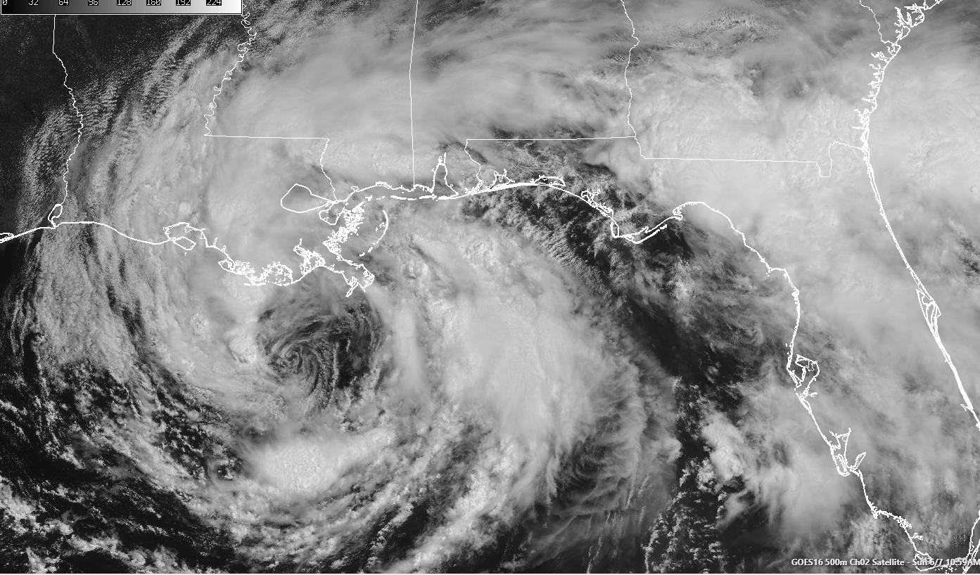
Cristobal on Satelllite:
Here is the latest advisory:
BULLETIN
Tropical Storm Cristobal Advisory Number 24
NWS National Hurricane Center Miami FL AL032020
1000 AM CDT Sun Jun 07 2020
…CRISTOBAL MOVING CLOSER TO SOUTHEASTERN LOUISIANA…
…HEAVY RAINFALL AND STORM SURGE EXPECTED FROM SOUTHEASTERN
LOUISIANA EASTWARD TO THE FLORIDA PANHANDLE…
SUMMARY OF 1000 AM CDT…1500 UTC…INFORMATION
———————————————–
LOCATION…28.7N 90.0W
ABOUT 90 MI…145 KM S OF NEW ORLEANS LOUISIANA
MAXIMUM SUSTAINED WINDS…50 MPH…85 KM/H
PRESENT MOVEMENT…N OR 355 DEGREES AT 12 MPH…19 KM/H
MINIMUM CENTRAL PRESSURE…994 MB…29.36 INCHES
Category: Alabama's Weather, ALL POSTS, Tropical
About the Author (Author Profile)
Bill Murray is the President of The Weather Factory. He is the site's official weather historian and a weekend forecaster. He also anchors the site's severe weather coverage. Bill Murray is the proud holder of National Weather Association Digital Seal #0001 @wxhistorianSubscribe
If you enjoyed this article, subscribe to receive more just like it.


