4:00 PM Update on TD Cristobal as it Moves Through Southern Arkansas
SUMMARY OF 400 PM CDT…2100 UTC
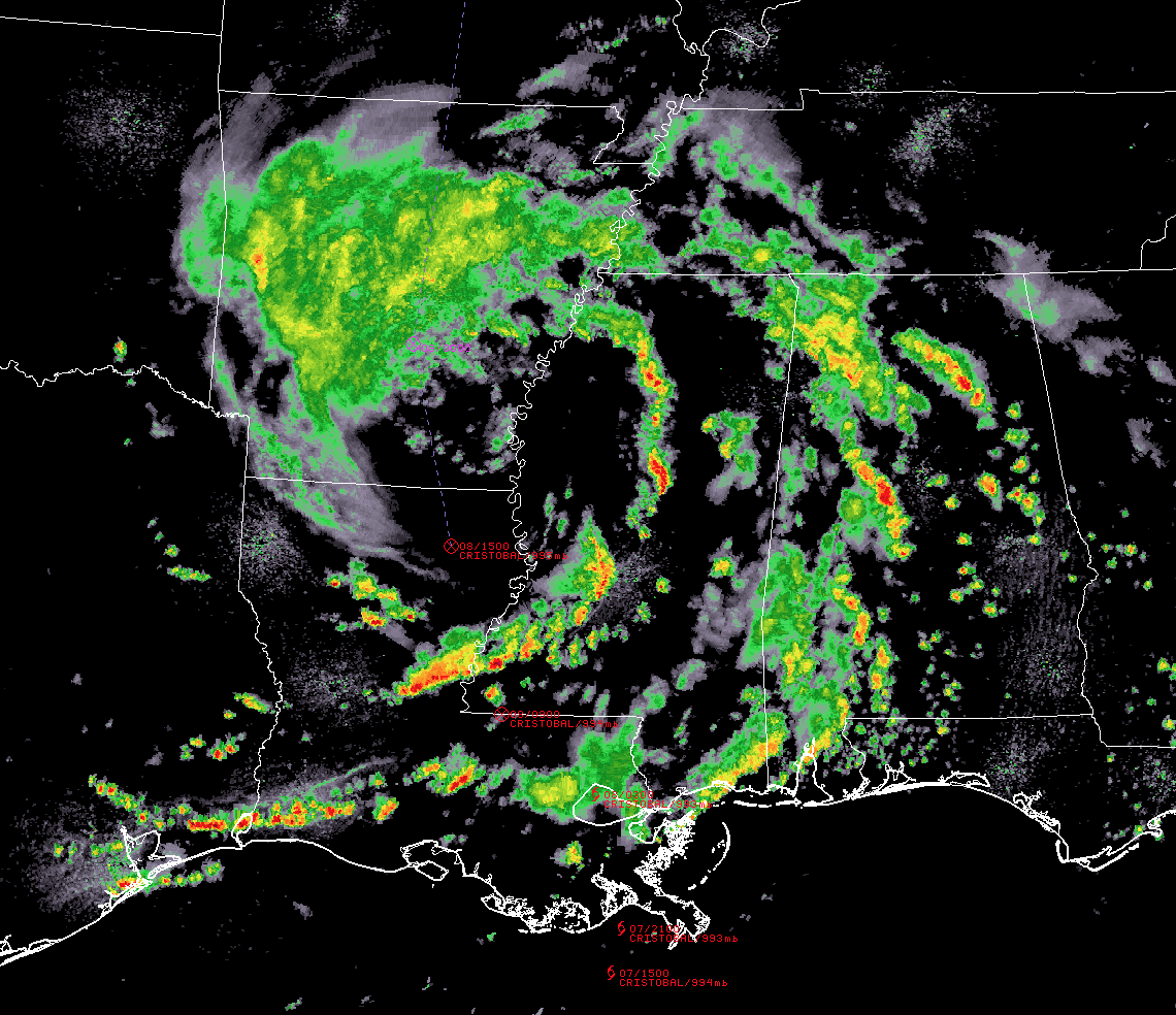
LOCATION…34.0N 92.0W
ABOUT 110 MI…180 KM N OF MONROE LOUISIANA
ABOUT 135 MI…220 KM WSW OF MEMPHIS TENNESSEE
MAXIMUM SUSTAINED WINDS…35 MPH…55 KM/H
PRESENT MOVEMENT…N OR 360 DEGREES AT 18 MPH…30 KM/H
MINIMUM CENTRAL PRESSURE…994 MB…29.36 INCHES
WATCHES AND WARNINGS
Flash Flood Watches are in effect in and near the length of the Mississippi Valley.
DISCUSSION AND OUTLOOK
At 400 PM CDT (2100 UTC), the center of Tropical Depression Cristobal was located near latitude 34.0 North, longitude 92.0 West. The depression is moving toward the north near 18 mph (30 km/h) and this motion is expected to accelerate and become more north-northeast as Cristobal moves through the Midwest and western Great Lakes.
Maximum sustained winds are near 35 mph (55 km/h) with higher gusts. Little change in strength is forecast during the next 48 hours. Some weakening of Cristobal is expected tonight into Tuesday morning before the low restrengthens as it acquires non-tropical character Tuesday night into Wednesday.
The estimated minimum central pressure is 994 MB (29.36 inches).
HAZARDS AFFECTING LAND
WIND: Gusty winds are expected to gradually subside over portions of the northern Gulf coast from southeastern Louisiana to the western Florida Panhandle. Gusty winds could also occur Tuesday night and Wednesday over portions of the Midwest and western Great Lakes as Cristobal becomes an extratropical low.
RAINFALL: Cristobal is expected to produce additional rainfall accumulations of around an inch along the Gulf Coast from Louisiana to the Florida Panhandle, resulting in isolated storm total amounts of 10 inches. Cristobal will also produce rainfall totals of 2 to 4 inches with local amounts to 6 inches from Arkansas to the western Great Lakes through Wednesday morning. This rainfall may produce flash flooding and is forecast to produce isolated significant river flooding across portions of the central Gulf Coast into the Lower Mississippi Valley. Smaller streams across southeast Louisiana and southern Mississippi have begun to rise and are forecast to crest mid-week. New and renewed significant river flooding is possible across the Mid and Upper Mississippi Valley.
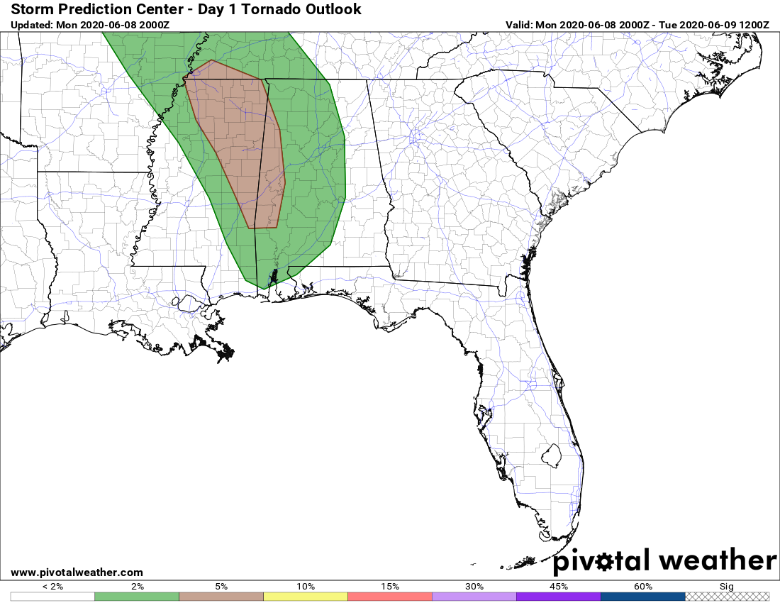
TORNADOES: Isolated tornadoes are possible this evening and tonight across eastern and northern Mississippi, western Alabama, and western Tennessee.
Category: Alabama's Weather, ALL POSTS, Severe Weather, Tropical
About the Author (Author Profile)
Scott Martin is an operational meteorologist, professional graphic artist, musician, husband, and father. Not only is Scott a member of the National Weather Association, but he is also the Central Alabama Chapter of the NWA president. Scott is also the co-founder of Racecast Weather, which provides forecasts for many racing series across the USA. He also supplies forecasts for the BassMaster Elite Series events including the BassMaster Classic.Subscribe
If you enjoyed this article, subscribe to receive more just like it.


