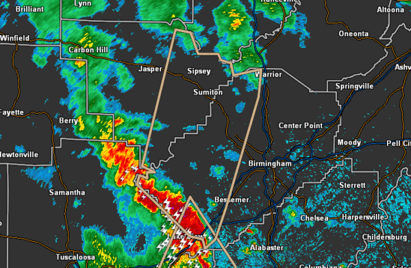
Strong Storms Moving Into Jefferson and Walker Counties
…SIGNIFICANT WEATHER ADVISORY FOR EASTERN WALKER AND WESTERN
JEFFERSON COUNTIES UNTIL 500 PM CDT…
At 409 PM CDT, Doppler radar was tracking strong thunderstorms along
a line extending from near Bull City to North Johns to near Tannehill
Ironworks State Park. Movement was north at 45 mph.
Winds in excess of 40 mph will be possible with these storms.
Locations impacted include…
Bessemer, Hueytown, Sumiton, Cordova, Dora, Pleasant Grove,
Adamsville, Warrior, Graysville, Sylvan Springs, Brookside, Mulga,
Sipsey, Maytown, West Jefferson, North Johns, Cardiff, Gorgas Steam
Plant, Bull City and Edgewater.
Category: Alabama's Weather, ALL POSTS, Severe Weather, Tropical


