Second Tornado Warning for the Storm Approaching Mount Vernon
Definite tornado debris signature with this one approaching Mount Vernon…
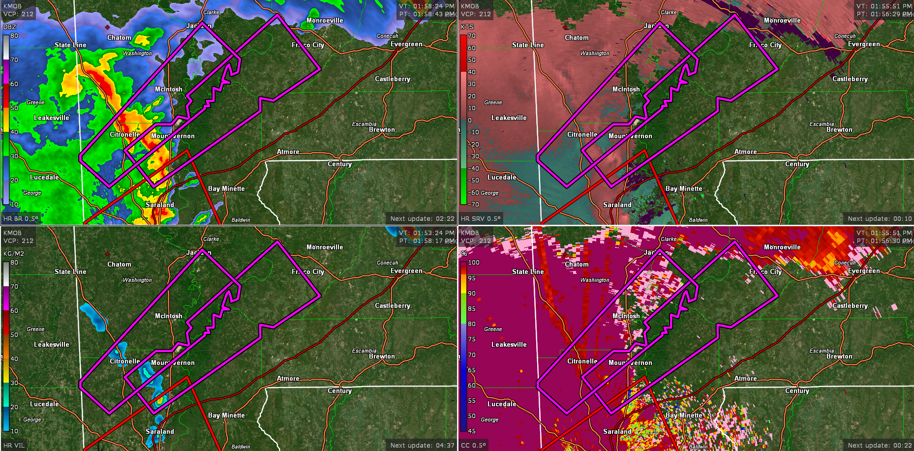
The National Weather Service in Mobile has issued a
* Tornado Warning for…
Southwestern Monroe County in south central Alabama…
Northeastern Mobile County in southwestern Alabama…
Northwestern Baldwin County in southwestern Alabama…
Southeastern Clarke County in southwestern Alabama…
* Until 245 PM CDT.
* At 155 PM CDT, a tornado producing storm was located 5 miles
southwest of Movico, or 8 miles southeast of Citronelle, moving
northeast at 55 mph.
HAZARD…Damaging tornado.
SOURCE…Radar confirmed tornado.
IMPACT…Flying debris will be dangerous to those caught without
shelter. Mobile homes will be damaged or destroyed.
Damage to roofs, windows, and vehicles will occur. Tree
damage is likely.
* This tornadic storm will be near…
Movico around 200 PM CDT.
Mount Vernon around 205 PM CDT.
Uriah around 240 PM CDT.
Category: Alabama's Weather, ALL POSTS, Severe Weather
About the Author (Author Profile)
Bill Murray is the President of The Weather Factory. He is the site's official weather historian and a weekend forecaster. He also anchors the site's severe weather coverage. Bill Murray is the proud holder of National Weather Association Digital Seal #0001 @wxhistorianSubscribe
If you enjoyed this article, subscribe to receive more just like it.


