Timing on the Strong Line of Storms for South Alabama; General Radar Update at 2:35 p.m.
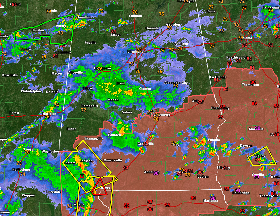
The powerful line of storms that is producing damaging winds and spin-up tornadoes over Southwest Alabama is moving northeast at over 40 mph. It will affect Monroeville between 3:15-3:30, Greenville between 4:15 and 4:30, Montgomery around 5:30, and Auburn after 6:30.
It could change speed, so your timing may vary, so monitor it closely as it pushes northeast.
Storms across South Central Alabama right now are producing heavy rain and lightning as well as gusty winds from Camden to Greenville and are scattered between Troy, Eufaula, Dothan, and Enterprise.
Further north, it’s mostly rain right now from Meridian to Tuscaloosa over to Brent, Marion, and Clanton.
And in North Alabama, storms continue over Marion County back into Mississippi. The storm in Marion County is a prolific lightning producer, but is not severe.
Category: Alabama's Weather, ALL POSTS
About the Author (Author Profile)
Bill Murray is the President of The Weather Factory. He is the site's official weather historian and a weekend forecaster. He also anchors the site's severe weather coverage. Bill Murray is the proud holder of National Weather Association Digital Seal #0001 @wxhistorianSubscribe
If you enjoyed this article, subscribe to receive more just like it.


