Severe Weather Threat Trimmed Southward and Eastward
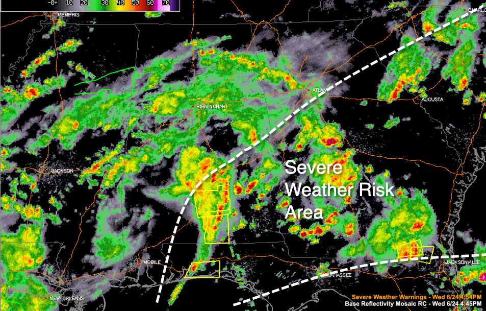
The threat of severe weather will now be limited to areas along and south of the I-85 Corridor in southeastern Alabama ahead of the thunderstorm complex that is moving northeast across that area. Damaging wind gusts to 60 mph and hail are now the threats.
There is a severe thunderstorm warning expiring at 5:15 for parts of Butler, Crenshaw, and Covington Counties.
Mobile has canceled the severe thunderstorm watch for the following counties: Baldwin, Butler, Clarke, Conecuh, Escambia, Mobile, Monroe, Washington, and Wilcox in Alabama. It continues for several counties in Southeast Alabama.
Across Central Alabama, light to moderate rain continues to fall. No lightning is being reported.
In North Alabama, storms are occurring from south of Huntsville to Fyffe to Gaylesvillle. Heavy rain with some lightning is being reported.
Category: Alabama's Weather, ALL POSTS, Severe Weather
About the Author (Author Profile)
Bill Murray is the President of The Weather Factory. He is the site's official weather historian and a weekend forecaster. He also anchors the site's severe weather coverage. Bill Murray is the proud holder of National Weather Association Digital Seal #0001 @wxhistorianSubscribe
If you enjoyed this article, subscribe to receive more just like it.


