It’s One Hour Later & No Warnings Are in Effect for North/Central Alabama
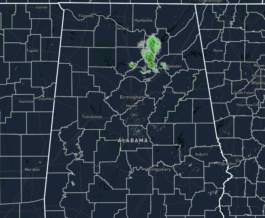
As of 8:03 pm, radar is very much calmer than what we saw just one hour ago. All of the thunderstorm activity over Cullman and Blount counties have weakened considerably at this point, only leaving some light rain over portions of Blount, Cullman, Etowah, and Marshall counties. No tornado or severe thunderstorm warnings are currently in effect as the last tornado warning was allowed to expire at 8:00 pm.
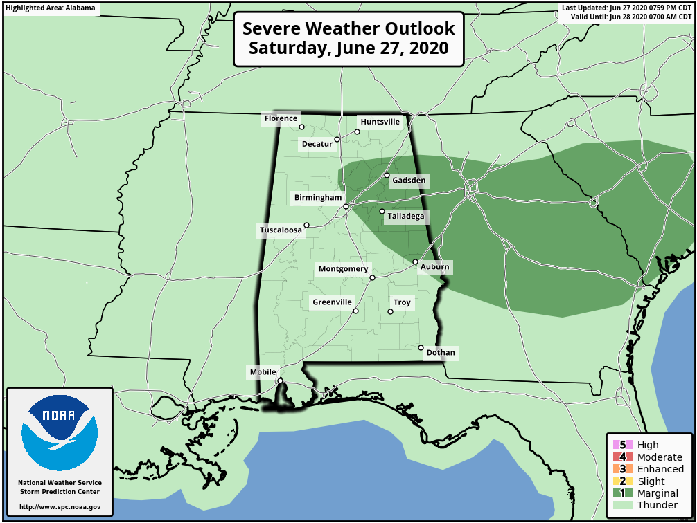
Only a small portion of North/Central Alabama remains in a Marginal Risk for severe storms during the rest of the evening which includes locations inside of a line from Albertville (Marshall Co.) to Good Hope (Cullman Co.) to Birmingham (Jefferson Co.) to Wind Creek State Park (Tallapoosa Co.) to Smiths Station (Lee Co.). While I don’t believe we will see any more strong to severe storms tonight, if any storms do develop, there will be a very small risk of isolated damaging winds up to 60 MPH and large hail up to quarter size.
If anything does form, we’ll have immediate updates.
Category: Alabama's Weather, ALL POSTS, Severe Weather
About the Author (Author Profile)
Scott Martin is an operational meteorologist, professional graphic artist, musician, husband, and father. Not only is Scott a member of the National Weather Association, but he is also the Central Alabama Chapter of the NWA president. Scott is also the co-founder of Racecast Weather, which provides forecasts for many racing series across the USA. He also supplies forecasts for the BassMaster Elite Series events including the BassMaster Classic.Subscribe
If you enjoyed this article, subscribe to receive more just like it.


