Sunday Weather Xtreme: Fewer Storms Today and Tomorrow
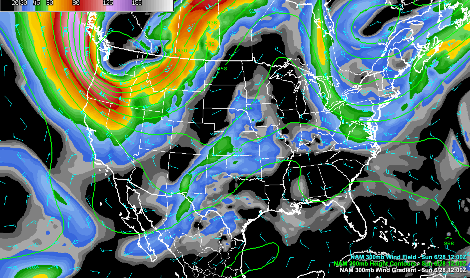
ON THE WEATHEERMAPS: Big trough In the West, trough in the Northeast. In the middle, there is a ridge from the Great Lakes to the Gulf, but that ridge is dented by a little shortwave over Alabama. This shortwave trough was responsible for yesterday’s showers and storms. But the shortwave should weaken and a ridge will build over Alabama. That process will begin this afternoon. Showers and storms should be more limited across the state today, and with fewer clouds and showers, temperatures will approach 90F again today, which is normal for this time of year. It will be quite humid, with dewpoints in the middle 70s. This will allow lows to fall only into the lower 70s tonight.
THE WEEK AHEAD: The ridge builds over Alabama on Monday, and it should look a lot like today, with isolated showers and storms forming during the afternoon and evening. Highs will once again be near 90F. By Tuesday, the trough over the Northeast will have closed off into an upper low that will be squeezing Alabama from the right. Showers and storms should be on the increase, mainly during the afternoon and evening hours. It will be that way right on through the rest of the week and into the weekend. Highs will be in the upper 80s. Lows will be in the 70s.
FOURTH OF JULY WEEKEND: The pattern of scattered showers and storms will spill into Saturday and the holiday celebrations. The day won’t be a washout, but you will be dodging afternoon storms. Highs will be in the upper 80s. Lows will be in the 70s.
VOODOO TERRITORY: The showery pattern will continue into the week after the holiday. Rainfall amounts over the two week period look like they will average around three inches. But some spots may get as much as 6 or 7 inches, while some places will get less than 2.
BEACHCAST: It has been a hot weekend along the beautiful beaches of Alabama and Northwest Florida, with heat index value approaching 100 outside of the sea breeze. Today will be partly sunny with a small chance of showers and storms. The week ahead will be partly sunny to partly cloudy, with a few mostly cloudy periods thrown in. Showers and thunderstorm chances will be on the rise through the week, with rain chances each day about 50-60%. Surf will be running generally less than 1 foot with a low rip current index outside of storms. Water temperatures are running in the lower 80s.
Click here to see the Beach Forecast Center page.
WEATHERBRAINS: This week, the panel will entertain Captain Kelsie Carpenter of the 53rd Weather Reconnaissance Squadron AKA the Hurricane Hunters. Check out the show at www.WeatherBrains.com. You can also subscribe on iTunes. You can watch the show live at live.bigbrainsmedia.com or on James’ YouTube Channel You will be able to see the show on the James Spann 24×7 weather channel on cable or directly over the air on the dot 2 feed.
ON THIS DATE IN 2006: Rivers all across the Mid-Atlantic into New England were in flood as a stationary front caused very heavy rainfall. Nearly 200,000 residents in the Wilkes-Baare, Pennsylvania area were asked to evacuate. Flood warnings were in effect for eight states and states of emergency were declared in parts of Pennsylvania and New York. Two days of record rainfall in the nation’s capital sent floodwaters surging into the IRS headquarters and the National Archive. The flooding washed a fifty-foot hole into the bed of I-88 near Sidney, New York. Two truck drivers were killed when their rig rain off into the chasm. Follow my weather history tweets on Twitter. I am @wxhistorian at Twitter.com.
Category: Alabama's Weather, ALL POSTS
About the Author (Author Profile)
Bill Murray is the President of The Weather Factory. He is the site's official weather historian and a weekend forecaster. He also anchors the site's severe weather coverage. Bill Murray is the proud holder of National Weather Association Digital Seal #0001 @wxhistorianSubscribe
If you enjoyed this article, subscribe to receive more just like it.


