A Strong Storm Moving Across Portions of Marion and Winston Counties
SIGNIFICANT WEATHER ADVISORY FOR EASTERN MARION AND WESTERN WINSTON COUNTIES UNTIL 8:45 AM CDT
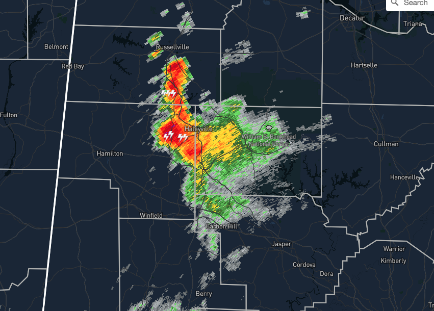
We are watching a strong thunderstorm that is currently crossing the Marion and Winston county line. The current movement was northeast at 20 MPH. Winds in excess of 40 MPH will be possible with these storms.
Heads up if you are in Haleyville, Lynn, Brilliant, Ashbank, Brinn, Lake Buttahatchee, Needmore, Ashridge, Bear Creek, Natural Bridge, Weiss, Posey Field Airport, Tessner, Clear Creek, Pearces Mill, Pebble, Upper Bear Creek Reservoir, Texas, and Delmar.
Torrential rainfall is also occurring with these storms and may lead to localized flooding. Do not drive your vehicle through flooded roadways. Frequent cloud to ground lightning is occurring with these storms. Lightning can strike 10 miles away from a thunderstorm. Seek a safe shelter inside a building or vehicle.
Category: Alabama's Weather, ALL POSTS, Severe Weather
About the Author (Author Profile)
Scott Martin is an operational meteorologist, professional graphic artist, musician, husband, and father. Not only is Scott a member of the National Weather Association, but he is also the Central Alabama Chapter of the NWA president. Scott is also the co-founder of Racecast Weather, which provides forecasts for many racing series across the USA. He also supplies forecasts for the BassMaster Elite Series events including the BassMaster Classic.Subscribe
If you enjoyed this article, subscribe to receive more just like it.


