Strong Storm Now Affecting Parts of Franklin & Lawrence Counties
SIGNIFICANT WEATHER ADVISORY FOR EASTERN FRANKLIN AND SOUTHWESTERN LAWRENCE COUNTIES UNTIL 1015 AM CDT
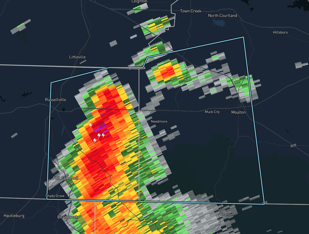
At 9:24 AM CDT, Doppler radar was tracking a strong thunderstorm 9 miles east of Russellville, moving east at 20 MPH. Winds in excess of 40 mph will be possible with this storm.
Locations impacted include…
Russellville, Moulton, Phil Campbell, Newburg, Hatton, Mt Hope, Tharptown, Ne Smith, Spruce Pine, and Bankhead National Forest.
Frequent cloud to ground lightning is occurring with this storm. Lightning can strike several miles away from a thunderstorm. Seek a safe shelter inside a building or vehicle.
Category: Alabama's Weather, ALL POSTS, Severe Weather
About the Author (Author Profile)
Scott Martin is an operational meteorologist, professional graphic artist, musician, husband, and father. Not only is Scott a member of the National Weather Association, but he is also the Central Alabama Chapter of the NWA president. Scott is also the co-founder of Racecast Weather, which provides forecasts for many racing series across the USA. He also supplies forecasts for the BassMaster Elite Series events including the BassMaster Classic.Subscribe
If you enjoyed this article, subscribe to receive more just like it.


