

A Quick Check on Our Weather at Midday; Marginal Risk Dropped for Central Alabama
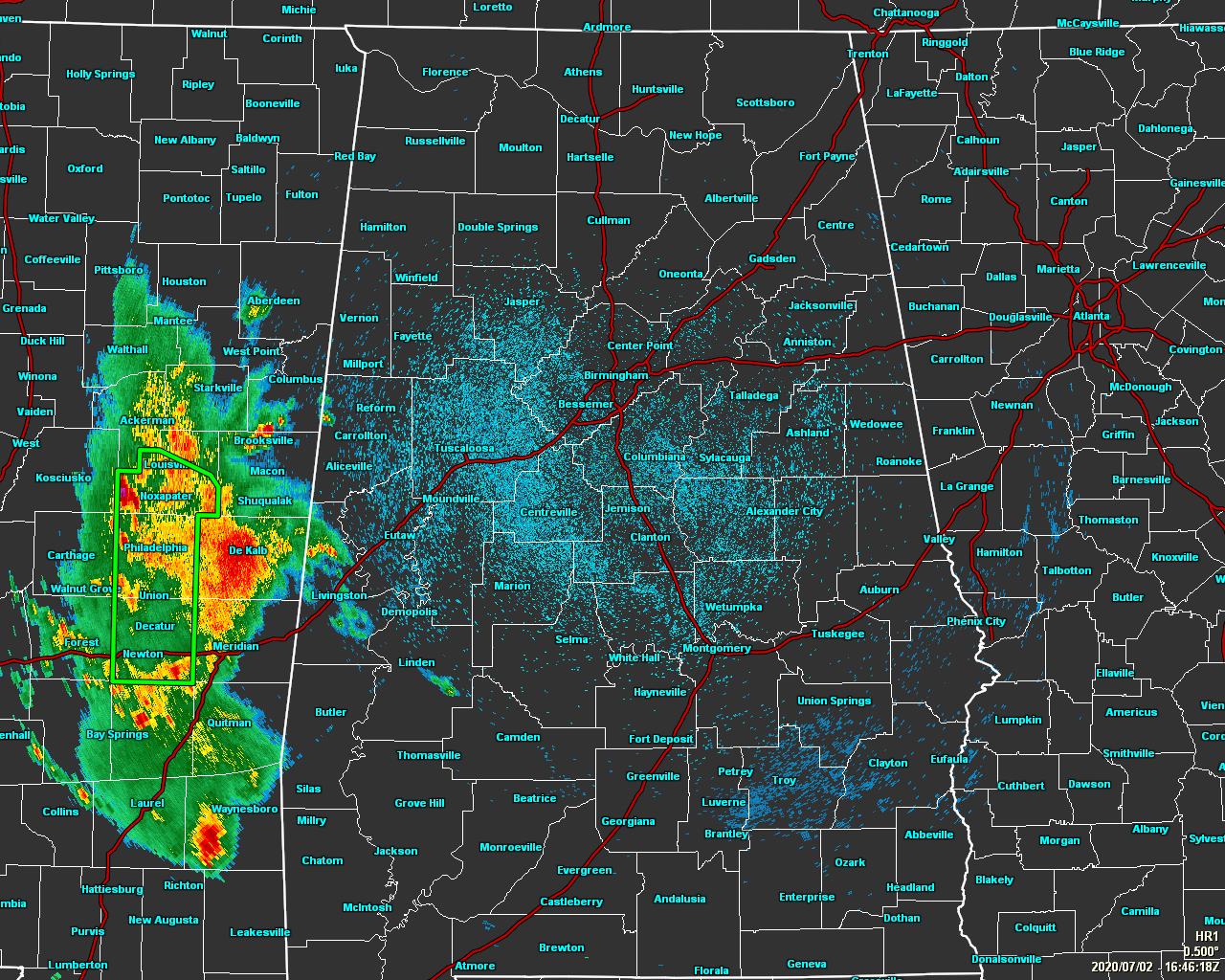
As of 11:50 am, radar shows nearly all of Central Alabama is rain-free at the moment, but some showers have crept across the state line and are affecting portions of Pickens, Sumter, and Marengo counties. None of these are heavy at the moment and are moving to the south. Much of the heavier activity has stayed over in Mississippi and is causing some flash flooding issues for such cities as Louisville to Philadelphia to Newton.
Temperatures across Central Alabama at the 11:00 am Round-Up were in the upper 70s to the mid-80s with dewpoints in the upper 60s to the mid-70s, making it feel really sticky outside. Birmingham was sitting at 79 degrees with a 69-degree dewpoint. The warm spot was Tuscaloosa at 84 degrees with a 73-degree dewpoint. The cool spot was Demopolis at 77 degrees with a dewpoint of 72 degrees.

The good news is that the Marginal Risk for severe storms that was up for the west and southwest portions of Central Alabama has been dropped by the Storm Prediction Center. Much of Mississippi and just a sliver of the western parts of South Alabama remain in the Marginal Risk.
Scattered showers and thunderstorms are expected to form during the afternoon hours but it looks like coverage may be much less than expected. I still believe the best rain chances will be west of I-65 (40-60%). Drier air aloft is building in from the northeast and will keep the shower and thunderstorm chances rather low east of I-65 (20-40%). Highs should reach the mid to upper 80s across the area and possibly touching 90 degrees in and around the Tuscaloosa region. Those rain chances will greatly decrease right after sunset and most, if not all, should be dry by midnight. Lows tonight will be in the lower to mid-70s.
Friday looks more like a typical summertime day with a good bit of sunshine to start, but those clouds will build with the heating of the day. We’ll have the chance of scattered afternoon showers and thunderstorms ranging from around 30% in the northeastern parts of the area to 60% in the southwestern and southern parts. Highs look to top out in the lower 90s with dewpoints remain high in the mid-70s.
Category: Alabama's Weather, ALL POSTS, Severe Weather
About the Author (Author Profile)
Scott Martin is an operational meteorologist, professional graphic artist, musician, husband, and father. Not only is Scott a member of the National Weather Association, but he is also the Central Alabama Chapter of the NWA president. Scott is also the co-founder of Racecast Weather, which provides forecasts for many racing series across the USA. He also supplies forecasts for the BassMaster Elite Series events including the BassMaster Classic.Subscribe
If you enjoyed this article, subscribe to receive more just like it.


