Gonzalo Hanging On to Tropical Storm Status as of the 10:00 pm NHC Update
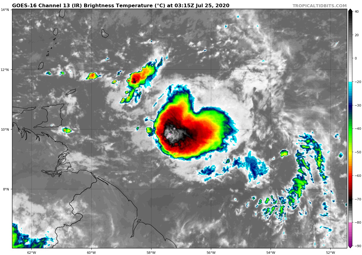
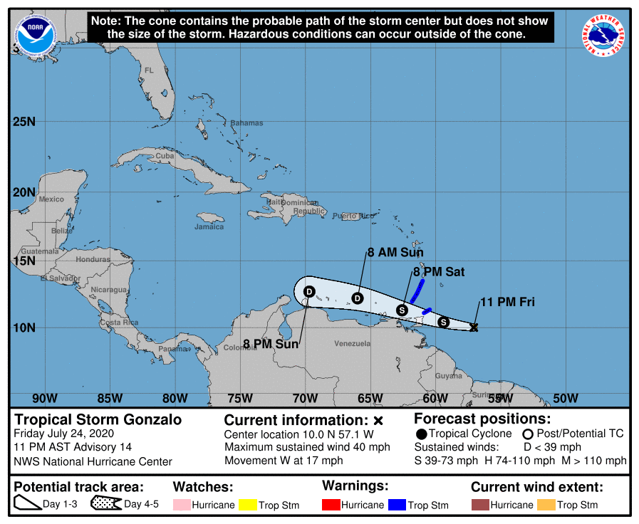
Although there has been a recent increase in deep convection in association with Gonzalo, data from an Air Force Reserve Hurricane Hunter aircraft continues to show that the tropical cyclone is poorly organized. The aircraft has not yet found winds to support tropical storm strength, however, the advisory intensity will remain a possibly generous 35-kt until the aircraft completes its mission overnight. There is also some possibility that this recent convective burst could result in some short-term re-organization. However, with the system losing organization over the past day or so, it is becoming less likely that the small cyclone will be able to significantly recover due to the nearby dry mid-level environment. The updated NHC intensity forecast no longer calls for any re-strengthening, and Gonzalo could even become a tropical depression before reaching the Windward Islands. After that time, dry air and Gonzalo’s close proximity to the coast of Venezuela are likely to cause the system to weaken and degenerate into a trough of low pressure. The NHC forecast now calls for dissipation by 60 h, but this could occur sooner.
Gonzalo continues moving generally westward or 270/15 kt. The system is not expected to gain much latitude as it should continue moving westward to west-northwestward within the low-level easterly flow. The track guidance continues to trend southward and the NHC track forecast has again been shifted in that direction. The new track lies to the south of the consensus aids, closest to the GFS and UKMET ensemble means.
Key Messages
1. Gonzalo is forecast to bring tropical storm conditions to a portion of the southern Windward Islands Saturday and Saturday night. Tropical Storm Warnings are currently in effect for some of the islands. Interests in the southern Windward Islands should monitor the progress of Gonzalo and follow any advice given by local officials.
2. Gonzalo is expected to produce heavy rain over portions of the southern Windward Islands. This could lead to life-threatening flash flooding.
About the Author (Author Profile)
Scott Martin is an operational meteorologist, professional graphic artist, musician, husband, and father. Not only is Scott a member of the National Weather Association, but he is also the Central Alabama Chapter of the NWA president. Scott is also the co-founder of Racecast Weather, which provides forecasts for many racing series across the USA. He also supplies forecasts for the BassMaster Elite Series events including the BassMaster Classic.Subscribe
If you enjoyed this article, subscribe to receive more just like it.


