EXPIRED Severe Thunderstorm Warning for Northeastern Cherokee County Until 11:30 am
The National Weather Service in Birmingham has issued a
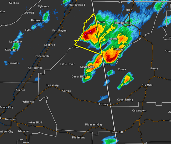
* Severe Thunderstorm Warning for…
Northeastern Cherokee County in northeastern Alabama…
* Until 1130 AM CDT.
* At 1058 AM CDT, a severe thunderstorm was located near Little River
Falls, or near Little River Canyon National Preserve, moving north
at 20 mph.
HAZARD…60 mph wind gusts and half dollar size hail.
SOURCE…Radar indicated.
IMPACT…Hail damage to vehicles is expected. Expect wind damage
to roofs, siding, and trees.
* Locations impacted include…
Little River Falls, New Moon, Broomtown, Chesterfield and Little
River Canyon NP.
PRECAUTIONARY/PREPAREDNESS ACTIONS…
For your protection move to an interior room on the lowest floor of a
building.
Category: Alabama's Weather, ALL POSTS, Severe Weather
About the Author (Author Profile)
Scott Martin is an operational meteorologist, professional graphic artist, musician, husband, and father. Not only is Scott a member of the National Weather Association, but he is also the Central Alabama Chapter of the NWA president. Scott is also the co-founder of Racecast Weather, which provides forecasts for many racing series across the USA. He also supplies forecasts for the BassMaster Elite Series events including the BassMaster Classic.Subscribe
If you enjoyed this article, subscribe to receive more just like it.


