

Isaias is Better Organized and is Still Expected to Make Landfall as a Hurricane
SUMMARY OF 500 PM EDT…2100 UTC…INFORMATION
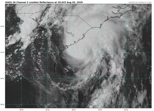
LOCATION…32.0N 79.4W
ABOUT 60 MI…100 KM SSE OF CHARLESTON SOUTH CAROLINA
ABOUT 120 MI…195 KM SSW OF MYRTLE BEACH SOUTH CAROLINA
MAXIMUM SUSTAINED WINDS…70 MPH…110 KM/H
PRESENT MOVEMENT…NNE OR 15 DEGREES AT 16 MPH…26 KM/H
MINIMUM CENTRAL PRESSURE…993 MB…29.33 INCHES

SUMMARY OF WATCHES AND WARNINGS IN EFFECT
A Storm Surge Warning is in effect for…
* Edisto Beach South Carolina to Cape Fear North Carolina
* Pamlico and Albemarle Sounds, including the Neuse and Pamlico Rivers
* Oregon Inlet North Carolina to the North Carolina/Virginia border
A Storm Surge Watch is in effect for…
* Cape Fear to Oregon Inlet North Carolina
A Hurricane Warning is in effect for…
* South Santee River South Carolina to Surf City North Carolina
A Tropical Storm Warning is in effect for…
* Savannah River to South Santee River South Carolina
* North of Surf City North Carolina to Stonington Maine
* Pamlico and Albemarle Sounds
* Chesapeake Bay
* Tidal Potomac River
* Delaware Bay
* Long Island and Long Island Sound
* Martha’s Vineyard, Nantucket, and Block Island
A Tropical Storm Watch is in effect for…
* North of Stonington to Eastport Maine
DISCUSSION AND OUTLOOK
At 500 PM EDT (2100 UTC), the center of Tropical Storm Isaias was located by NOAA Doppler weather radars near latitude 32.0 North, longitude 79.4 West. Isaias is moving toward the north-northeast near 16 mph (26 km/h), and this general motion accompanied by a gradual increase in forward speed is expected through tonight followed by a further increase in the forward speed on Tuesday. On the forecast track, the center of Isaias will approach the coasts of northeastern South Carolina and southern North Carolina within the hurricane warning area this evening. The center will then move inland across eastern North Carolina early Tuesday morning, move along the coast of the mid-Atlantic states on Tuesday, and continue across the northeastern United States Tuesday night.
Data from NOAA Doppler weather radars indicate that maximum sustained winds are near 70 mph (110 km/h) with higher gusts. Some strengthening is forecast later this afternoon or early evening, and Isaias is expected to make landfall tonight at or near hurricane strength along the coast of northeastern South Carolina or southern North Carolina. Only gradual weakening is anticipated after Isaias makes landfall in the Carolinas and moves across the U.S. mid-Atlantic region tonight and Tuesday.
Tropical-storm-force winds extend outward up to 125 miles (205 km) from the center. During the past couple of hours, a sustained wind of 45 mph (72 km/h) and a gust to 52 mph (83 km/h) were measured by a Weatherflow site at Folly Beach Pier, South Carolina.
The estimated minimum central pressure is 993 MB (29.33 inches).
KEY MESSAGES
STORM SURGE: The combination of a dangerous storm surge and the tide will cause normally dry areas near the coast to be flooded by rising waters moving inland from the shoreline. The deepest water will occur along the immediate coast in areas of onshore winds, where the surge will be accompanied by large waves. Surge-related flooding depends on the relative timing of the surge and the tidal cycle and can vary greatly over short distances.
WIND: Hurricane conditions are expected within the hurricane warning area in South and North Carolina this evening and tonight, with tropical storm conditions spreading onshore in the next few hours.
Widespread tropical-storm-conditions are expected in the tropical storm warning area from coastal North Carolina to the mid-Atlantic states, including portions of the Chesapeake Bay region, tonight and Tuesday, with wind gusts to hurricane force possible. These winds could cause tree damage and power outages.
Tropical storm conditions are expected to reach southern New England Tuesday afternoon and northern New England Tuesday night and early Wednesday.
RAINFALL: Heavy rainfall along the East Coast, near the path of Isaias, will result in flash and urban flooding, some of which may be significant in the eastern Carolinas, Mid-Atlantic, and Northeast through Wednesday. Widespread minor to moderate river flooding is possible across portions of the Carolinas and the Mid-Atlantic. Quick-responding rivers in the Northeast will also be susceptible to minor river flooding.
TORNADOES: A few tornadoes will be possible near northeastern South Carolina coastal areas by early this evening, before spreading across eastern North Carolina tonight into Tuesday morning. A couple of tornadoes will be possible on Tuesday from eastern Virginia northeastward into southern New England.
SURF: Swells generated by Isaias are affecting portions of the Bahamas and the southeast coast of the United States and will spread northward along the U.S. east coast during the next couple of days. These swells are likely to cause life-threatening surf and rip current conditions.
All information from the National Hurricane Center’s 4:00 pm CDT Update.
Category: ALL POSTS
About the Author (Author Profile)
Scott Martin is an operational meteorologist, professional graphic artist, musician, husband, and father. Not only is Scott a member of the National Weather Association, but he is also the Central Alabama Chapter of the NWA president. Scott is also the co-founder of Racecast Weather, which provides forecasts for many racing series across the USA. He also supplies forecasts for the BassMaster Elite Series events including the BassMaster Classic.Subscribe
If you enjoyed this article, subscribe to receive more just like it.


