NWS Birmingham Issues a Marginal Risk for the Southwestern Counties
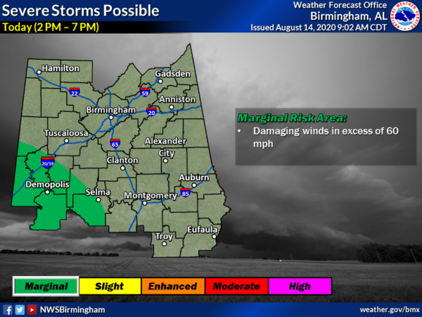
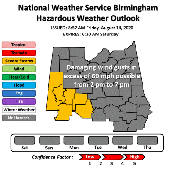
NWS Birmingham has just released an updated Hazardous Weather Outlook for its county warning area and shows that a Marginal Risk for severe storms has been introduced for the southwestern parts of the area. Here is the text from the HWO:
This Hazardous Weather Outlook is for the counties served by the National Weather Service office in Birmingham.
DAY ONE…Outlook through Tonight.
Showers and thunderstorms may produce damaging winds in excess of 60 MPH roughly from 2 pm to 7 pm today generally along and southwest of a line from Aliceville to Selma.
At this point, no severe weather is expected for the remainder of Central Alabama or for the North Alabama counties covered by NWS Huntsville.
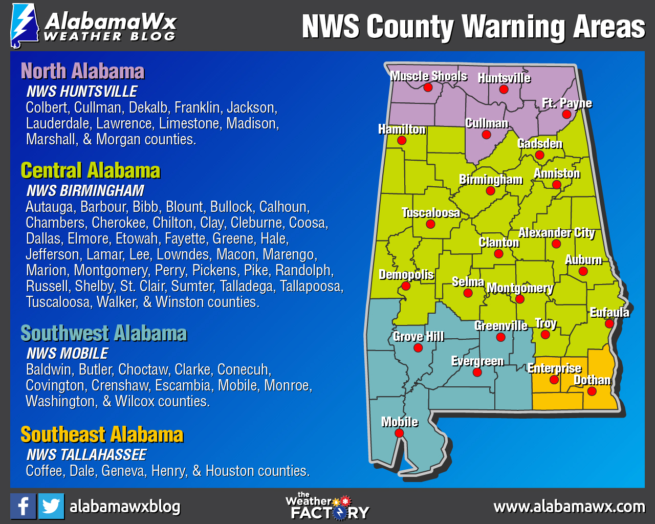
Just in case you need a refresher for which NWS office serves your county, the above map has the breakdown for each of the four NWS offices that serve the state of Alabama.
Category: Alabama's Weather, ALL POSTS, Severe Weather
About the Author (Author Profile)
Scott Martin is an operational meteorologist, professional graphic artist, musician, husband, and father. Not only is Scott a member of the National Weather Association, but he is also the Central Alabama Chapter of the NWA president. Scott is also the co-founder of Racecast Weather, which provides forecasts for many racing series across the USA. He also supplies forecasts for the BassMaster Elite Series events including the BassMaster Classic.Subscribe
If you enjoyed this article, subscribe to receive more just like it.


