EXTENDED to 12:30 PM – Flood Advisory for Parts of Greene, Hale, and Sumter Counties until 10 a.m.
At 1022 AM CDT, Doppler radar indicated heavy rain due to thunderstorms. Minor flooding is ongoing or expected to begin shortly in the advisory area. Between 0.5 and 1 inch of rain has fallen.
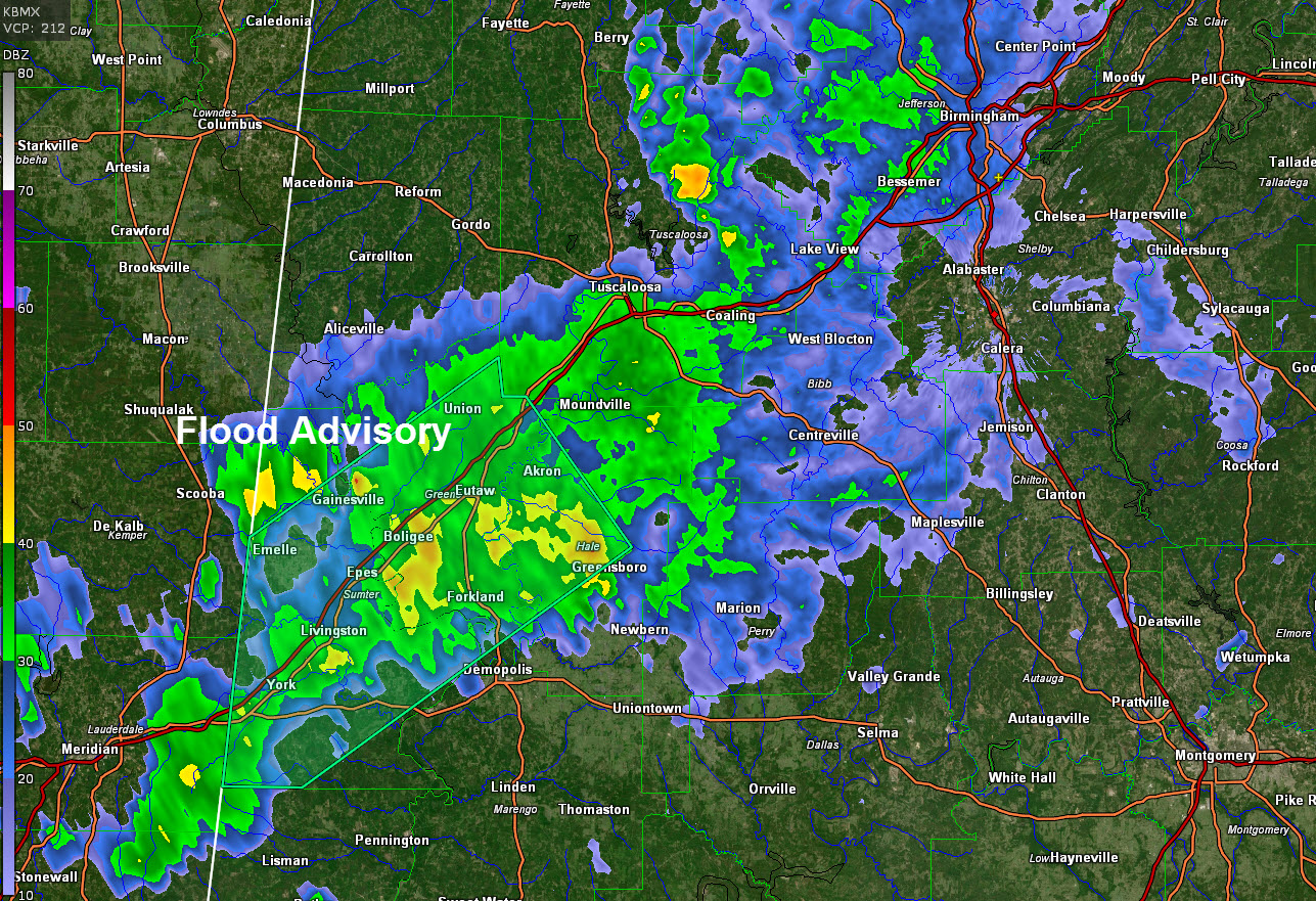
The National Weather Service in Birmingham has issued a
* Flood Advisory for…
Greene County in west central Alabama…
Northwestern Hale County in west central Alabama…
Sumter County in west central Alabama…
* Until 1030 AM CDT.
* At 724 AM CDT, Doppler radar indicated heavy rain due to
thunderstorms. Minor flooding is ongoing or expected to begin
shortly in the advisory area. Between 1 and 2 inches of rain have
fallen.
Some locations that will experience flooding include…
Livingston, Eutaw, York, Cuba, Forkland, Akron, Boligee, Union,
Gainesville, Epes, Emelle, Tishabee, Thornhill, Allison,
Bluffport, The University Of West Alabama, Walden Quarters, Dug
Hill, Coatopa and West Greene.
Additional rainfall of 1 to 2 inches is expected over the area. This
additional rain will result in minor flooding.
PRECAUTIONARY/PREPAREDNESS ACTIONS…
Turn around, don’t drown when encountering flooded roads. Most flood
deaths occur in vehicles.
In hilly terrain there are hundreds of low water crossings which are
potentially dangerous in heavy rain. Do not attempt to cross flooded
roads. Find an alternate route.
Category: Alabama's Weather, ALL POSTS, Severe Weather
About the Author (Author Profile)
Bill Murray is the President of The Weather Factory. He is the site's official weather historian and a weekend forecaster. He also anchors the site's severe weather coverage. Bill Murray is the proud holder of National Weather Association Digital Seal #0001 @wxhistorianSubscribe
If you enjoyed this article, subscribe to receive more just like it.


