

CANCELED Severe T-Storm Warning for Parts of Walker, Marion, Winston Co. Until 6:15 pm
The National Weather Service in Birmingham has issued a
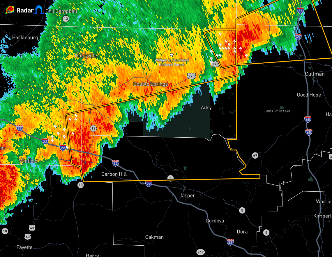
* Severe Thunderstorm Warning for…
Northern Walker County in central Alabama…
Southeastern Marion County in northwestern Alabama…
Southern Winston County in northwestern Alabama…
* Until 615 PM CDT.
* At 521 PM CDT, a severe thunderstorm was located near Lynn, moving
east at 45 mph.
HAZARD…60 mph wind gusts and penny size hail.
SOURCE…Radar indicated.
IMPACT…Expect damage to roofs, siding, and trees.
* Locations impacted include…
Jasper, Carbon Hill, Lynn, Arley, Kansas, Nauvoo, Eldridge, Curry,
Camp McDowell, Smith Dam, Ashbank, Smith Lake, Poplar Springs,
Helicon, Corinth Rec Area, Falls City, Houston, Mill Branch, Maple
Branch and Hullett Branch.
PRECAUTIONARY/PREPAREDNESS ACTIONS…
A Tornado Watch remains in effect until 800 PM CDT for central,
northwestern and west central Alabama.
For your protection move to an interior room on the lowest floor of a
building.
Category: Alabama's Weather, ALL POSTS, Severe Weather
About the Author (Author Profile)
Scott Martin is an operational meteorologist, professional graphic artist, musician, husband, and father. Not only is Scott a member of the National Weather Association, but he is also the Central Alabama Chapter of the NWA president. Scott is also the co-founder of Racecast Weather, which provides forecasts for many racing series across the USA. He also supplies forecasts for the BassMaster Elite Series events including the BassMaster Classic.Subscribe
If you enjoyed this article, subscribe to receive more just like it.


