Strong Storms Impacting Parts of Jefferson, Tuscaloosa, & Walker Counties
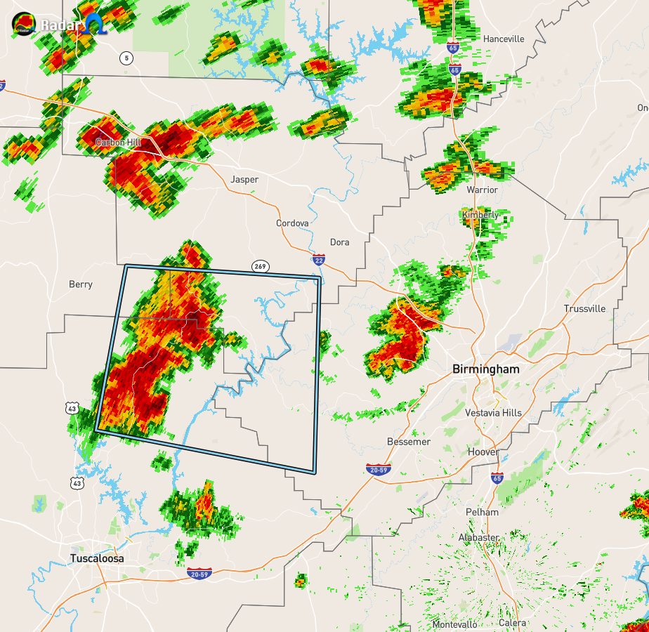
…SIGNIFICANT WEATHER ADVISORY FOR SOUTH CENTRAL WALKER…
NORTHEASTERN TUSCALOOSA…SOUTHWESTERN JEFFERSON AND EAST CENTRAL
FAYETTE COUNTIES UNTIL 300 PM CDT…
At 238 PM CDT, Doppler radar was tracking a strong thunderstorm 8
miles northwest of Bankhead Lock And Dam, or 18 miles north of Holt,
moving northeast at 30 mph.
Winds in excess of 40 mph will be possible with this storm.
Locations impacted include…
Boley Springs, Gorgas Steam Plant, Bull City, Gorgas, Bankhead Lock
And Dam, Whitson, Goodsprings, Wiley, The Wye, Tutwiler, Windham
Springs and Little Shoal.
PRECAUTIONARY/PREPAREDNESS ACTIONS…
Frequent cloud to ground lightning is occurring with this storm.
Lightning can strike 10 miles away from a thunderstorm. Seek a safe
shelter inside a building or vehicle.
Category: Alabama's Weather, ALL POSTS, Severe Weather
About the Author (Author Profile)
Scott Martin is an operational meteorologist, professional graphic artist, musician, husband, and father. Not only is Scott a member of the National Weather Association, but he is also the Central Alabama Chapter of the NWA president. Scott is also the co-founder of Racecast Weather, which provides forecasts for many racing series across the USA. He also supplies forecasts for the BassMaster Elite Series events including the BassMaster Classic.Subscribe
If you enjoyed this article, subscribe to receive more just like it.


