

Hotter, Drier Weather For Alabama Later This Week
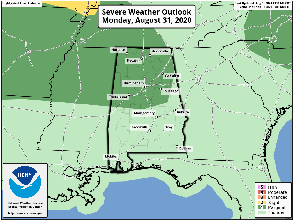
RADAR CHECK: As expected, we have a number of showers and strong thunderstorms across Alabama this afternoon. They are moving eastward, and stronger storms are producing very heavy rain, gusty winds, and frequent lightning. SPC maintains a low end, “marginal risk” (level 1/5) for the northern half of the state through the evening hours.
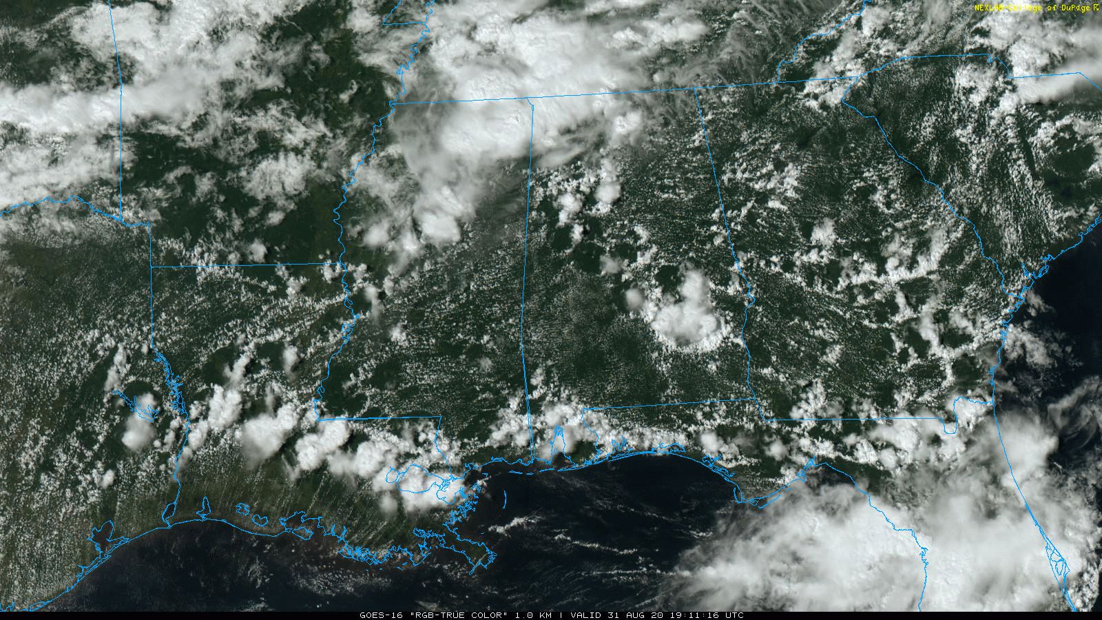
Showers and storms will fade away later tonight after sunset.
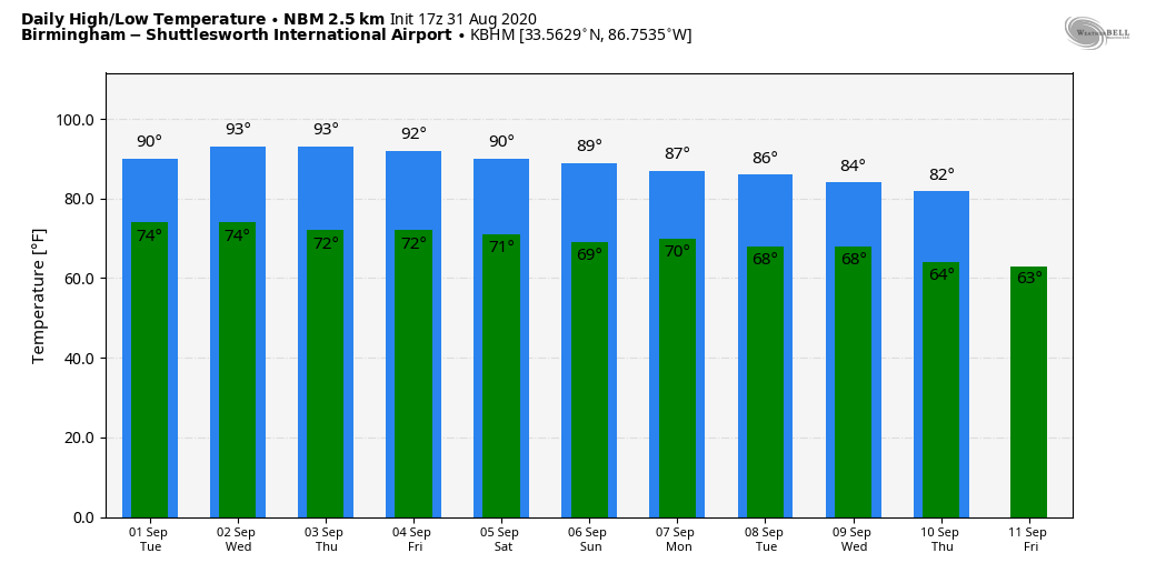
The weather won’t change much tomorrow; partly sunny with scattered showers and thunderstorms developing by afternoon. Odds of any one spot getting wet tomorrow will be in the 50/60 percent range, and the high will be close to 90 degrees.
WEDNESDAY THROUGH FRIDAY: An upper ridge will strength over the Deep South, meaning hot and mostly dry weather on these three days. Partly sunny days, fair nights, highs in the 91-94 degree range. The chance of a shower is not zero, but they should be few and far between during the afternoon and evening hours.
LABOR DAY WEEKEND: Heat levels will come down; we expect highs in the mid to upper 80s Saturday through Monday. Showers should be widely scattered Saturday, then a bit more numerous Sunday and Monday (but no “wash-out”). As usual, most of the showers and storms will come during the afternoon and evening hours.
NEXT WEEK: A pattern change will bring two fronts into the state. The first one arrives Monday, the second one most likely Wednesday. There will be a chance of showers and storms with each front, and following the second one we expect a nice surge of cooler air with lower humidity. By Thursday and Friday of next week, highs drop into the low 80s, with lows in the 50s over a decent part of North Alabama. See the Weather Xtreme video for maps, graphics, and more details.
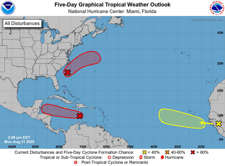
TROPICS: NHC is monitoring three tropical waves. One is a tropical wave is expected to emerge off the coast of Africa in a day or two. Gradual development of this system will be possible through the end of the week while it moves slowly westward over the far eastern tropical Atlantic Ocean. No way of knowing now if this will impact the U.S… if it does, it is at least 7-10 days away.
A broad area of low pressure associated with a tropical wave over the central Caribbean Sea has changed little in organization since yesterday, and satellite-derived winds indicate that there is no closed circulation. However, environmental conditions are expected to gradually become more conducive for development, and a tropical depression is likely to form during the next couple of days while the system moves westward at 15 to 20 mph. Odds are high that this system will keep moving westward into Central America without moving northward into the Gulf of Mexico.
And, an area of low pressure is located about 135 miles southeast of Wilmington, North Carolina. This system continues to become better organized, and a tropical depression is expected to form later today or tonight while the system moves northeastward, near but offshore of the southeastern coast of the United States and then away from land. An Air Force Reserve Hurricane Hunter aircraft is en route to investigate the system this afternoon.
There are no systems threatening the Gulf Coast for the Labor Day weekend; the weather looks routine there with the usual mix of sun and scattered thunderstorms.
ON THIS DATE IN 1935: The most intense hurricane to make landfall was a modest tropical depression on this day. Called the Labor Day Hurricane, this storm went through phenomenal intensification to become a Category 5 hurricane by September 2nd.
BEACH FORECAST: Click here to see the AlabamaWx Beach Forecast Center page.
WEATHER BRAINS: Don’t forget you can listen to our weekly 90 minute show anytime on your favorite podcast app. This is the show all about weather featuring many familiar voices, including our meteorologists here at ABC 33/40.
CONNECT: You can find me on all of the major social networks…
Facebook
Twitter
Instagram
Pinterest
Snapchat: spannwx
Look for the next Weather Xtreme video here by 7:00 a.m. tomorrow…
Category: Alabama's Weather, ALL POSTS, Weather Xtreme Videos
About the Author (Author Profile)
James Spann is one of the most recognized and trusted television meteorologists in the industry. He holds the AMS CCM designation and television seals from the AMS and NWA. He is a past winner of the Broadcast Meteorologist of the Year from both professional organizations.Subscribe
If you enjoyed this article, subscribe to receive more just like it.


