Ana is on the Board

000
WTNT32 KNHC 150836
TCPAT2
BULLETIN
TROPICAL STORM ANA ADVISORY NUMBER 13
NWS TPC/NATIONAL HURRICANE CENTER MIAMI FL AL022009
500 AM AST SAT AUG 15 2009
…ANA FORMS IN THE TROPICAL ATLANTIC OCEAN…
INTERESTS IN THE LEEWARD ISLANDS SHOULD MONITOR THE PROGRESS OF TROPICAL STORM ANA. A TROPICAL STORM WATCH MAY BE REQUIRED FOR PORTIONS OF THE LEEWARD ISLANDS LATER TODAY.
FOR STORM INFORMATION SPECIFIC TO YOUR AREA IN THE UNITED STATES…INCLUDING POSSIBLE INLAND WATCHES AND WARNINGS…PLEASE MONITOR PRODUCTS ISSUED BY YOUR LOCAL NATIONAL WEATHER SERVICE FORECAST OFFICE. FOR STORM INFORMATION SPECIFIC TO YOUR AREA OUTSIDE OF THE UNITED STATES…PLEASE MONITOR PRODUCTS ISSUED BY YOUR NATIONAL METEOROLOGICAL SERVICE.
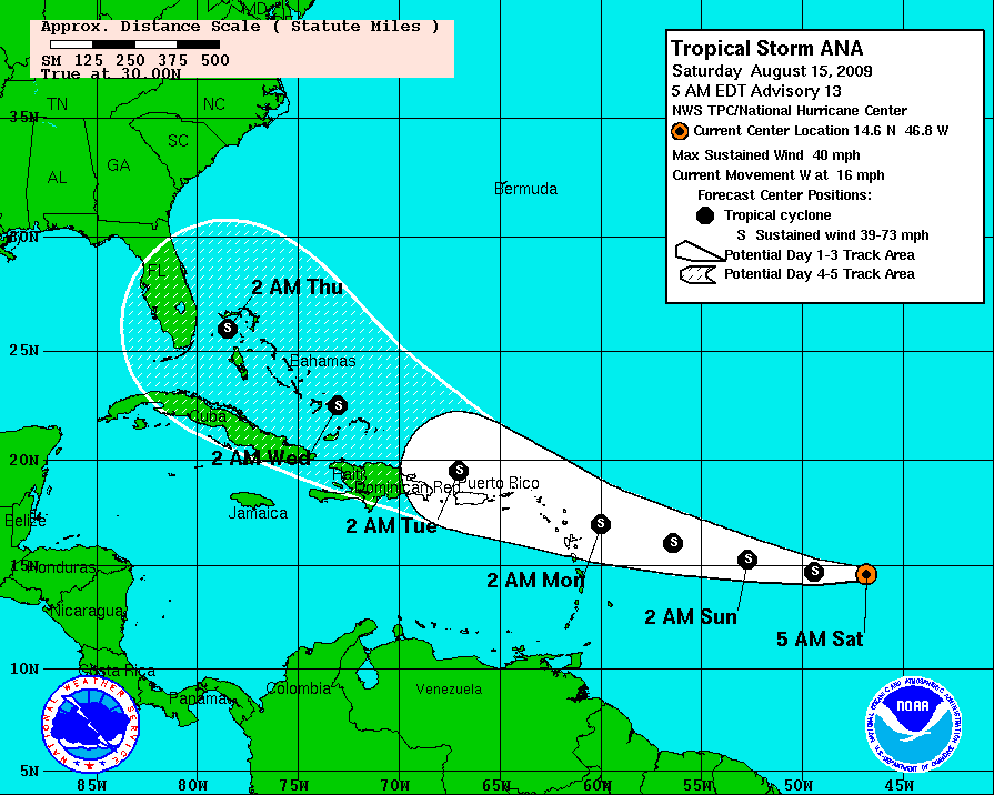
AT 500 AM AST…0900 UTC…THE CENTER OF TROPICAL STORM ANA WAS LOCATED NEAR LATITUDE 14.6 NORTH…LONGITUDE 46.8 WEST OR ABOUT 1010 MILES…1630 KM…EAST OF THE LEEWARD ISLANDS.
ANA IS MOVING TOWARD THE WEST NEAR 16 MPH…26 KM/HR…AND THIS GENERAL MOTION IS EXPECTED TO CONTINUE FOR THE NEXT COUPLE OF DAYS WITH AN INCREASE IN FORWARD SPEED. ON THIS FORECAST TRACK ANA COULD BE APPROACHING THE LEEWARD ISLANDS ON MONDAY.
MAXIMUM SUSTAINED WINDS ARE NEAR 40 MPH…65 KM/HR…WITH HIGHER GUSTS. SLOW STRENGTHENING IS FORECAST FOR NEXT 48 HOURS.
TROPICAL STORM FORCE WINDS EXTEND OUTWARD UP TO 70 MILES…110 KM FROM THE CENTER.
THE ESTIMATED MINIMUM CENTRAL PRESSURE BASED ON DATA FROM NOAA BUOY
41041 IS 1005 MB…29.68 INCHES.
…SUMMARY OF 500 AM AST INFORMATION…
LOCATION…14.6N 46.8W
MAXIMUM SUSTAINED WINDS…40 MPH
PRESENT MOVEMENT…WEST OR 270 DEGREES AT 16 MPH MINIMUM CENTRAL PRESSURE…1005 MB
THE NEXT ADVISORY WILL BE ISSUED BY THE NATIONAL HURRICANE CENTER AT 1100 AM AST.
$$
FORECASTER BLAKE
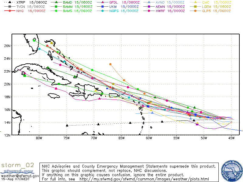
Here is the spaghetti plot of the various track models…

The general consensus is a track toward the Bahamas and South Florida over the next five days.
Here is the NHC forecast and cone of uncertainty.

Some overall tropical model madness…
Canadian from yesterday afternoon allowed a weak system (Ana) moving through the Greater Antilles over the next few days then strengthening rapidly as it moved into the Gulf of Mexico with a landfall on the northern Gulf Coast. The GFDL also puts it in a position to enter the Gulf in about five days where it could become a significant Gulf hurricane. The HWRF brings it to South Florida in five days as a category t wo hurricane.
These hypotheses were the output of the various models. As Ana becomes a better organized system today, the computers will start to get a better handle on where it might go.
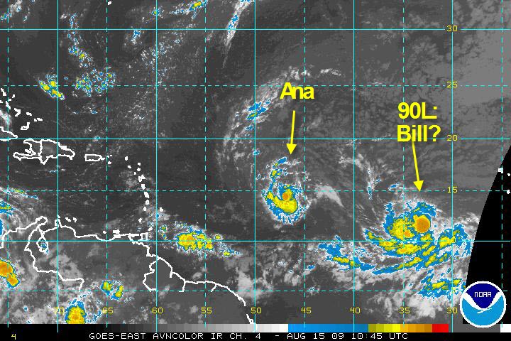
And back to the east of Ana, disturbance 90L has a high potential for becoming a tropicall cyclone today according to the National Hurricane Center.
Category: Uncategorized


