Hurricane Hunter Aircraft Investigating Paulette, Currently Just Below Hurricane Strength
SUMMARY OF 800 PM AST…0000 UTC…INFORMATION
———————————————-
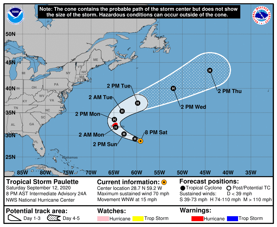
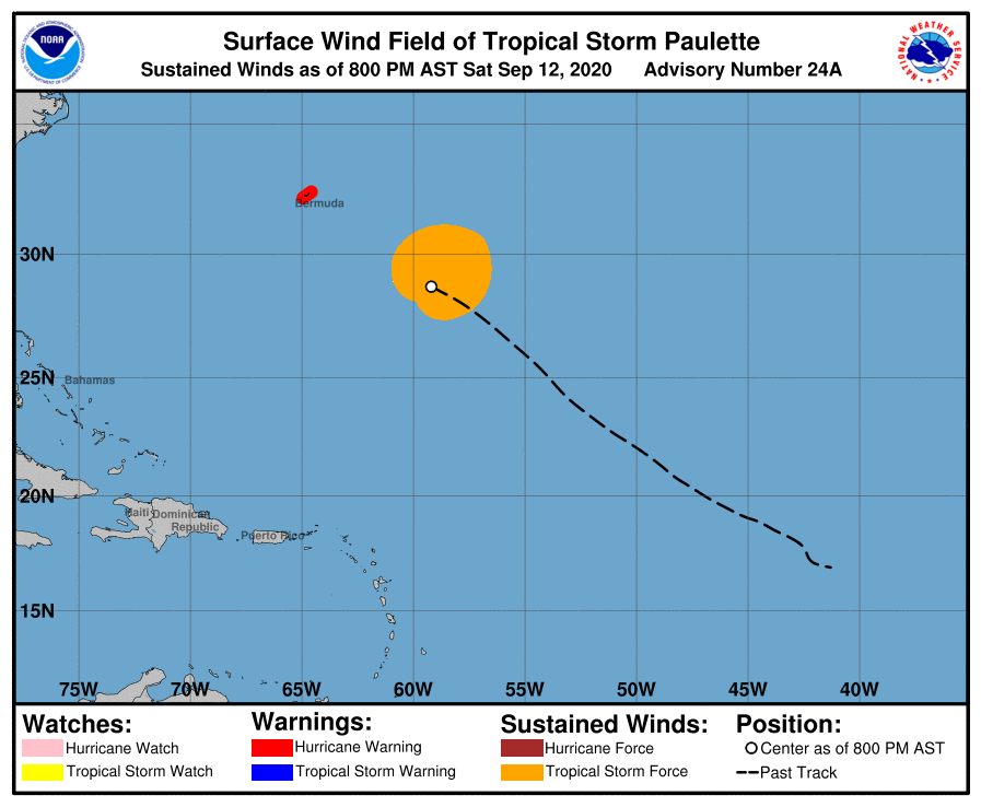
LOCATION…28.7N 59.2W
ABOUT 415 MI…670 KM SE OF BERMUDA
MAXIMUM SUSTAINED WINDS…70 MPH…110 KM/H
PRESENT MOVEMENT…WNW OR 300 DEGREES AT 15 MPH…24 KM/H
MINIMUM CENTRAL PRESSURE…981 MB…28.97 INCHES
WATCHES AND WARNINGS
——————–
A Hurricane Warning is in effect for…
* Bermuda
DISCUSSION AND OUTLOOK
———————-
At 800 PM AST (0000 UTC), the center of Tropical Storm Paulette was located by an Air Force Reserve Hurricane Hunter aircraft near latitude 28.7 North, longitude 59.2 West. Paulette is moving toward the west-northwest near 15 mph (24 km/h). A west-northwest or northwest motion is expected through Sunday night. A turn toward the north with a decrease in forward speed is forecast on Monday, followed by a northeastward motion Monday night and Tuesday. On the forecast track, the center of Paulette will move near or over Bermuda Monday morning.
Maximum sustained winds are near 70 mph (110 km/h) with higher gusts. The Hurricane Hunter plane has not yet completed its pattern and should provide more information about winds associated with Paulette during the next couple of hours. The tropical storm is forecast to strengthen and will likely become a hurricane tonight. Paulette is expected to be a dangerous hurricane when it is near Bermuda Sunday night and Monday.
Tropical-storm-force winds extend outward up to 195 miles (315 km) from the center.
The estimated minimum central pressure is 981 mb (28.97 inches) based on reports from the reconnaissance aircraft.
HAZARDS AFFECTING LAND
———————-
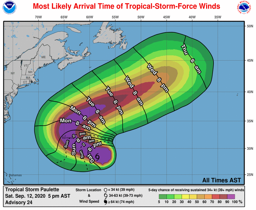
WIND: Hurricane conditions are expected to reach Bermuda by Sunday night or early Monday. Winds are expected to first reach tropical storm strength by late Sunday, making outside preparations difficult or dangerous. Preparations to protect life and property should be rushed to completion.
STORM SURGE: A dangerous storm surge is expected to produce significant coastal flooding on Bermuda in areas of onshore winds. Near the coast, the surge will be accompanied by large and destructive waves.
RAIN: Paulette is expected to bring periods of heavy rain to Bermuda Sunday through Monday, with rainfall accumulations of 3 to 6 inches likely.
SURF: Swells generated by Paulette are affecting portions of the Leeward Islands, the Greater Antilles, the Bahamas, and Bermuda and will continue to spread westward to the east coast of the United States over the next day or two. These swells are likely to cause life-threatening surf and rip current conditions. Please consult products from your local weather office.
Category: ALL POSTS, Severe Weather, Tropical
About the Author (Author Profile)
Scott Martin is an operational meteorologist, professional graphic artist, musician, husband, and father. Not only is Scott a member of the National Weather Association, but he is also the Central Alabama Chapter of the NWA president. Scott is also the co-founder of Racecast Weather, which provides forecasts for many racing series across the USA. He also supplies forecasts for the BassMaster Elite Series events including the BassMaster Classic.Subscribe
If you enjoyed this article, subscribe to receive more just like it.


