A 9 a.m. Update on Sally and Coastal Weather
The center of Hurricane Sally is located 100 miles south of Mobile at the hour. It is creeping northwest at 2 mph. Top winds are 85 mph.
The pressure continues to slowly fall, and is down to 982 millibars.
It is expected to slowly turn to the north and then northeast over the next 24 hours and make landfall on the coast between Bay. St. Louis and Pensacola, but most likely near the Alabama/Mississippi border during the morning hours on Wednesday with winds around 85 mph.
In this scenario, tropical storm force winds could be felt all the way from Destin to Bay. St. Louis, with strong tropical storm force winds from Biloxi to the Alabama/Florida border, and hurricane-force winds from Pascagoula to Mobile Bay.
Overlay this scenario anywhere from Bay. St. Louis to Pensacola and you see the various scenarios that could happen.
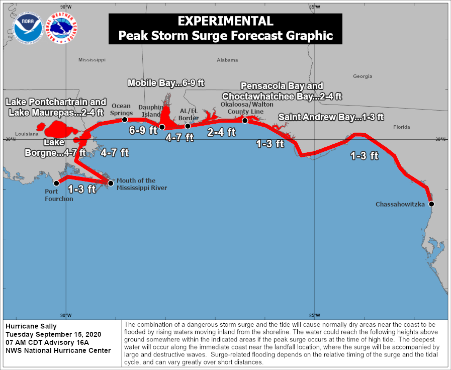
Of course, this scenario would bring a very dangerous storm surge of 6-9 feet up into Mobile Bay.
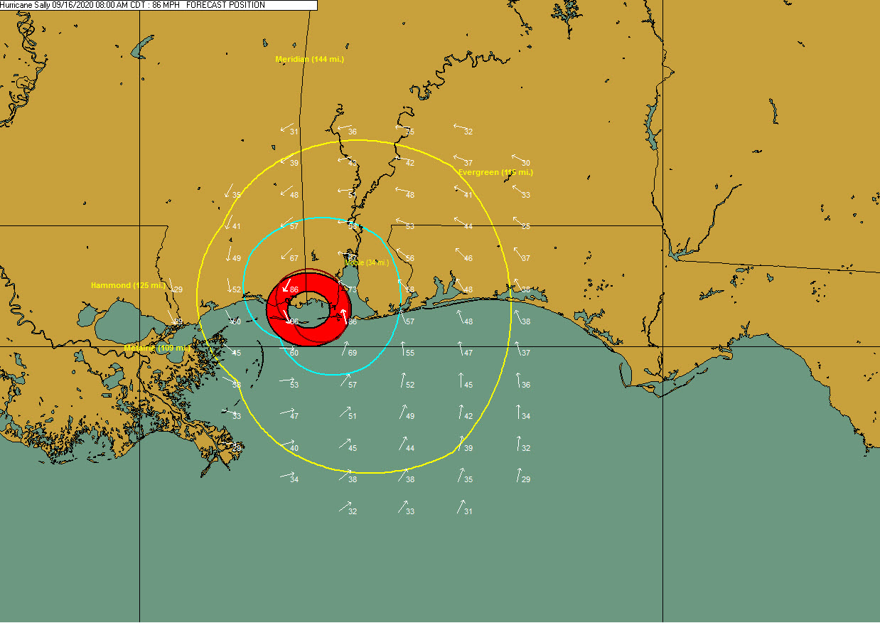
The wind field has expanded, and at landfall should look something like this, with possible tropical storm force wind possible in the yellow ellipse, possible strong tropical storm force (>58 mph) in the aqua ellipse, and possible hurricane-force winds in the red.
Winds are currently running 15-30 mph along the coast with gusts between 30-40 mph.
Some reports:
Lakefront Airport New Orleeans: Overcast…N 29G37…Paek wind gusts 38 mph
Mobile: Rain…NE 23G36
Pensacola Naval Air Station: Rain…ENEE 30G40…Peak Gust 44 mph
Destin: Thunderstorm/Rain…E 17G29
Tyndall AFB Panama City: Light Rain…E 19G29
The NOAA buoy 42012 south of Orange Beach is reporting an easterly wind at 43 mph gusting to 53 mph. It has measured a recent gust of 59 mph. The Viosca Knoll platform well south of the Alabama coast has been consistently measuring hurricane gusts since yesterday, but its anemometer is 160 meters high.
Water is piling up into the coast, especially along in Mississippi and along the east-facing shores of Louisiana where the coastlines funnel together. Current surge values:
Mobile State Docks…1.2 feet above normal
Dauphiin Island…2.3 feet above normal
Pascagoula…2.5 feet above normal
Waveland MS…3.2 feet above normal
Shell Beach LA…4.1 feet above normal
Category: Alabama's Weather, ALL POSTS, Tropical
About the Author (Author Profile)
Bill Murray is the President of The Weather Factory. He is the site's official weather historian and a weekend forecaster. He also anchors the site's severe weather coverage. Bill Murray is the proud holder of National Weather Association Digital Seal #0001 @wxhistorianSubscribe
If you enjoyed this article, subscribe to receive more just like it.


