Hurricane Teddy to Bring Tropical Storm Force Winds to Bermuda
The center of Hurricane Teddy will pass about 125 miles east of Bermuda on Monday.
Tropical storm force winds will begin there tonight around sunset. They will peak Monday morning around 9 a.m. when winds will reach 55-60 mph with gusts to 68 mph.
Winds will remain above tropical storm force until early Tuesday morning.
Then the system will impact Nova Scotia and Prince Edward Island as a tropical storm early Wednesday.
BULLETIN
Hurricane Teddy Intermediate Advisory Number 33A
NWS National Hurricane Center Miami FL AL202020
200 PM AST Sun Sep 20 2020
…OUTER BANDS OF TEDDY SHOWING UP ON BERMUDA RADAR…
…DANGEROUS RIP CURRENTS FORECAST ALONG WESTERN ATLANTIC BEACHES
FOR SEVERAL DAYS…
SUMMARY OF 200 PM AST…1800 UTC…INFORMATION
———————————————-
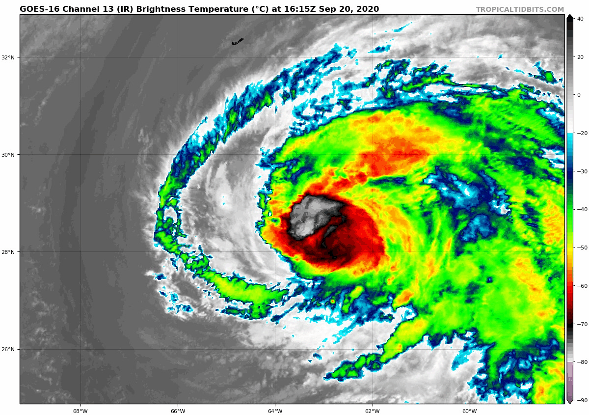
LOCATION…28.6N 63.1W
ABOUT 270 MI…435 KM SSE OF BERMUDA
MAXIMUM SUSTAINED WINDS…105 MPH…165 KM/H
PRESENT MOVEMENT…NW OR 320 DEGREES AT 9 MPH…15 KM/H
MINIMUM CENTRAL PRESSURE…964 MB…28.47 INCHES
WATCHES AND WARNINGS
——————–
CHANGES WITH THIS ADVISORY:
None.
SUMMARY OF WATCHES AND WARNINGS IN EFFECT:
A Tropical Storm Warning is in effect for…
* Bermuda
A Tropical Storm Warning means that tropical storm conditions are
expected within the warning area.
Interests in Atlantic Canada should closely monitor the progress of
Teddy.
For storm information specific to your area, please monitor
products issued by your national meteorological service.
DISCUSSION AND OUTLOOK
———————-
At 200 PM AST (1800 UTC), the center of Hurricane Teddy was located
near latitude 28.6 North, longitude 63.1 West. Teddy is moving
toward the northwest near 9 mph (15 km/h). A turn toward the north
is expected tonight, and then Teddy is forecast to continue
generally northward for another couple days. On the forecast track,
Teddy will approach Bermuda tonight, and the center should pass east
of the island Monday morning. Teddy should be approaching Nova
Scotia on Wednesday.
Maximum sustained winds are near 105 mph (165 km/h) with higher
gusts. The system is expected to remain a large and powerful
hurricane through Monday, then become a strong post-tropical cyclone
on Tuesday.
Teddy is a large hurricane. Hurricane-force winds extend outward up
to 80 miles (130 km) from the center and tropical-storm- force winds
extend outward up to 205 miles (335 km).
The estimated minimum central pressure is 964 mb (28.47 inches).
HAZARDS AFFECTING LAND
———————-
Key messages for Teddy can be found in the Tropical Cyclone
Discussion under AWIPS header MIATCDAT5 and WMO header WTNT45 KNHC
and on the web at www.hurricanes.gov/text/MIATCDAT5.shtml.
WIND: Tropical storm conditions are expected to affect Bermuda
tonight and could continue into Monday night.
SURF: Large swells generated by Teddy are affecting the Lesser
Antilles, the Greater Antilles, the Bahamas, Bermuda, the east coast
of the United States, and Atlantic Canada. These swells are likely
to cause life- threatening surf and rip current conditions. Please
consult products from your local weather office.
NEXT ADVISORY
————-
Next complete advisory at 500 PM AST.
$$
Forecaster Blake
About the Author (Author Profile)
Bill Murray is the President of The Weather Factory. He is the site's official weather historian and a weekend forecaster. He also anchors the site's severe weather coverage. Bill Murray is the proud holder of National Weather Association Digital Seal #0001 @wxhistorianSubscribe
If you enjoyed this article, subscribe to receive more just like it.


