Gamma Strengthening as it Approaches the Yucatan: A Morning Look at the Tropics
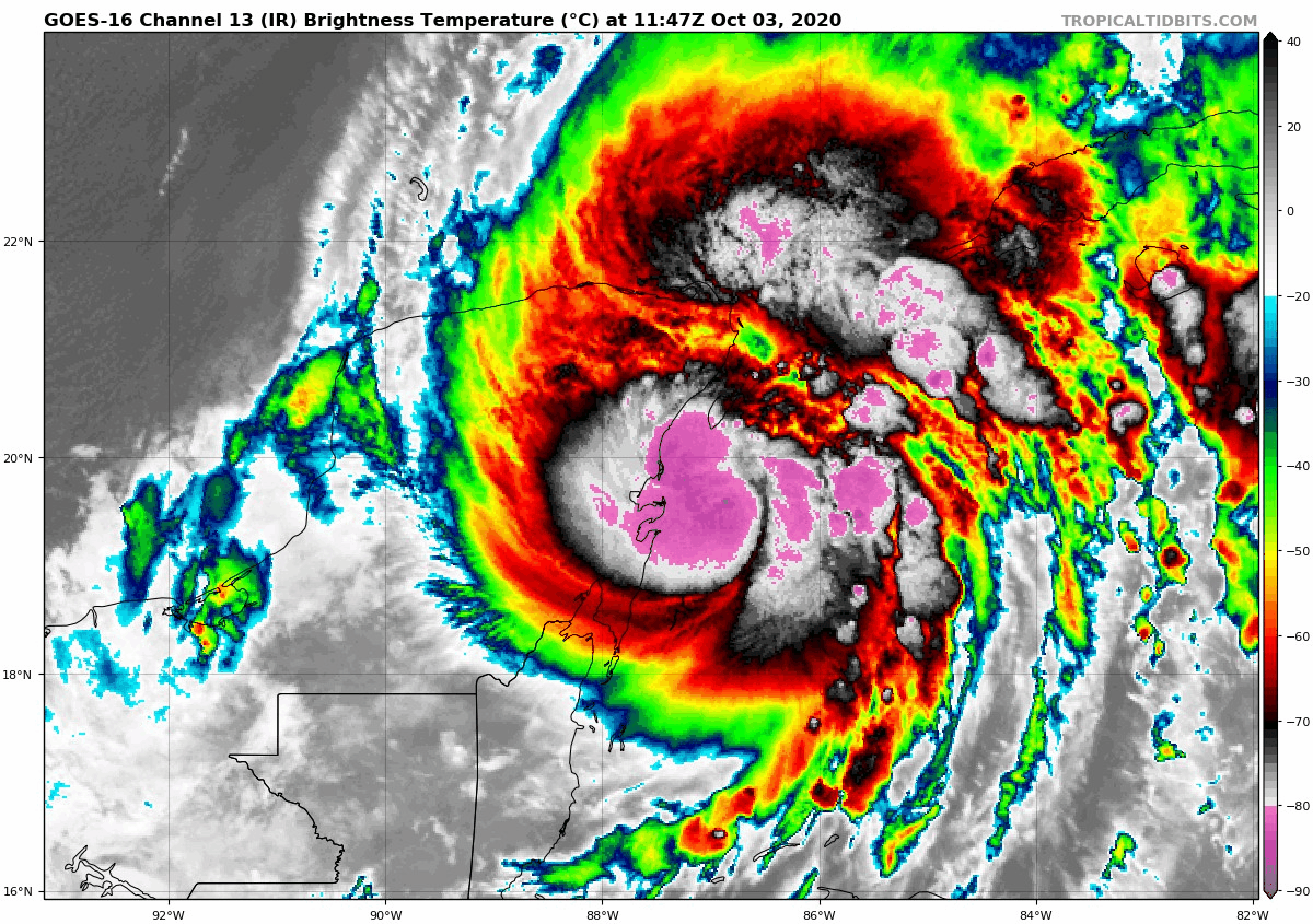
NOAA Hurricane Hunters have found flight-level winds near hurricane force in the last 30 minutes as they penetrate the center of Tropical Storm Gamma as it nears the Yucatan Peninsula. The crew found flight-level winds of 69 knots on this pass, which when adjusted for altitude would compute to about 62 knots. Readings from the Stepped Frequency Microwave Radiometer, which observes surface winds, measured 55 knots, or about 64 mph.
On the 7 a.m. advisory, top winds were 65 mph. So, Gamma is a strong tropical storm, nearing hurricane strength, but it is running out of time before landfall on northeastern Yucatan. That will come in the next few hours. It might take until 1 p.m. or so since the current direction is a little north of northwest.
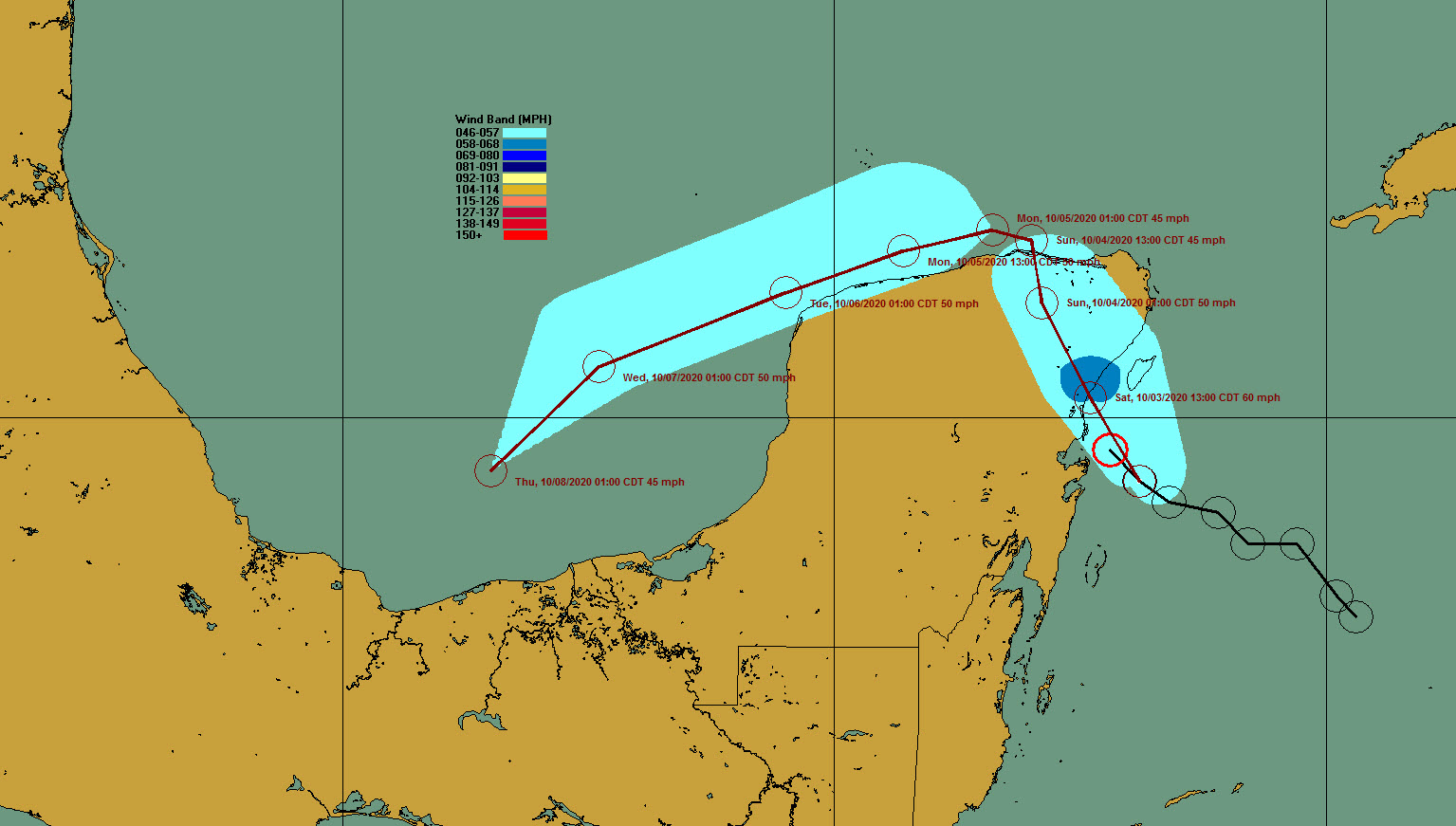
The storm is expected to take a diagonal path across the Yucatan, emerging into the southern Gulf of Mexico Sunday around noon. The NHC forecast turns it sharply westward, tracking it along the coast of the Yucatan through Monday night. It will not affect the U.S.
Strong tropical storm force winds will be experienced near where the center makes landfall today, but after emerging into the Gulf, thee forecast track would prevent it from strengthening much because of land interaction, and it is not expected to even become a strong tropical storm in the Gulf.
The overnight run of the GFS does carry it a little further into the Gulf but weakens it into a tropical depression as it turns west anyway.
The latest run of the Euro keeps it over or very close to Yucatan through Monday night before allowing bringing it into the Bay of Campeche as a low-end tropical storm and dissipating it there while a second cyclone enters the Gulf from the western Caribbean on Tuesday night. But that system never amounts to much.
The NHC does give that second system over the Caribbean a 50% chance of formation over the next five days.
The GFS doesn’t either, but it does draw more moisture up into the southeastern United States, including Alabama, to interact with an approaching front to bring some rain chances to the state for the weekend. That has been a trend in recent runs of the GFS.
The Euro brings some showers into South Alabama by late in the weekend but keeps Central Alabama mostly dry.
Category: Alabama's Weather, ALL POSTS, Tropical
About the Author (Author Profile)
Bill Murray is the President of The Weather Factory. He is the site's official weather historian and a weekend forecaster. He also anchors the site's severe weather coverage. Bill Murray is the proud holder of National Weather Association Digital Seal #0001 @wxhistorianSubscribe
If you enjoyed this article, subscribe to receive more just like it.


