Strong Storms Moving Into Cullman County
…SIGNIFICANT WEATHER ADVISORY FOR WESTERN CULLMAN COUNTY UNTIL 545 PM CDT…
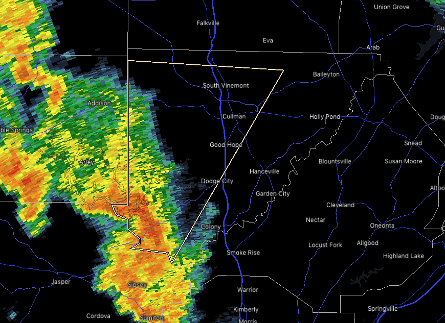
At 506 PM CDT, Doppler radar was tracking a strong thunderstorm over
Smith Dam, or 11 miles southeast of Arley, moving northeast at 40
mph.
Wind gusts of 40 to 45 mph will be possible with this storm.
Locations impacted include…
Cullman, Good Hope, Dodge City, Baldwin, Vinemont, West Point,
Phelan, Wilburn, Crane Hill and Logan.
PRECAUTIONARY/PREPAREDNESS ACTIONS…
Strong gusty winds will be capable of knocking down small tree limbs
along with other small unsecured items. Seek safe shelter until this
storm has passed.
If on or near Smith Lake, get out of the water and move indoors or
inside a vehicle. Remember, lightning can strike out to 10 miles
from the parent thunderstorm. If you can hear thunder, you are close
enough to be struck by lightning. Move to safe shelter now! Do not
be caught on the water in a thunderstorm.
Category: Alabama's Weather, ALL POSTS, Severe Weather
About the Author (Author Profile)
Scott Martin is an operational meteorologist, professional graphic artist, musician, husband, and father. Not only is Scott a member of the National Weather Association, but he is also the Central Alabama Chapter of the NWA president. Scott is also the co-founder of Racecast Weather, which provides forecasts for many racing series across the USA. He also supplies forecasts for the BassMaster Elite Series events including the BassMaster Classic.Subscribe
If you enjoyed this article, subscribe to receive more just like it.


