Stunning Saturday Afternoon
ON THE MAPS: High pressure is centered over East-Central Tennessee today and continues to provide this phenomenal fall weather to all locations across the Southeast. This high will remain the dominant feature in our weather the next several days but it will slide to the east, so our flow will become a bit more southerly rolling into the next week, which means temperatures will moderate.
STUNNING SATURDAY AFTERNOON: WOW!!!, it was definitely a chilly start to our Saturday with 30s and 40s covering Alabama, but under a cobalt blue sky full of sunshine temperatures are heading into the 60s and 70s across the state this afternoon.
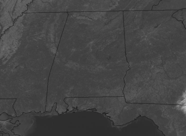
It is simply a gorgeous day of weather, and they rarely get better than this in Alabama anytime of the year. Tonight will be another clear and chilly one, not as cold as this morning, but expect widespread 40s and 50s by early tomorrow morning.
SUN-FILLED SUNDAY: Not much change tomorrow, the sky will be most clear and full of sunshine once again. Our winds will be more southeasterly compared to easterly today, so we should see warmer temps with mid and upper 70s expected across North/Central Alabama.
IN THE TROPICS: Looks like we are likely going to see Epsilon in the next few days, also Zeta certainly seems possible in the long range models as well as the NHC continues to monitor two areas of concern.
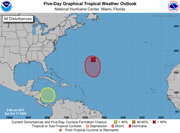
1. Showers and thunderstorms are showing some signs of organization in association with a non-tropical low pressure system located about 500 miles east-southeast of Bermuda. Continued slow development is expected, and a subtropical depression or storm is very likely to form during the next day or two while the low meanders well to the southeast of Bermuda. Formation chance through 48 hours…high…80 percent.
2. A broad area of low pressure is expected to form in a few days over the southwestern Caribbean Sea. Some gradual development of this system will be possible through the middle of next week while it moves slowly northward or north-northwestward over the western Caribbean Sea. Formation chance through 5 days…low…30 percent.
Again, hurricane season runs through the end of November and I don’t think we are done naming storms just yet this year.
BEACH FORECAST CENTER: Get the latest weather and rip current forecasts for the beaches from Fort Morgan to Panama City on our Beach Forecast Center page. There, you can select the forecast of the region that you are interested in visiting.
WORLD TEMPERATURE EXTREMES: Over the last 24 hours, the highest observation outside the U.S. was 111.6F at Vioolsdrif, South Africa. The lowest observation was -89.1F at University Dome, Antarctica.
CONTIGUOUS TEMPERATURE EXTREMES: Over the last 24 hours, the highest observation was 106F at Palm Desert, CA. The lowest observation was 7F at Daniel, WY.
Category: Alabama's Weather, ALL POSTS
About the Author (Author Profile)
Macon, Georgia Television Chief Meteorologist, Birmingham native, and long time Contributor on AlabamaWX. Stormchaser. I did not choose Weather, it chose Me. College Football Fanatic. @Ryan_StinnetSubscribe
If you enjoyed this article, subscribe to receive more just like it.


