

Flash Flood Watch Expanded to Include Blount County
The National Weather Service in Birmingham has issued a
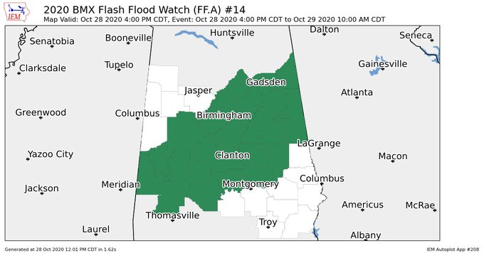
* Flash Flood Watch for portions of central Alabama…east central
Alabama…northeast Alabama and west-central Alabama, including
the following areas, in central Alabama, Autauga, Bibb, Blount,
Chilton, Coosa, Dallas, Elmore, Jefferson, Perry, Shelby, St. Clair
and Talladega. In east-central Alabama, Calhoun, Clay, Cleburne,
Randolph and Tallapoosa. In northeast Alabama, Cherokee and
Etowah. In west-central Alabama, Greene, Hale, Marengo, Sumter and
Tuscaloosa.
* From Wednesday afternoon through Thursday morning
* 2 To 4 inches of rain along with some locally amounts are expected
to occur from Zeta through Thursday morning across the watch area.
* Heavy rain may cause flooding in low lying areas. Please use
caution when traveling.
PRECAUTIONARY/PREPAREDNESS ACTIONS…
A Flash Flood Watch means that conditions may develop that lead to
Flash Flooding. Flash Flooding is a very dangerous situation. You
should monitor later forecasts and be prepared to take action should
Flash Flood Warnings be issued.
Category: Alabama's Weather, ALL POSTS, Severe Weather, Tropical
About the Author (Author Profile)
Scott Martin is an operational meteorologist, professional graphic artist, musician, husband, and father. Not only is Scott a member of the National Weather Association, but he is also the Central Alabama Chapter of the NWA president. Scott is also the co-founder of Racecast Weather, which provides forecasts for many racing series across the USA. He also supplies forecasts for the BassMaster Elite Series events including the BassMaster Classic.Subscribe
If you enjoyed this article, subscribe to receive more just like it.


