Rain Overspreading the State
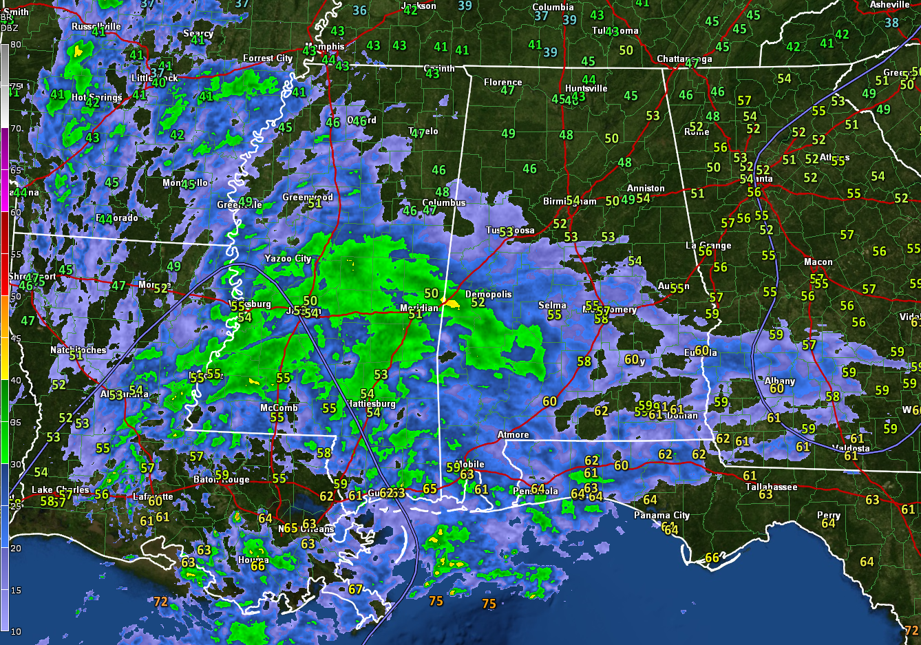
Rain is overspreading Alabama at this hour. The leading edge of the rain shield extends from Fayette to Tuscaloosa to Clanton to Tuskegee and into Georgia.
The heavier rain is over Sumter, Marengo, and Wilcox Counties and points to the south.
The only lightning right now is over southeastern Louisiana. There will be thunder this afternoon and evening across the area, but the only strong storms are expected to be over extreme South Alabama, with some strong storms as far north as Montgomery and Auburn.
Temperatures are in the 50s south of I-59 with 40s to the north. Highs today will range from the upper 50s over the Tennessee Valley, to near 60F around I-20, into the middle 60s over South Central Alabama.
It will turn much colder overnight, with temperatures falling into the 30s by morning over the northern part so the state with 40s elsewhere. The mercury will generally fall slowly across the area on Monday, reaching the 30s by mid-afternoon across the northern half of the state.
Monday night will feature a widespread freeze with lower and middle 20s north and upper 20s south.
Category: Alabama's Weather, ALL POSTS
About the Author (Author Profile)
Bill Murray is the President of The Weather Factory. He is the site's official weather historian and a weekend forecaster. He also anchors the site's severe weather coverage. Bill Murray is the proud holder of National Weather Association Digital Seal #0001 @wxhistorianSubscribe
If you enjoyed this article, subscribe to receive more just like it.


