Strong to Severe Storms Possible Tonight Through the First Half of New Year’s Day
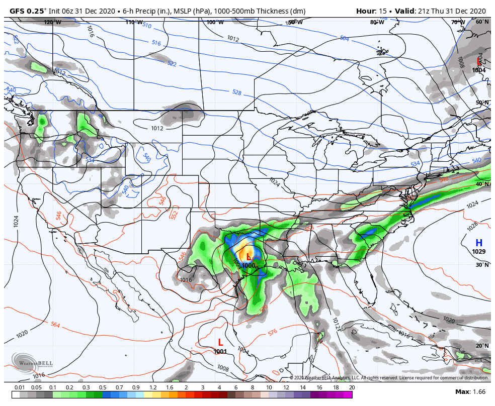
Thursday at 3:00 pm (06z GFS).
TODAY AND FRIDAY
A surface low will start off today getting its act together over the southeastern parts of Texas and will slowly move north-northeastward that will eventually pull a strong cold front across the area during the overnight hours and through the early afternoon hours on Friday. Much of today may end up being dry, but scattered showers and maybe a few rumbles of thunder will be possible during the afternoon and evening hours. Heavier rain and thunderstorms will move in during the late-night and overnight hours from the southwest and eventually move across the area and move out of the eastern parts by the mid to late afternoon hours on Friday. Some of those storms could be strong to severe.
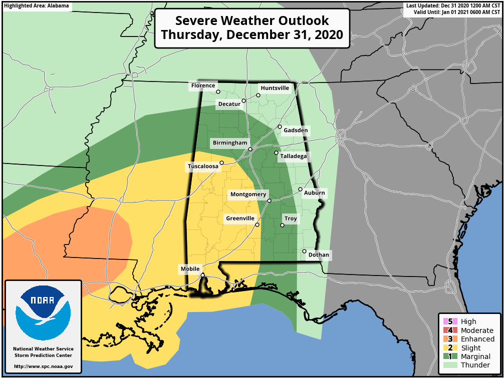
The latest update from the Storm Prediction Center keeps the risk areas for today similar to what was displayed on Wednesday. A level 2 Slight Risk for severe storms for Thursday, including locations west of a line from Reform to Brookwood to Billingsley to Fort Deposit. A level 1 Marginal Risk stretches outside of that and includes locations west of a line from Russellville to Falkville to Steele to Tuskegee to Clio.
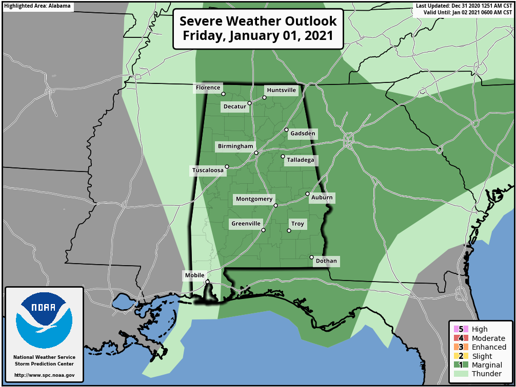
The big change was to the risk areas for Friday, as now nearly all of Central Alabama is defined in a level 1 Marginal Risk except for the extreme southwestern corner of the area.
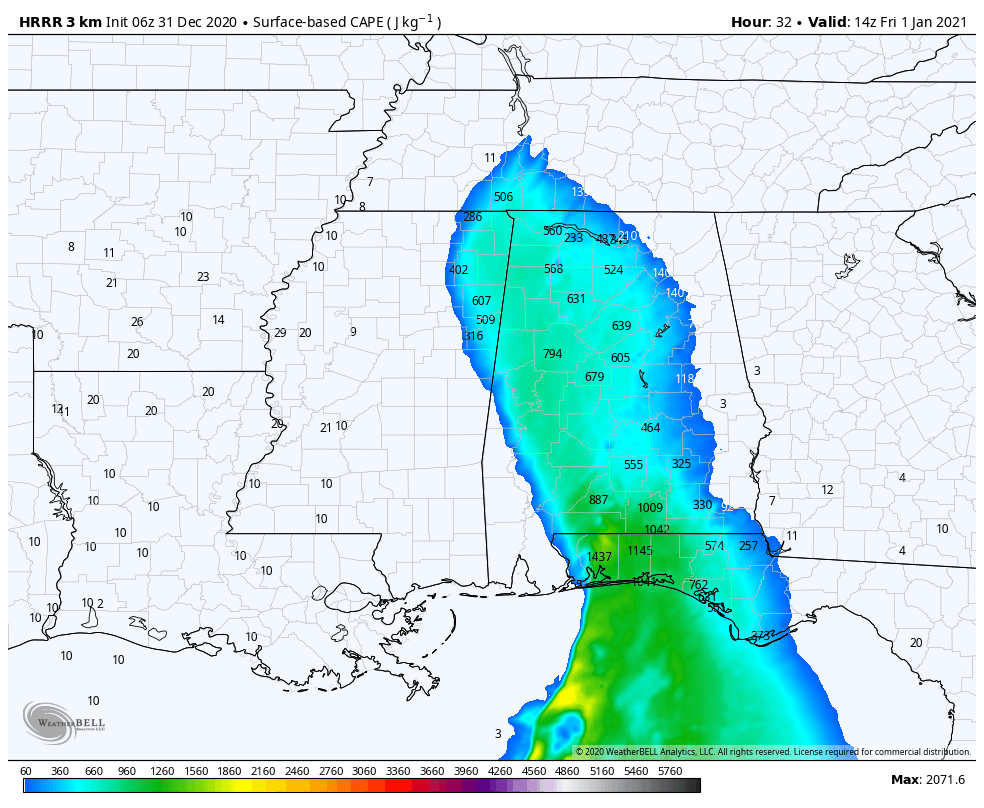
Instability values 9:00 am Friday (06z HRRR 32-hour run).
There will be a decent supply of instability available, according to the latest 06z HRRR 32-hour model run, along with a good bit of wind shear, and a decent amount of helicity. All of those ingredients combined show that there will be the potential for rotating updrafts that may lead to damaging wind gusts up to 60 MPH and a few tornadoes.
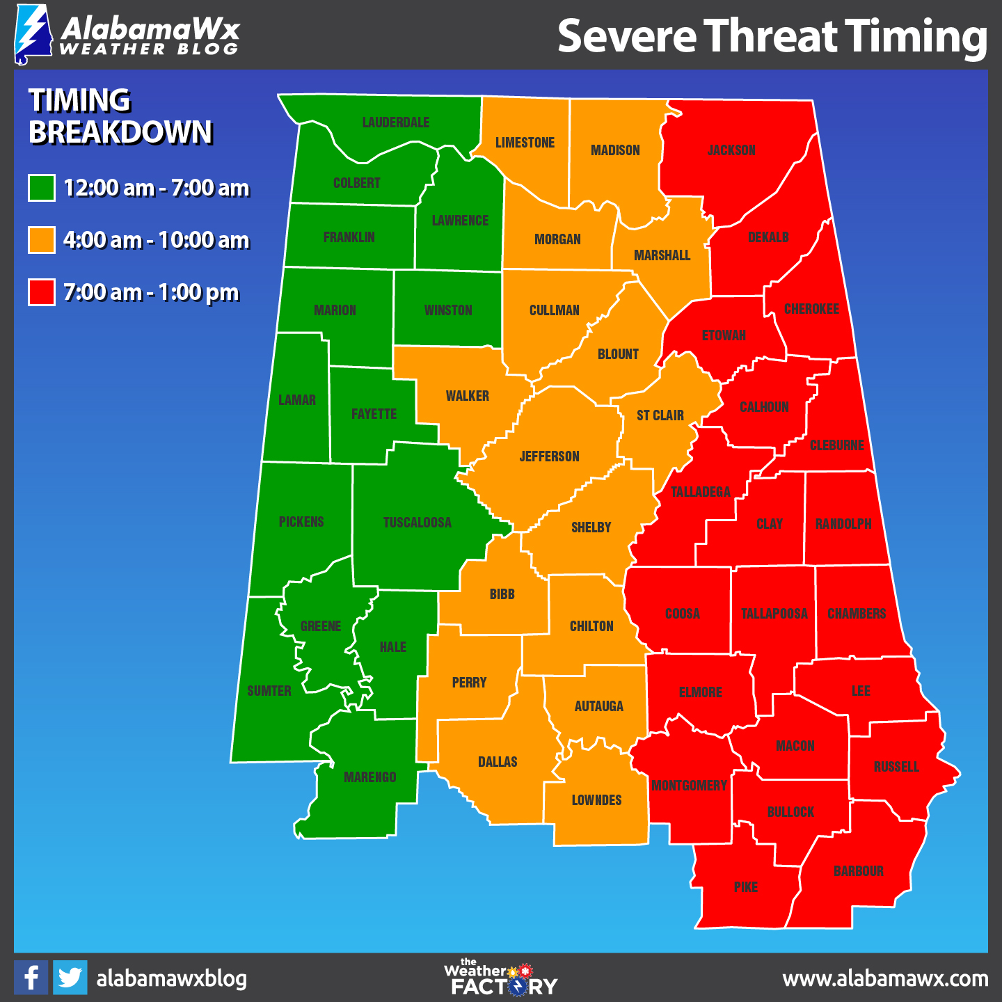
Timing for the potential for stronger to severe storms will be from midnight to 7:00 am for the western-third of the area, 4:00 am to 10:00 am for the central parts, and from 7:00 am to 1:00 pm for the eastern parts.
Today’s highs will be in the upper 50s to the mid-70s across the area with skies starting off partly to mostly cloudy, but eventually becoming cloudy before the rain moves in. Friday’s highs will be in the upper 60s to the mid-70s across the area before the cooler air starts to move in behind the front. Clouds will start to diminish behind the front as well, and we may get some sunshine before we lose the daylight.
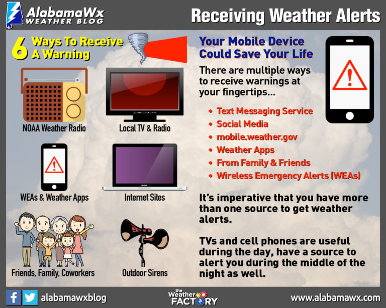
Be sure to have multiple ways to receive warnings and have your batteries charged in your smartphones and mobile devices. Also, have your safety plans and emergency kits ready to go just in case your location goes under a warning.
We’ll have updates throughout the day.
THE WEEKEND
Some sunshine will return to the area for the weekend as skies will be partly to mostly sunny on Saturday, but we may have a small disturbance move through the northern parts of Central Alabama that may squeeze off a few raindrops late. Highs will be in the mid-50s to the mid-60s.
Sunday will feature a good bit of sunshine with cooler temperatures as highs will be in the upper 40s to the mid-50s.
NEXT WEEK
Monday’s weather will be absolutely fabulous as skies will be mainly sunny with maybe a passing cloud or two. Afternoon highs will be in the mid-50s to right around 60 degrees across Central Alabama.
Not much different on Tuesday as highs will be in the upper 50s to the mid-60s under mostly sunny skies.
And we’ll end off the forecast period as Wednesday will feature a mix of sun and clouds with highs in the upper 50s to the mid-60s. A developing storm system will move into the western parts of the area by the late night hours, potentially bringing another round of strong to severe storms, but it is way too early to know for sure at this point. We’ll keep our eyes on it.
Category: Alabama's Weather, ALL POSTS, Severe Weather, Weather Xtreme Videos
About the Author (Author Profile)
Scott Martin is an operational meteorologist, professional graphic artist, musician, husband, and father. Not only is Scott a member of the National Weather Association, but he is also the Central Alabama Chapter of the NWA president. Scott is also the co-founder of Racecast Weather, which provides forecasts for many racing series across the USA. He also supplies forecasts for the BassMaster Elite Series events including the BassMaster Classic.Subscribe
If you enjoyed this article, subscribe to receive more just like it.


