Late Morning Look at Alabama’s Weather: Clouds Hanging Tough
Clouds are hanging tough this morning across much of Alabama. There is not much hope that they will break before late afternoon now, so sunshine may be harder to come by than earlier thought despite drier air moving in at the lower and mid-levels of the atmosphere.
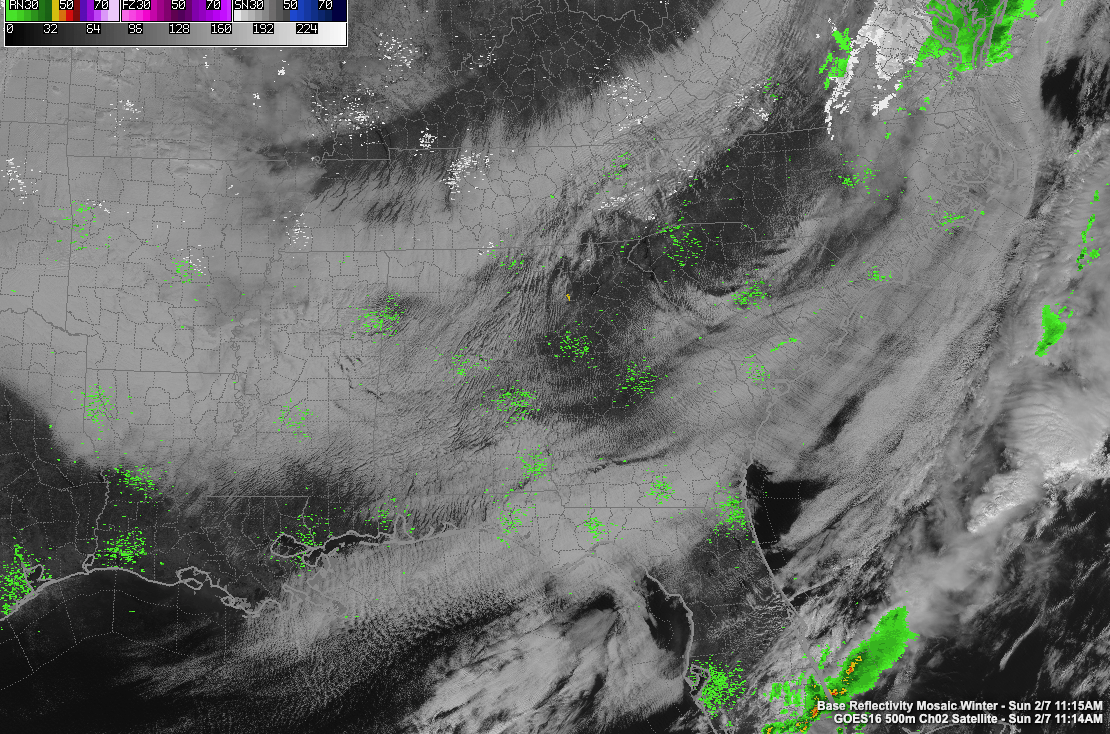
The nearest precipitation to Alabama is snow over Virginia, Pennsylvania, and the Delmarva, where 3-6 inches will fall today. There are strong storms still over South Florida. Severe thunderstorm warnings are in effect around Lake Okeechobee, and there is a marginal risk in downstream areas from the approaching storms. There was a tornado watch overnight, but no severe weather reports have been received since midnight.
Things have improved dramatically in the Tampa Bay area where the Super Bowl will be held late this afternoon. Skies are not sunny there and temperatures are in the lower 70s. Gametime temperatures will be falling through the 60s with a light northerly wind.
Back home in Alabama, temperatures this afternoon will range from the middle 40s over the Tennessee Valley, to near 50F in the I-20 Corridor, and middle 50s to the south.
Skies should clear somewhat overnight, perhaps in time to see a good pass of the International Space Station this evening around 6:13. The beautiful sight will reach a maximum height of 48 degrees. It will appear from the west-northwest and will pass off to the south-southeast.
Overnight lows will be in the upper 20s over the North, with readings near freezing over the remainder of the northern half of Alabama. Clouds may thicken again overnight. In fact, they may never dissipate over West Alabama. But we should see increasing sun tomorrow.
Rain showers may return to the southern half of the area Monday night and will be possible on Tuesday and Wednesday. At least it will be mild, with highs in the 60s Tuesday, Wednesday, and Thursday. Rain will become likely Thursday.
Still no clear picture of what our potential for wintry weather will be over the next two weeks. The morning run of the GFS has moved back to a sleet/freezing rain situation for next Saturday night and Sunday with no wintry weather for the following Monday and Tuesday. So there is some potential out there between the coming weekend and midweek of the following week.
There is even big disagreement on next weekend’s temperatures. The GFS has much of the area not getting above freezing next Sunday. The European is calling for a high of 64F.
Stay tuned.
Category: Alabama's Weather, ALL POSTS
About the Author (Author Profile)
Bill Murray is the President of The Weather Factory. He is the site's official weather historian and a weekend forecaster. He also anchors the site's severe weather coverage. Bill Murray is the proud holder of National Weather Association Digital Seal #0001 @wxhistorianSubscribe
If you enjoyed this article, subscribe to receive more just like it.


